×

|
Rate it:
Tags:
Level: Intermediate
Length: 11 mi (17.7 km)
Surface: Singletrack
Configuration: Loop
Elevation: +1,029/ -971 ft
Total: 23 riders
Mountain Biking Genoa Peak
#32 of 108 mountain bike trails in Nevada
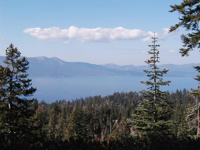
A moderate ride along a ridgeline with scenic views of the Lake Tahoe Basin to the west and the Carson Valley to the east. Several spurs off the main road access peaks with Genoa Peak being the highest (9,150'). An excellent ten-mile loop off the main ridge is possible.
First added by dppaladino on May 3, 2005. Last updated Apr 30, 2020. → add an update
Before you go
- Drinking water: unknown
- Lift service: unknown
- Night riding: unknown
- Pump track: unknown
- Restrooms: unknown
- Fat bike grooming: unknown
- E-bikes allowed: unknown
- Fee required: unknown
This trail information is user-generated. Help improve this information by suggesting a correction.
From South Lake Tahoe, take Kingsbury Grade (SR 207) and turn left on North Benjamin Road, which turns into Andria Drive. Continue to the end of the pavement and park. Take Genoa Peak Road 14N32. A longer trip is possible if you take two cars. Park the second vehicle off of U.S. HWY 50 behind the Nevada Department of Transportation Station, one-fourth mile south of the SR 28 and U.S. HWY 50 junction.


Loading reviews...View more