×

|
Rate it:
Tags:
Level: Advanced
Length: 0 mi (0 km)
Surface: Singletrack
Configuration: One-way
Elevation: +665/ -1,520 ft
Total: 1 riders
Mountain Biking Fourth of July to Carmen Creek Trail
#135 of 335 mountain bike trails in Idaho
Shuttle to high altitude, big climb out of 4th of July Basin, on the CDT; ridge and alpine conditions predominate for several miles. Descend a rocky section to a lake before continuing past a large pond in 2-3 miles. Continue up a switchback (hike-a-bike mostly) section to a high exposed ridge. Turn right into Carmen Creek. Descend on very rocky and steep singletrack that eventually turns into doubletrack and then into a rough dirt road then pavement before reaching the Salmon River.
First added by lemhi_mtn_ryder on Jul 21, 2014. Last updated Apr 28, 2020. → add an update
Before you go
- Drinking water: unknown
- Lift service: unknown
- Night riding: unknown
- Pump track: unknown
- Restrooms: unknown
- Fat bike grooming: unknown
- E-bikes allowed: unknown
- Fee required: unknown
This trail information is user-generated. Help improve this information by suggesting a correction.
From Salmon, Idaho, head North on Highway 93 for 15 miles, turn right onto 4th of July Creek Road, continue up the road until its forks near the top. Park and start on the right fork heading towards the CDT.

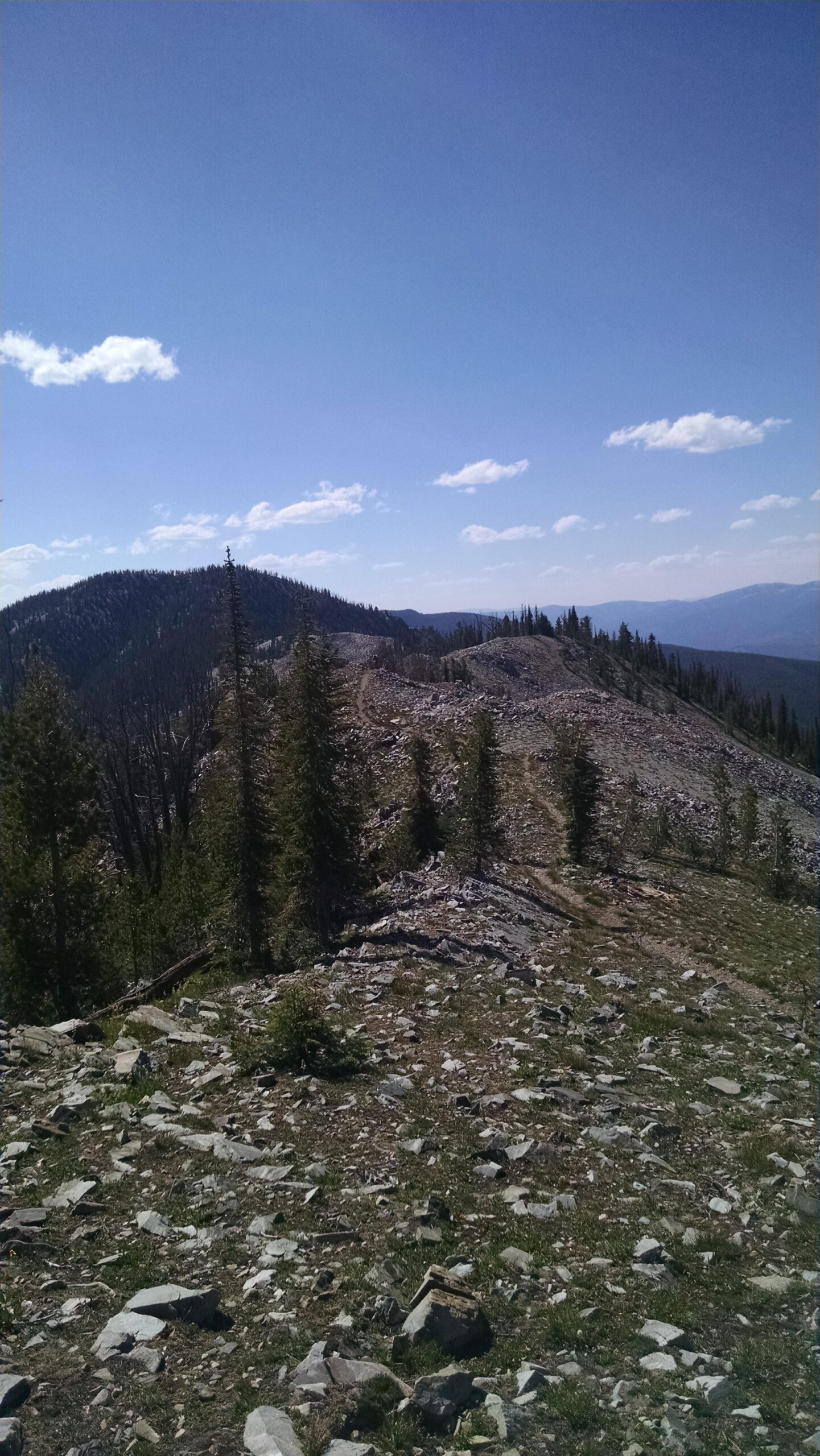

A great high elevation ride on the Idaho, Montana Continental Divide area, just north of Salmon, Idaho. This route is very scenic and is usually snow free in July to September. The trail will work you with its climbs and descents. Small portions will require short hike a bike for most riders due to steepness, rocks, or washout. The views for this alpine route are fantastic. This is not a ride for beginners or those not capable of riding rough and primitive backcountry trails.
| Thank