It's a state park so the focus isn't on the bike trails but they are decent for what they are relative to the area. There's a couple techy sections which mix it up. There are a couple dangerous downhills that you may want to walk down/up but other than that it's great for a casual biker. The staff does a great job of maintaining the trails, rerouting when there's landslides and such. You can bike through the whole system in a couple hours depending on your speed. Overall good trails but not necessarily a mtb destination.
Its not really a mountain biking destination, but there are still some fun trails to ride if you don't mind large stair sets. I only come here because it is the only place around here locally. The best trails to ride are Laurel point(windy single track and a technical area in the very beginning), Great meadows(also known as fossil beach)(downhill freeride type stuff), and there is also turkey neck. These trails aren't built for bikes but you can still ride them.
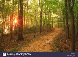
Short easy trails with lots of woods and wildlife. Clean facilities and friendly staff on site. Ride park road to the beach for shark tooth hunting and to cliffs for views of the Potomac. Local roads are lightly traveled and part of Northern Neck Heritage Trail.


It's a state park so the focus isn't on the bike trails but they are decent for what they are relative to the area. There's a couple techy sections which mix it up. There are a couple dangerous downhills that you may want to walk down/up but other than that it's great for a casual biker. The staff does a great job of maintaining the trails, rerouting when there's landslides and such. You can bike through the whole system in a couple hours depending on your speed. Overall good trails but not necessarily a mtb destination.
| ThankIts not really a mountain biking destination, but there are still some fun trails to ride if you don't mind large stair sets. I only come here because it is the only place around here locally. The best trails to ride are Laurel point(windy single track and a technical area in the very beginning), Great meadows(also known as fossil beach)(downhill freeride type stuff), and there is also turkey neck. These trails aren't built for bikes but you can still ride them.
| ThankShort easy trails with lots of woods and wildlife. Clean facilities and friendly staff on site. Ride park road to the beach for shark tooth hunting and to cliffs for views of the Potomac. Local roads are lightly traveled and part of Northern Neck Heritage Trail.
| Thank