
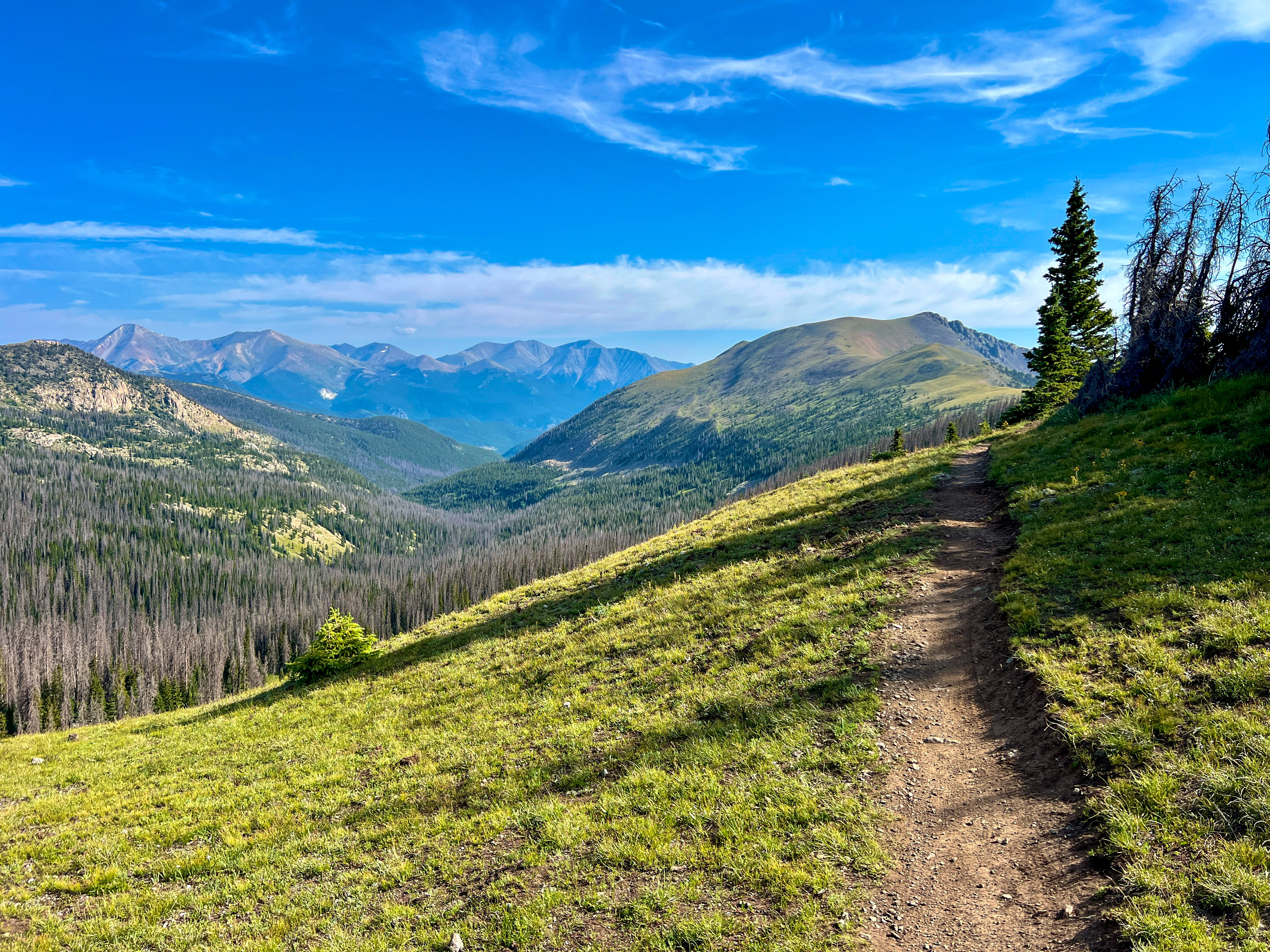
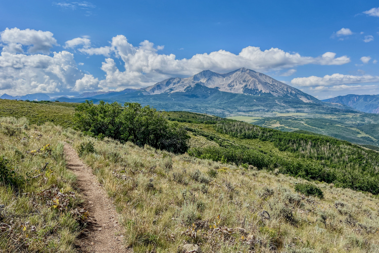
The first time I rode the famed Monarch Crest Trail was way back in 2008. At the time, it was arguably my first-ever high-alpine mountain bike ride, and the rolling ridgeline singletrack at nearly 12,000ft with jaw-dropping views in all directions reshaped my understanding of the sport of mountain biking.
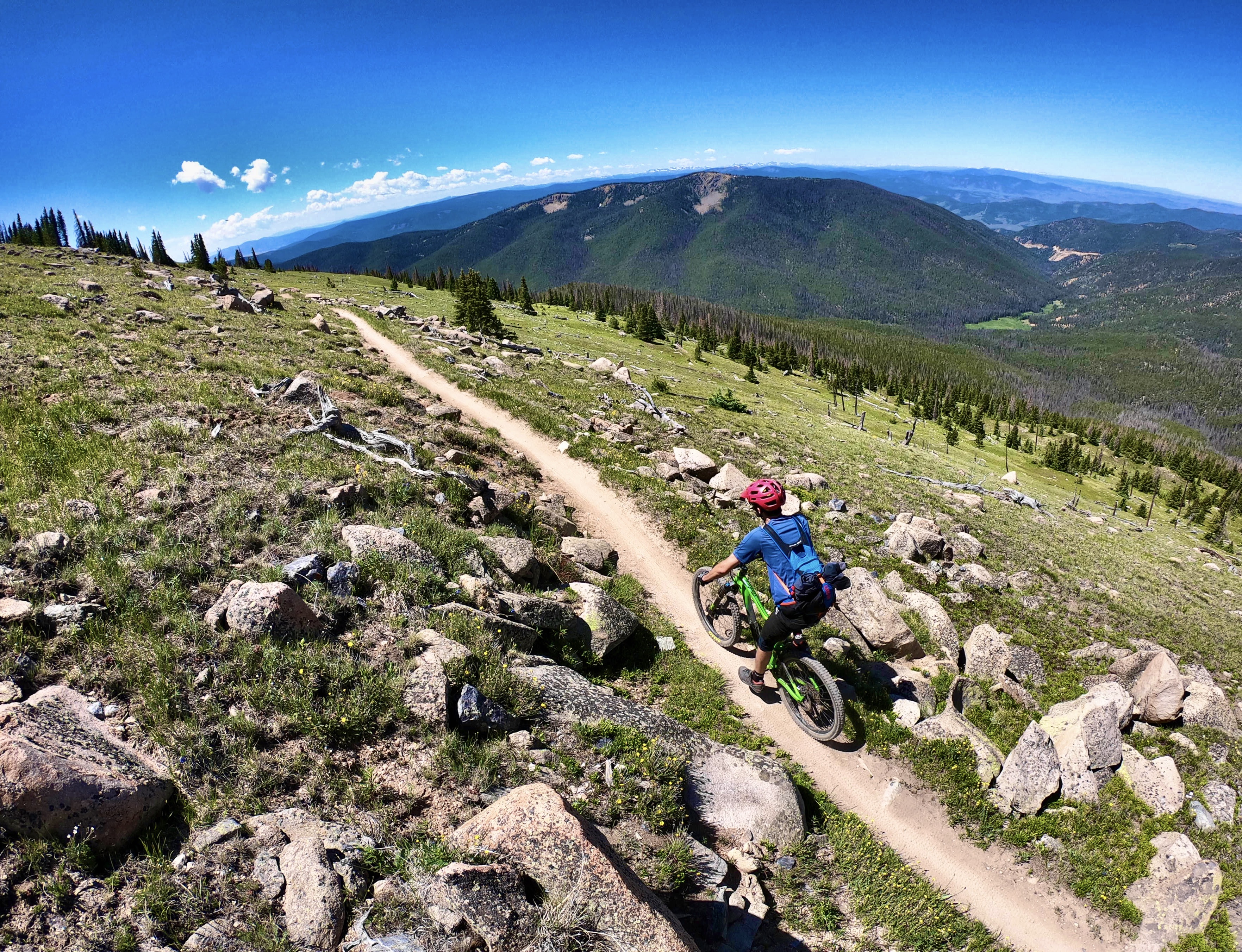
And then came the downhill. The first few short downhill sections begin along the top of the Crest, picking up in earnest as you head toward the crossing with Marshall Pass. Then all of a sudden, the singletrack ends: you find yourself barreling down a narrow doubletrack mining road, losing about 500 precious vertical feet in just a few minutes.
“Why isn’t this downhill on singletrack?” I wondered to myself. I always design mountain bike rides to climb the dirt roads and descend on the singletrack, and losing vert on a shitty two-track was so disappointing. Thankfully, the singletrack picks up soon after Marshall Pass.
Ever since that first ride in ‘08, I’ve continued to wonder why this section of such a famous mountain bike trail is so blasé. But now, finally, it’s happening: this doubletrack downhill will soon be transformed into a beautiful 1.8 miles of singletrack nirvana.
One of the best shared-use trails in the nation
To understand how we got here, it helps to look back at the history of the Monarch Crest. This gorgeous section of high-alpine singletrack was built in the 1960s, and at that time it was open to motorcycle traffic, in addition to horses and hikers. Mountain bikers hadn’t even come on the scene yet.
In the intervening decades, several major long-distance trails have been developed, and their governing committees have decided to use this incredible stretch of singletrack as part of their route alignments. The first was the Colorado Trail (CT) in the 80s. Because the Monarch Crest “mostly followed the Continental Divide and the ridgeline that we needed to use, we just kind of said, ‘Hey, we’re going to put the Colorado Trail here,” said Paul Talley, Executive Director of the Colorado Trail Foundation (CTF). “The Continental Divide Trail (CDT) came later and said, ‘Well, we’re going to use the same section.’”
Due to this long history, motorcycle use has continued to be grandfathered into this section of trail. The Monarch Crest is such a visually-stunning trail in a sensitive high-alpine environment that, if built today, it most likely wouldn’t be open to motos.
In fact, recent trail development on the CDT just to the north suggests it might not even be open to mountain bikes, either. This new CDT section on a high-alpine stretch near Cottonwood Pass isn’t located in a Wilderness area, and yet for some reason, it still bans bikes.
Shared use is precisely what makes the Monarch Crest so special.
“[The Monarch Crest] is one of the few sections of the Colorado Trail that are open to all users. And it’s one of the only sections of most thru hiking trails that are open to all users as well,” said Talley. “So out of the Pacific Crest Trail and all the others, there’s very few.”
Recent improvements on the Monarch Crest
The CTF has been hard at work on key reroutes in this area for the last few years. The first was a major reroute at the top of the Fooses Creek Trail, a section of the CT where it splits from the CDT and descends off the mountain. This section is non-motorized.
Then, last year, the CTF in conjunction with other local trail advocates like Salida Mountain Trails (SMT), Gunnison Trails, and the Central Colorado Mountain Riders (CCMR) (a dirt bike advocacy group), completed a reroute on the Crest itself. This latest 0.6-mile reroute might not sound like much, but it bypasses a major snowdrift that forms every winter on top of the mountain.
Again, a snowdrift doesn’t sound so bad, but this monster often boasts a near-vertical downhill side that’s 20 feet tall (or more) in the early season, while the majority of the trail is otherwise dry and rideable. That 20-foot-tall snowdrift is impossible for motos to negotiate, and it can be dangerous for mountain bikers to glissade down, as it ends abruptly on the tundra. Several riders have broken ankles sliding down this drift over the years, prompting search and rescue evacuations.
To avoid the drift entirely, many riders are tempted to ride across the alpine tundra, “whatever direction they wanted to go,” and then meet back up with the trail later. “There [were] all these little damaging paths around that people would take,” explained Talley. “So the big thing about the snowdrift reroute is it’s going to protect the tundra a lot better.”
“Over the last five years, we’ve contributed right at $5.5 million to the Colorado Trail in either direct work or in-kind work.”
Paul Talley, Executive Director of the Colorado Trail Foundation
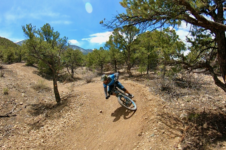
From doubletrack to singletrack
The opportunity to reroute the nasty doubletrack downhill arose thanks in part to Monarch Mountain Ski Resort’s recent terrain expansion, which opened the new No Name Basin on the western side of the Continental Divide for the 2025/2026 ski season. The CT/CDT runs along that ridge, and the trail needed to be moved to accommodate the new ski terrain.
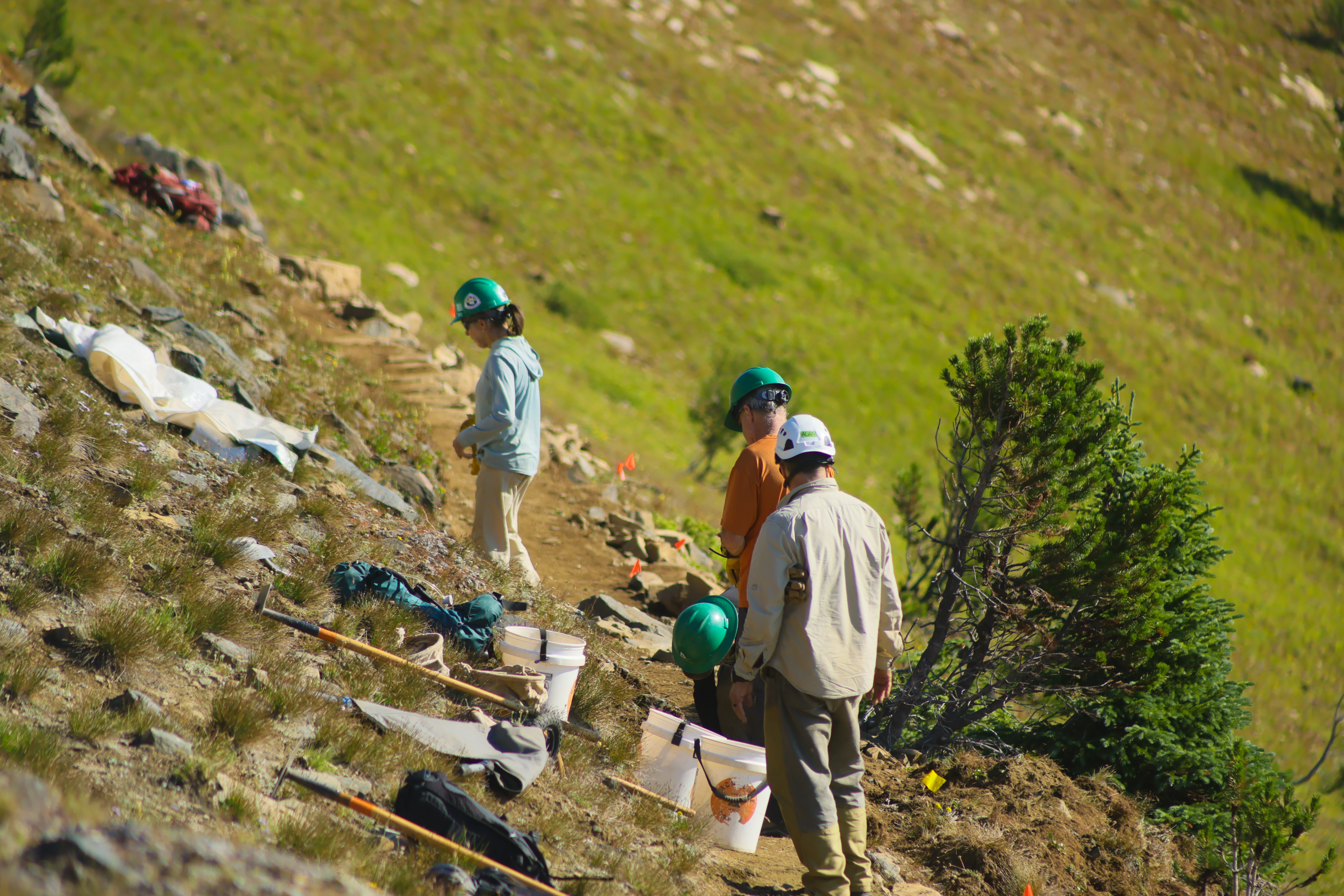
This section of the trail is home to ancient archeological sites: 3,000- to 4,000-year-old hunting camps atop the Continental Divide. The USFS and CTF knew that running into more archaeological sites was likely, and so, the ‘ologists had to come out and analyze the new alignment. With ongoing funding issues in the federal government, it takes a lot of patience and begging to get a NEPA study pushed through, so when the ‘ologists finally came to the area, the CTF bundled in the hoped-for doubletrack reroute further south along the Crest into the NEPA study. Success — approval!
To fund the 1.8-mile reroute, CCMR applied for a motorized trail grant through Colorado Parks and Wildlife (CPW), funded by OHV registration tags. This $99,661 grant will fund the machine work on the reroute, and they’ve selected local builder James Flatten, known as the “Flow Farmer,” for the job.
Flatten will run the machine, and volunteer crews from the CTF will do the hand finishing on the trail. Talley told me that the CTF invests heavily in trail building and maintenance along the CT, both with dollars and in-kind volunteer labor. The CTF averages about 15,000 hours per year of volunteer labor, which was worth about $2.6 million over the last five years. In addition, 87% of the CTF’s budget goes straight into the trail, totaling another $2.8 million over the last five years. “So over the last five years, we’ve contributed right at $5.5 million to the Colorado trail in either direct work or in-kind work,” said Talley.
If you do the math, that averages out to about $10,000 invested per mile of trail over the last five years. “And here’s what’s crazy: if you take that 15,000 hours a year, it averages out to be about 29 hours of work per mile of trail that we do every year with volunteers,” Talley added.
What will riders find on this new reroute?
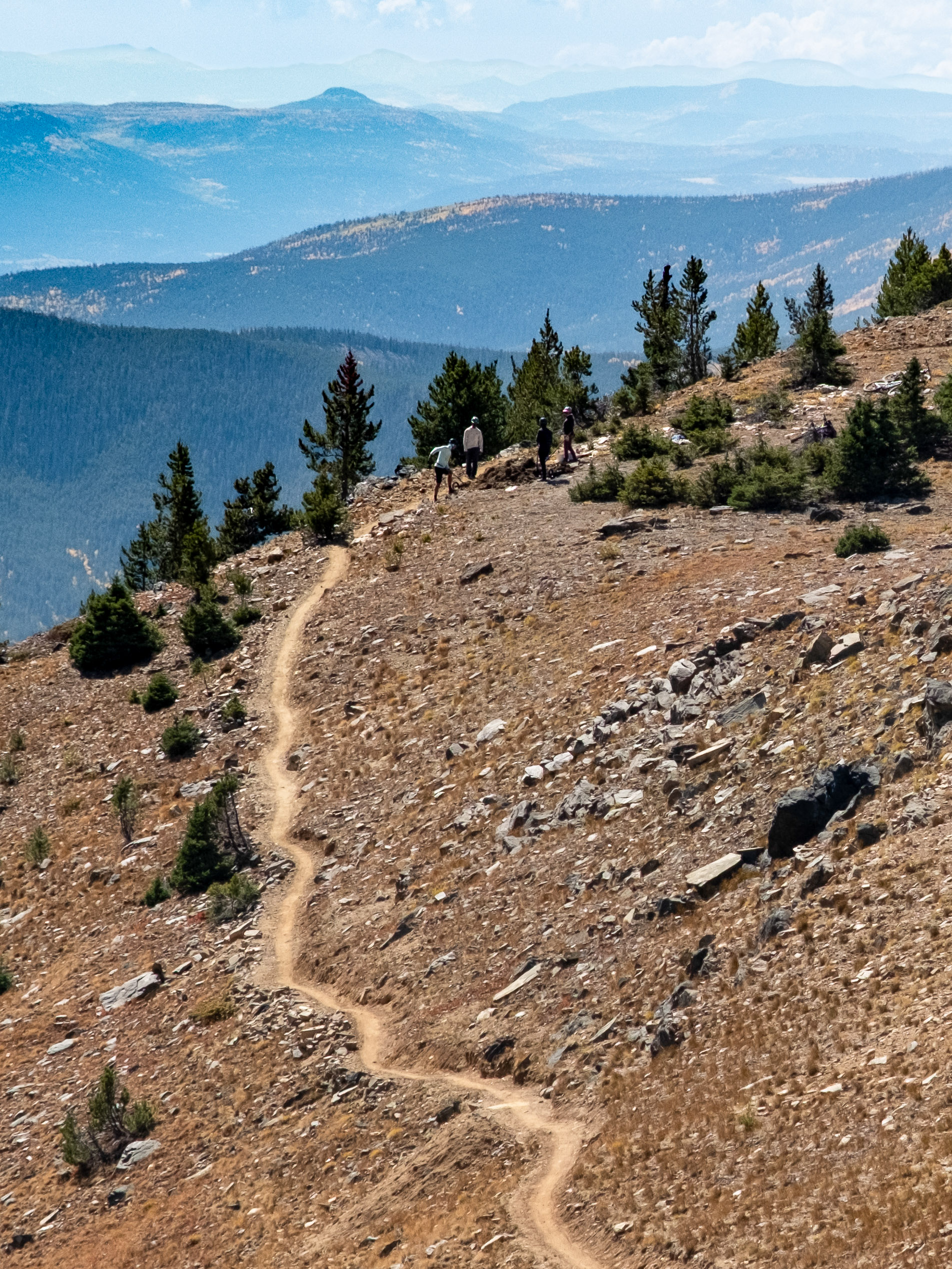
The new 1.8-mile reroute will split off to the left from the existing singletrack before it reaches the old mine site, where the doubletrack begins. The new trail will skirt up above the mine, wrapping around the flanks of Mount Ouray, and then descend all the way to Marshall Pass. “There’s some meadows and some great areas it’ll go through. It should be a really good singletrack experience,” said Talley.
Reactions to the recent CT reroutes near the Crest have been mixed. I personally had a blast ripping down the rerouted section of the Fooses Creek descent, but I noticed a couple of awkward corners that didn’t ride well on mountain bikes. One in particular is a true flow-killer. After the build, MTB advocates and bike shop employees tried to convince the CT and USFS to change the corners, and while some work has been done, the results remain mixed. In my personal opinion, it’s just one corner… but it’s definitely an awkward one.
I asked Talley about the planned design of this new Monarch Crest reroute and whether or not it would ride well on mountain bikes.
“It was actually designed by someone who was on the motorized trail crew for the Forest Service, and so the local motorized trail crew was really highly involved in the design,” he said. “And even now, CCMR and us and the CDT are still tweaking the design so that it’s good for all users.”
Talley went on to explain that while many USFS trail management objectives (TMOs) are written for hiking, and simply allow mountain bike use, the TMO for this new stretch of trail specifically includes motorcycles and mountain bikes. “This trail was designed for motorcycles and mountain bikes in mind. So it will not be like a bike park. It will not have high berms, it will […] be built in a way that it’s very good for motorcycles and bikes and e-bikes, and then hikers and equestrians as well,” he explained. “So the corridor will be cleared high for equestrians, but it will also be built in a way that it stands up to the mountain bikes and motorcycles.”
Projected opening: June 15, 2027
While this new reroute cleared the NEPA process, it came with a caveat: a one-month seasonal closure from May 15 to June 15 for elk calving. In a normal snow year, this won’t be a big problem: as a general rule-of-thumb, the Monarch Crest is usually rideable (albeit with snow drifts) by the fourth of July. However, in a historically low snow year like this one, the trail will likely be rideable by that time.
Construction of the new reroute is planned for the 2026 build season, and Talley says they plan to have it finished before the snow falls. That will put the official opening at June 15, 2027, when the seasonal closure lifts… or when conditions allow, if it ever snows in Colorado again.
The road to get this new trail approved was long, and it took numerous organizations and agencies — from the CTF to CCMR and the USFS — to make it happen. While recent projects in the area have received mixed reviews, with an accomplished builder like Flatten on the job, it’s safe to say mountain bikers can get excited about the outcome of this long-anticipated Monarch Crest reroute.
Know about a new trail project we should cover? Whether you’re breaking ground on the next must-ride trail network or putting the finishing touches on a neighborhood flow trail, we want to hear about it. Drop us a line at [email protected] with the details, and your project could be featured!


8 Comments
Apr 10, 2026
Apr 11, 2026
Colorado Springs ruined trails by turning fast double track into a lame singletrack with many turns that are not fun to ride and only slow you down. But now my KOM is locked in since the high speed was ruined.
Apr 11, 2026
Personally I only ride to the high point and turn around, about 5.7 miles from the lot. Anything more is not enjoyable and overrated. Who the hell wants to ride all the way to Ponch Springs on miles of pavement? That's stupid. I'd rather do the fun section over and over and not get a shuttle.
Apr 15, 2026
Apr 13, 2026
Apr 10, 2026
The snowpack has been so bad I bet the full crest trail will be rideable by Memorial Day. The sad part is, the fire danger is going to be extreme almost all summer unless we get a true monsoon this year.
Apr 12, 2026
May 9, 2026