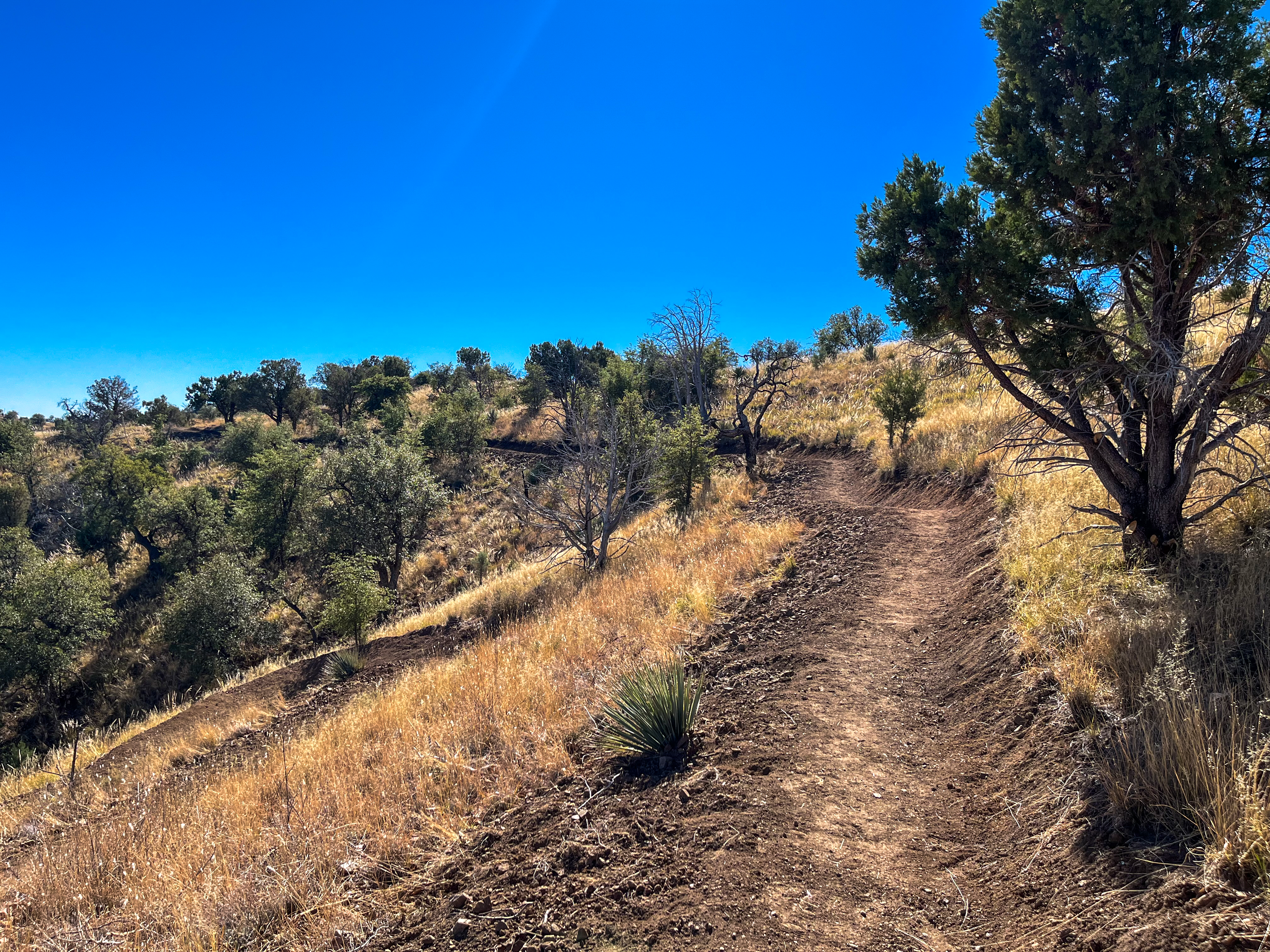
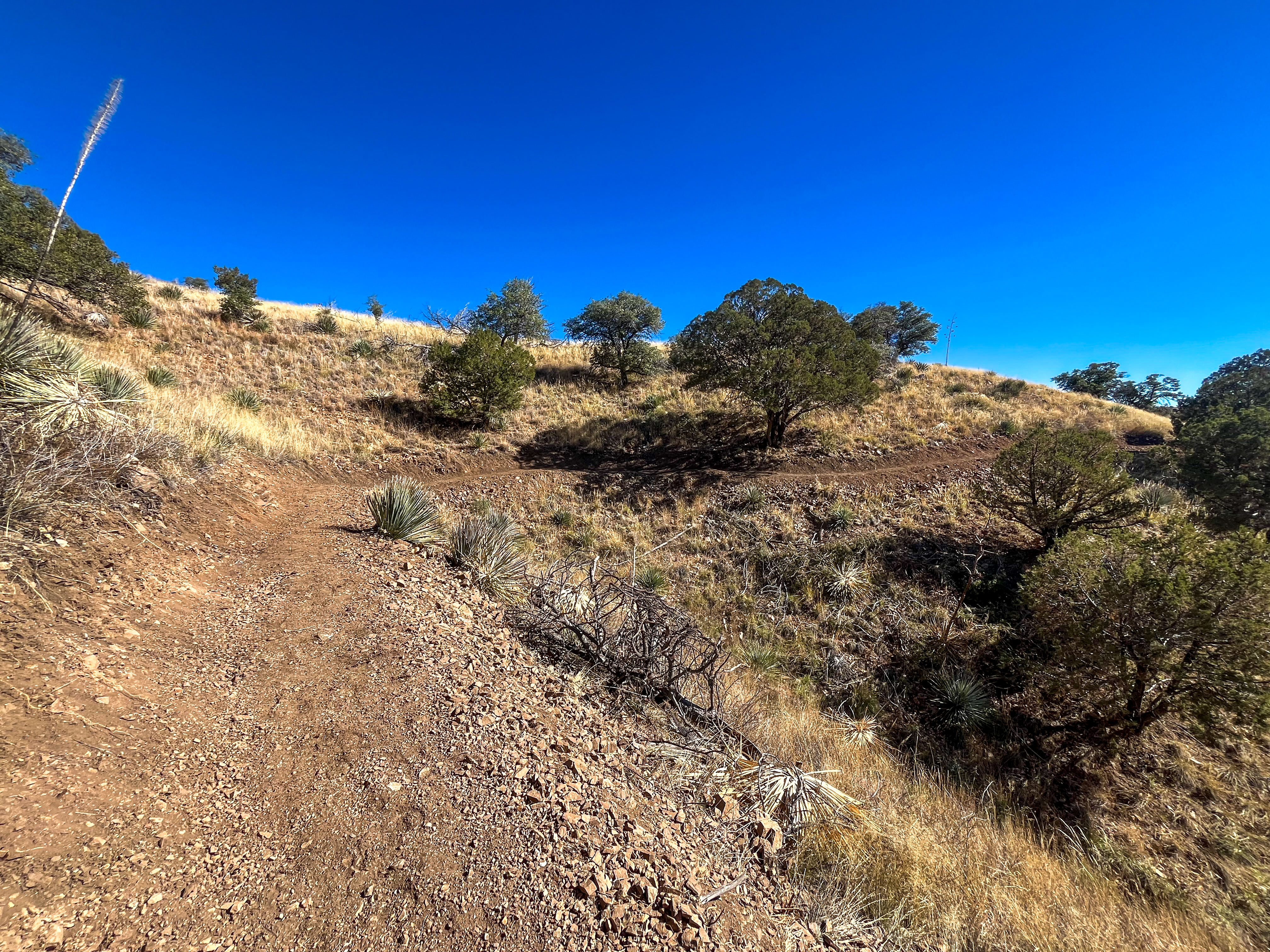
The Arizona Trail Association (ATA has been steadily chipping away at the 120 miles of dirt roads that once interrupted the 800-mile Arizona Trail, replacing them with purpose-built singletrack. Over the past decade, they’ve completed about 40 miles of these reroutes, with recent projects including a massive 25-mile section through Casa Blanca Canyon, completed in 2023.
While the ATA was tackling the physical challenge of building a sustainable trail through the rugged terrain of southern Arizona’s Santa Rita Mountains, they were also pioneering a completely new approach to the trail design process—one that’s proven to be dramatically more efficient, while also being more respectful of the indigenous peoples whose ancestral lands the trail crosses.
Building singletrack on the Ce:wi Duag
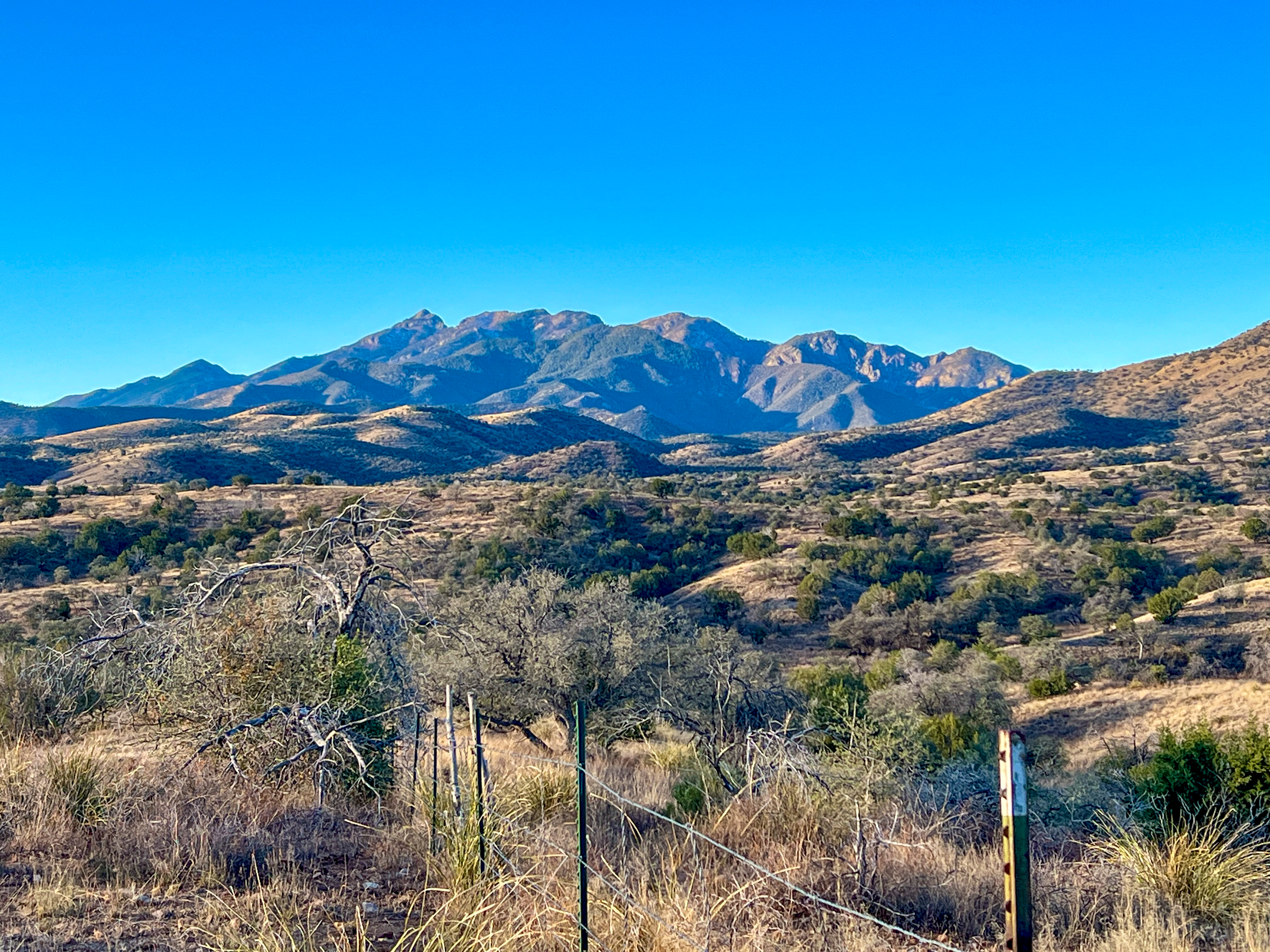
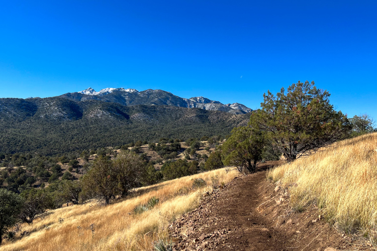
While even many Arizona locals consider southern Arizona near Tucson to be flat and low elevation, several massive mountains, known as sky islands, soar above the landscape. One of the most prominent rises to a height of 9,456 feet between the towns of Vail and Patagonia. This behemoth is known as “Ce:wi Duag” to the Tohono O’odham people, who have lived in the landscape since time immemorial. The name translates roughly to “Long Mountain,” which is apt, as the mountain range spreads for miles in all directions.
“Ce:wi Duag is vital to ceremonies, stories, and songs, and is home to ancestral villages, sacred sites, and critical natural resources,” according to PNTS.org. “Ce:wi Duag contains springs and natural resources not available in the lowlands, yet are integral to O’odham himdag (way of life). Equally important are the remnants of villages that contain the remains of O’odham ancestors. Tohono O’odham began living here at least 7,000 years ago, primarily because of the mountain’s ecological diversity, natural resources necessary for tools and ceremony, and the availability of food and shelter.”
Today, the prominent mountain peak is also known by the colonial name “Mount Wrightson,” while the mountains are collectively known by the Spanish name “Santa Rita Mountains.”
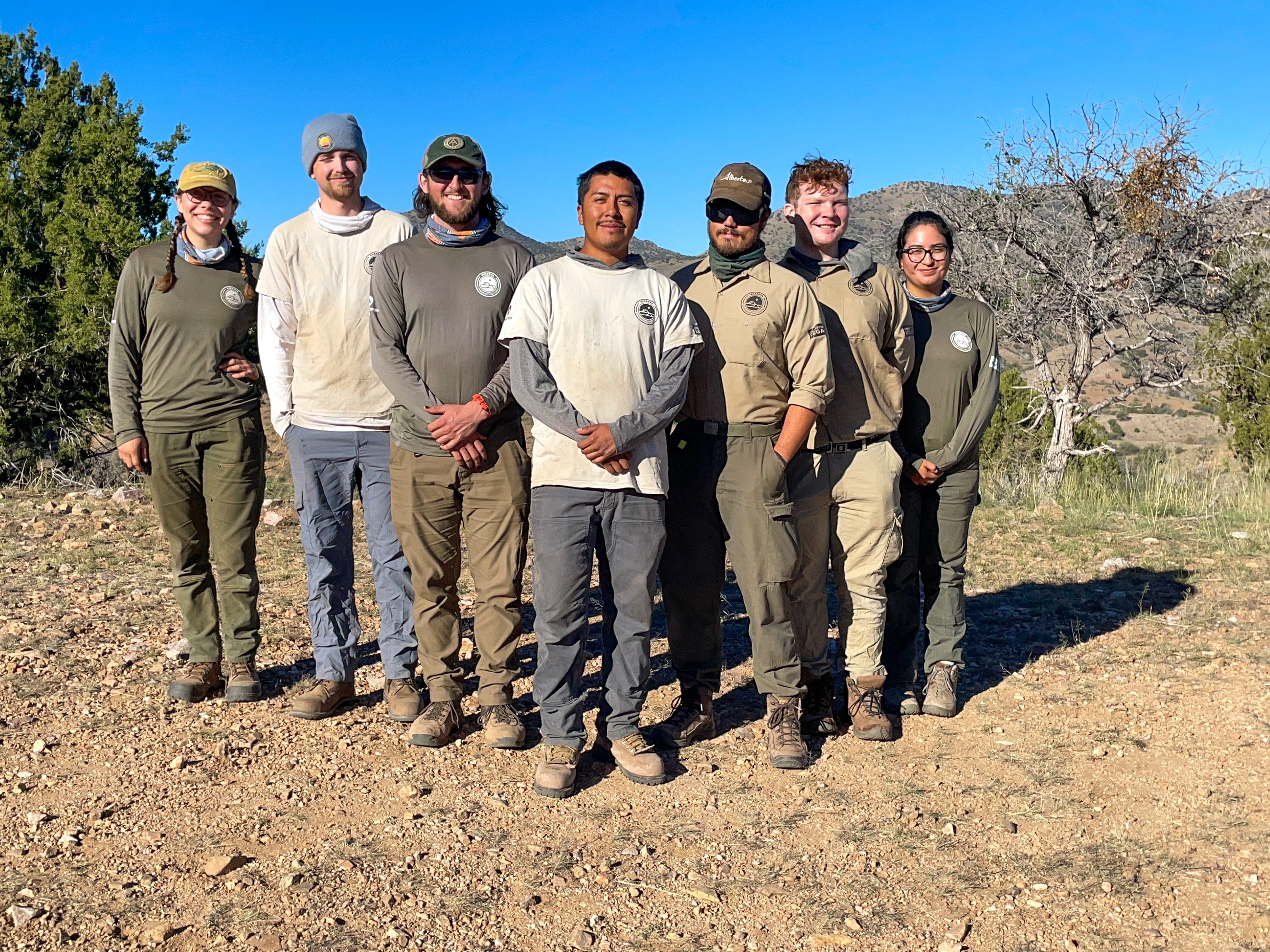
The Casa Blanca reroute was one of the first AZT reroutes in this landscape, but another 11-mile traverse across the Ce:wi Duag is currently in progress. Matthew Nelson, Executive Director of the ATA, chose the Arizona Conservation Corps’s (ACC) ancestral lands crew for the project because the landscape is home to endless sites of archeological and cultural significance. “It’s an opportunity for a little bit of cultural reconnection, potentially some cultural healing between the land and the people,” said Nelson. “And if these young O’odham members or other tribal members are discovering, say, artifacts, archeological sites, while they’re out there, I know that they’re going to be treated with absolute respect.”
“I shared this with the Forest, and they’re like, ‘Holy shit, I can’t believe this.’”
Matthew Nelson, Executive Director of the ATA
Working with the indigenous people first, not last, leads to a huge increase in efficiency
Generally, when the US Forest Service builds a trail, they do the trail design and environmental studies first, and the very last step is tribal consultation. “I think that can lead to project delays, but it’s also just generally disrespectful,” said Nelson. He shared that on most of the AZT’s projects, tribes and archeologists would then find about four archeological sites per mile of trail, or about 100 sites for a 25-mile reroute. This would require 100 trail design changes.
With the Casa Blanca Canyon and, subsequently, the Santa Rita Foothills Traverse projects, the ATA tested a different strategy. Instead of asking the tribes last, they asked for their input on the trail design first. The ATA shared the beginning point and end point of the new trail section and asked the tribes which areas should be avoided. Feedback that came back included “no hilltop, no ridge lines, no flat areas, you know, just keeping them on steep side slope.”
After designing the Casa Blanca Canyon reroute with tribal input first, the archaeologist then walked the route and only found four archeological sites over the entire 25 miles. That’s far less than usual for a project this size.
“I shared this with the Forest, and they’re like, ‘Holy shit, I can’t believe this,’” said Nelson.
Providing indigenous peoples with easier access to the land
As mountain bikers, we value trails like the AZT primarily for their recreational opportunities, but Nelson told me that now, when the ATA builds new sections of trail, they also consider how it can be used by native peoples to better access the land. This is of critical importance because the land is now “more difficult to access for societal and cultural needs,” according to PNTS.org.
Why are the lands more difficult to access? Well, they were taken from the Tohono O’odham. The tribe never signed a treaty ceding the Ce:wi Duag — the mountains passed out of indigenous control through the Gadsden Purchase and the 1902 Forest Reserve designation that converted ancestral O’odham land into what the federal government simply called “public domain.” The Tohono O’odham today hold 2.8 million acres of land — a small fraction of their historic ancestral lands.
While a singletrack trail can’t right this historic land theft, the AZT is now helping the Tohono O’odham gain better access to their ancestral lands.
“One of the most amazing things that came out of that early tribal consultation in the Santa Ritas is that we learned just how important these mountains are for resource procurements of basket plants,” said Nelson. “So plants like yucca, beargrass, and agave are really important for O’odham people. But without there being trails in this area, and private lands between major roads and public lands, there is no reasonable access. So with a trail being built through that area, one of the trail design features is proximity to basket plants. That way, people can hike along a trail, harvest beargrass or yucca, and then hike back out.
“Before talking with tribal consultants, we never even thought about integrating that element into trail design, but as we begin to realize that trails are cultural resources as much as they are recreational resources, trails become more relevant and will be used by a greater diversity of people,” he continued. “It’s been a really wonderful learning process for me as a trail professional and us as an organization.”
The Arizona Trail was always going to be a remarkable achievement — 800 miles of continuous trail connecting Mexico to Utah is no small feat. But what’s emerging from the ATA’s work in the Santa Ritas is something bigger than just better singletrack.
For mountain bikers, the math is simple: tribal consultation first means fewer redesigns, fewer delays, and a better singletrack experience. But the deeper lesson here is that when you build a trail that matters to more people — that helps an O’odham weaver access beargrass, or helps a community reconnect with ancestral land — the trail itself becomes more important, more protected, and more likely to endure.
Know about a new trail project we should cover? Whether you’re breaking ground on the next must-ride trail network or putting the finishing touches on a neighborhood flow trail, we want to hear about it. Drop us a line at [email protected] with the details, and your project could be featured!


0 Comments