Life in the desert has taught me that somewhere around 105 degrees Fahrenheit, any semblance of a cool breeze transitions to something more like a blow-dryer. The twenty-mile per hour headwind creates enough difficulty in riding a bike, but the hot air in my face and bright sun on my right side has become intolerable. Neither the ice cream bar I bought and quickly inhaled from the nearby gas station nor the fresh water bladder full of ice water brings sufficient relief from this oppression.
Yesterday I began my journey, leaving my house, and climbing 7,000 feet into the high Sierra above Bishop. I dropped back down a forgotten and precipitous singletrack into Big Pine Canyon. There, the invisible wilderness boundaries forced me back to the valley floor. On the shores of the dry remnant of Owens Lake, it’s obvious that my journey around the Sierra Nevada will bring bigger problems than just long climbs.

The late afternoon sun hits a raised railroad grade and casts a narrow shadow on the sand. I throw my sleeping pad against the earth, strip off my shoes, socks, shirt, and shorts, then lay down out of the sun. Flies buzz around my head. I wait for the sun to pass behind the Pacific Crest, and for the south wind to turn west.
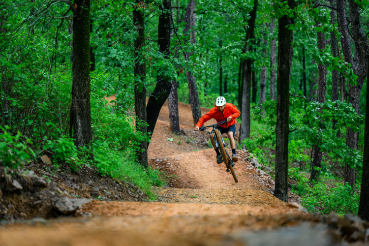
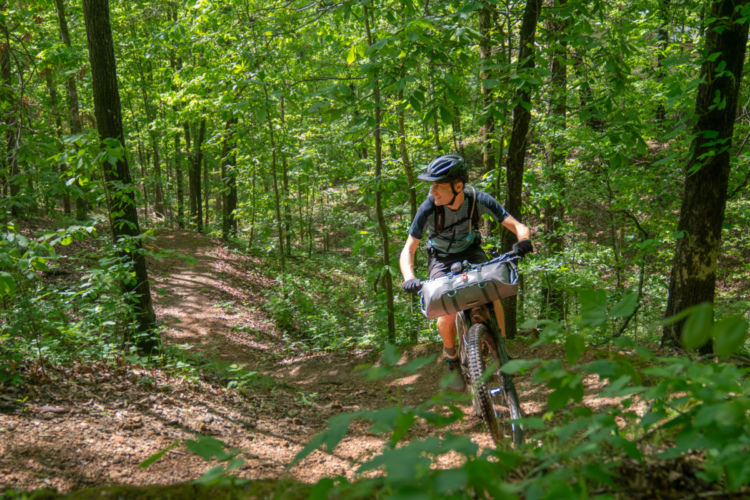
The question of “Why the hell am I doing this?” slips my mind before the next day when I find the answer. Another mile-and-change of vertical ascent brings me across the Pacific Crest, to the headwaters of the Kern River, where afternoon storms have left the air cool and smelling of wet earth. Joshua Trees and oppressive headwinds are a distant memory. The sticky dirt grabs my cornering knobs, zipping me back and forth, splashing through creeks. I push my loaded rig up a few boulders, and make camp at one of the best places in California to be with a bicycle: Sherman Pass, the top of the Cannell Trail.

Typically (and most easily) accessed by shuttle, the Cannell Trail undulates through the high forest between 9,5000 and 7,500 feet of elevation, before plunging a final eight miles and 5,000 vertical feet to the Kern River. Ruts make for narrow berms and send me between and over boulders. I sail out of the trees and into the golden canyon below. I coast onto the pavement, brakes and shocks heated from abuse, and spin into Kernville for a resupply and a beer.

Tracing the sometimes narrow band of fun and legal mountain biking terrain that lies between low valleys and the high wilderness of the Sierra Nevada creates an interesting conundrum. Deep canyons and high ridges alike must be crossed rather than followed. After crossing the Kern river, I am climbing up another 6,000 feet to the top of the Great Western Divide. Giant sequoia trees rise up from the earth, towering above the canopy.

I follow trails, sometimes narrow and forgotten, north out of one canyon and into the next. The Tule, Kaweah, Kings, San Joaquin, Merced, Tuolumne, and Stanislaus Rivers all cut from East to West and guard the way north.

Following back roads and trails, the canyons gift me with waterfalls and swimming holes, while the ridge-tops are spotted with granite domes where my tires hum joyously above the tree tops. One day I am carving through tunnels of manzanita joined by mountain and dirt bikers alike. The next day I spin alone by moonlight, passing between ghostly pine skeletons left by the 2013 Rim Fire.


I am delighted by the trails that send me down from high ridges, along narrow flume bridges, and off to the depths of the Stanislaus. I follow it upstream, on the bed of an old track that alternates between scrambling through boulders and floating upon the river banks. Thickets of bright green fill the narrow space between me and the rushing waters to my left. Up the river, a high suspension bridge brings me across and on to the next climb.

When I reach Bear Valley, I am greeted with hospitality, and a morning guide through miles of beautiful singletrack. Granite slabs interrupt the loamy trails that rise and fall to gradually bring me back over the Crest.

My guide bids me farewell and I cut north onto a remote and rugged jeep trail. I climb into the night and find my next camp among boulders, looking north over the wide reflective surface of Lake Tahoe.

While no longer dropping and rising repetitively between 2,500 and 9,000 feet of elevation, the Tahoe Rim Trail proves no less difficult a path. It makes its way over and around demanding, boulder strewn mountains, with switchbacks, steps, and ledges to overcome. Despite the traffic on the shores beneath me, I only occasionally encounter other visitors along the path. After a punishing 40 miles, I find myself relieved that it is the wrong day of the month to continue up the rim, and instead follow gentle flume trails to reach my descent to the lake, bounding through the air on two wheels along the Tyrolean downhill.

I leave Tahoe behind as darkness settles. Lights on, I creep off the side of Martis Peak, warily approaching horizon lines before dropping down steep stone notches toward the lights of Truckee.
[see_also id=’266725′]

I spend the next morning at a bike shop, acquiring some necessary rehabilitation for my two-wheeled companion, and at a nearby cafe I consume a burrito the size of my head. I find the way north relaxing and easy. It follows well groomed trails out of town, then a few sections of dirt road before taking faint paths down through the trees.

The next afternoon I am at Packer Saddle. Van-loads of mountain bikers mill about. After a few minutes, a couple of my friends from home come up the hill in an old Toyota pickup. A bit of rigging, and I am riding again, no longer alone, but three deep, down the dusty corridors of Butcher Ranch and Paulie Creek, and into the enchanted gorge of the Second Divide.

The next day the three of us turn south, back toward home. The sky has turned dark, and the light sprinkle that awoke us early that morning soon returns. We share a few optimistic words on how the clouds pleasantly block the sun before a clap of thunder sounds off its warning. My raincoat proves no match for the ensuing downpour. All three of us are soon soaked to the core. My friends gift me with their spare snacks before turning back, and I continue on.
The rain only worsens, and soon newly formed creeks are rushing down the road past me. I crest onto a ridge, greeted by a heavy gust of wind in my face and across my soaked body. My route jumps onto singletrack, which has turned into a river of its own. I abandon this pursuit in favor of potential shelter at the ghost town a few miles up the road. There I find a suitable porch, change into my dry clothes, and burrow into my sleeping bag, and reminisce about the 106 degree day in the Owens Valley two weeks ago.
I return to my damp biking clothes and pedal a few miles up to a ridge top. Here, a bit of cell phone service informs me that the weather will be better tomorrow, then worse the next day. Snow is falling, and forecasted for the higher elevations, and I am hopelessly ill prepared.
I could return to Downieville, or detour to Nevada City and wait out the storm, but the delay would bring me home several days late. With my family nearby, and on their way to Bishop to visit I have an easy ride home. My life partner is coming out of the Sierra Nevada wilderness for the first time this summer in a few days, and I don’t want to miss her. The bike ride is just for fun, just for me, and also very silly. I can finish it whenever. I turn off my route, and am soon with friends and family, only a little disappointed as I un-rig my bike. Eleven hundred miles of Sierra adventuring behind me, it’s hard not to smile.


6 Comments
Oct 10, 2019
Jan 26, 2020
Oct 10, 2019
Oct 10, 2019
Thanks for the well written reflection on your amazing bike packing trip. Any chance you could up load a map?
Thanks, Michael
Jan 27, 2020
Oct 10, 2019
Kevin