Take Gauley Mountain Trail off Mine Rd. and ride 1.5 miles, passing Tea Creek Connector Trail at .9 miles, and turning right on Bear Pen Ridge Trail. Take Bear Pen Ridge Trail for 3.5 miles to the bottom of the mountain. When you get to the bottom ride past Tea Creek Trail (one left and one right) and then cross Tea Creek (the stream). Continue on Bear Pen up the bank across the creek for another 1.7 miles to the intersection of Boundary Trail.
Here you need to decide if you feel like another 2 miles of tough, technical riding with a few short tough climbs. If you decide to miss that challenge, a couple beautiful places on the trail and an awesome overlook, go straight past Boundary and continue about another 1/2 mile to FR135. In a few hundred feet you will come to a steep uphill into a strip mine clear cut. Ride down through the clear cut to FR135. WARNING there is a DEEP drainage ditch across the trail in these weeds making it easy to nose dive into. Be alert. Once at FR135 go right to vehicle if you didn't drive past this intersection at the beginning.
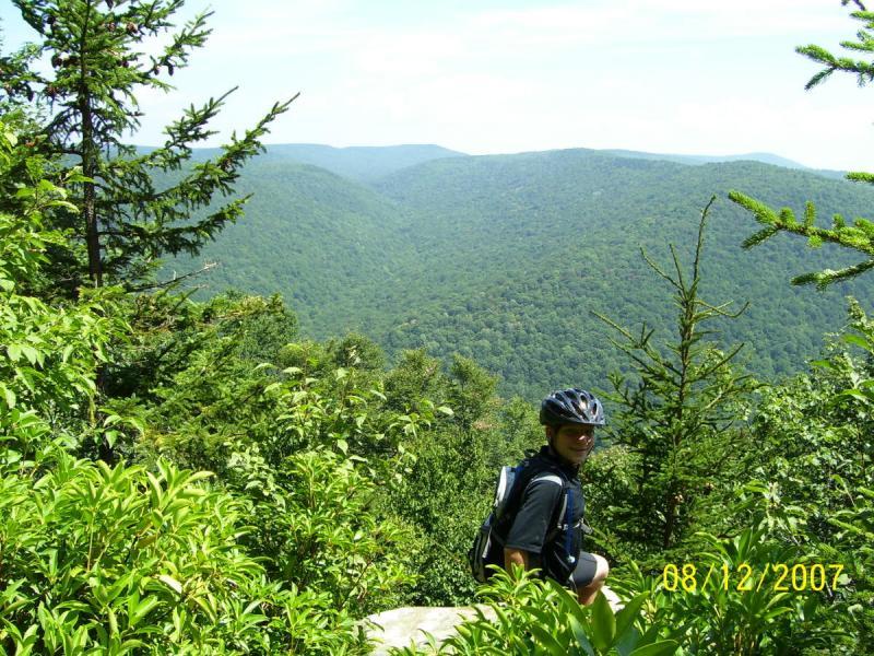
To continue the modified, challenging and beautiful loop, take Boundary Trail, ride just over 1 mile to the top of the mountain and the next intersection. There are several signs there and the overlook is on your left. Note, Boundary Trail goes right when you arrive. Don't get confused when you leave and go down Turkey Point/Saddle Loop. After viewing the overlook and taking that much needed break continue down a fun 1/2 mile with a few switchbacks to a plateau that takes you through a tight laurel tunnel and then to a steep, 50 foot drop and hike-a-bike down it. Just a short distance you will come out on a Forest Road. Turn right, noting Bannock Shoals trail on your left. Follow this road to the next intersection and stay right on FR135 and at all major intersections till you reach your truck. About 17.5 miles total. What a blast ! Check out the pics of this trail for example.


Hey all, I got them to move the gps file I noted below to the correct location. As for this loop, it's still an awesome ride if you don't want the miles the other loop mentioned gives you.
| ThankNote: the gps file attached here got here by accident. Please look at Gauley_Bearpen_Boundary_Shoals_Loop for the correct description to go with the gps file. I tried to get it corrected but someone didn't see it.
| ThankIMPORTANT NOTE: I see the Forest Service has changed something on this trail. Where Bear Pen meets Tea Creek it now ends. From Tea Creek toward what we knew as Boundary is now considered Boundary and the link out to FR135, which was once Bear Pen is now closed and you must follow Boundary all the way to the intersection of Bannock Shoals. Apparently that old section traverses through private property. I guess that is why they are now refering to the section between Tea Creek and Bannock Shoals as Boundary Trail now. FYI* Review edited 7/8/2008
| ThankJust spent a week at Tea Creek Campground and our group rode most the trails in the area. This loop is in great shape and drier than normal. Take advantage of these drier than usual conditions and get out there.
| Thank