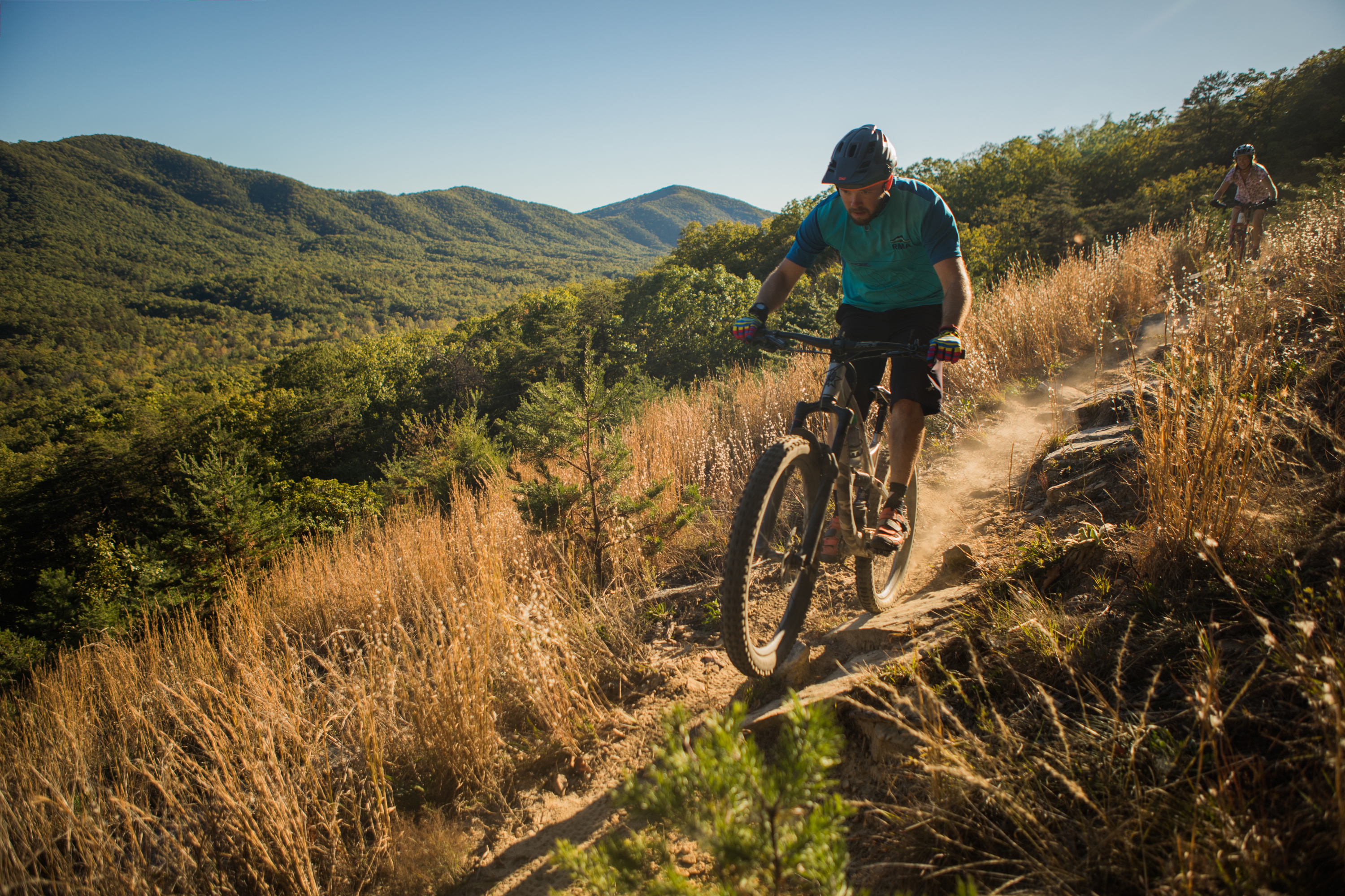
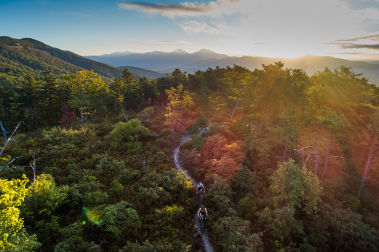
Carvins Cove is considered by many to be the premier trail system in Roanoke, if not all of Virginia. Long-time local rider Dan Lucas, Mechanic at Cardinal Bicycle, put it this way: "If you want burly speed zapping roots and technical rock gardens, we have that. If you want beginner-friendly zones, we have that. If you want lung-busting climbs and epic-quality routes, we have that too."
Carvins Cove offers over 60 miles of singletrack, providing a seemingly endless array of route combinations to choose from. This network is more than just a day trip — you can easily spend an entire weekend pedaling up and ripping down the steep mountainsides of this MTB paradise and not see everything.
"These trails are growing and have become a community gathering place," Lucas continued. "Junior cycling teams, beginners, and elite athletes all use Carvins Cove as a place to build skills and the cycling community. It's a place full of rich experiences and kind people. These trails are old, they have a lot of soul, and a lot of joy to give. It may not be on the big bucket list trail systems you see most places, but Carvins has a presence that can not be duplicated."
-Greg Heil
 | Araminta | 1 mi | |
 | Arrowhead | 3 mi | |
 | Brushy Mtn | 7 mi | |
| Buck | 1 mi | |
| Comet | 3 mi | |
| Enchanted Forest | 1 mi | |
| Four Gorge | 3 mi | |
| Four Gorge Ext | 1 mi | |
| Happy Valley | 7 mi | |
| Hemlock Tunnel | 2 mi | |
 | Hi-Dee-Hoe | 1 mi | |
| Hotel | 1 mi | |
| Jacob's Drop | 1 mi | |
| Kerncliff | 3 mi | |
| Lakeside Trail | 4 mi | |
| Little Bell | 1 mi | |
| School House | 1 mi | |
| Songbird | 2 mi | |
 | The Gauntlet | 2 mi | |
| The Trough | 2 mi | |
| Tuck-A-Way | 1 mi |


 11
11


These are nice trails but, for me personally, Carvin's Cove didn't come close to living up to singletrack's "#1 Trail System In The State" hype. IMO, plenty of nice, "average", 3-Star trails, but more 2-star trails (terrible flow-killing roots & rocks) than 4-star trails.
DISCLAIMER: My rating is based on only one visit - a 13mile loop targeting as many highly rated (trailforks) trails as possible. But I've had great luck with that 1st-timer strategy (let singletrack, mtbproject, etc. tell what destinations to drive to, then select route based on trailforks user trail ratings to select route) at dozens of "destination" trail systems all over the country.
| ThankChallenging and Awesome!!!
| ThankThe climbs are pretty much straight up to the summit but once you're up there the reward... ALL DOWNHILL FROM THERE!
This place is amazing. It really has it all, Trails with flow, bike park trails, climbing efforts, traverses... reasonably easy to navigate.
| ThankFun trail ridden in either direction. Few water crossings but normal conditions easily done. Connects to several other trails.
| ThankSteep with root drops and sharp switchbacks. Better do a brake check at top. Have climbed but so much more fun down.
| ThankFun trail ridden in either direction. Couple creek crossings but normally not a problem. Can be flowy if ridden fast.
| ThankTotal mileage is up to 60 and increasing
| ThankAbout the best trail at carvins.it flows very good and is well designed.
| ThankFlowy and gorgeous! Rode HiDeeHo, Gauntlet, Lakeside, Hemlock, Kerncliff, Tuckaway, and lower Comet where a deer visited us. Don't be dissuaded by the diamond ratings if you are a strong climber; rock/ root skill level was only beginner/intermediate. You may need to bring a 2nd set of lungs for the climb though! Broke a chain on the ride and it would have been a ridiculous hike out if we didn't have parts for repair. Come prepared. Local store Just the Right Gear provided friendly, affordable, fast repair post-ride. Nice people.
| ThankPlease do not give bad ratings based on personal difficulty experience. Mountain biking is a strenuous activity and can require difficult climbing, challenging downhill, and on occasion hike-a-bike. Rating a trail poorly solely because it was difficult does not imply it is a bad trail to ride. Please consider this next time you comment on a trail. Happy riding!
| ThankPosted July 5, 2017. These are excellent trails, well marked. HOWEVER: while biking out there we came across two ladies who were just terrified and had not just seen, but had been followed by a bear for at least 20 minutes. Later we saw a very large bear right off the trail. DO NOT BIKE THESE TRAILS ALONE...and be prepared to possibly encounter bears out here!
| ThankNice short connecting trail that lets you avoid the fire road. Short twisty hill with a short ride through the most peaceful pine trees in Virginia!
| Thanktrails were a little muddy in spots at the start of the ride. Half way thru the rain started and did not let up rest of ride. From that point the trails were a mess so we took it slow.
| Thankfun roller coaster
| Thankfun when dry
| ThankWell maintained trails,
| Thankgreat variety of trails. will be back
| ThankThis trail is a very fun, fast downhill that starts with a series of epic jumps. After that it transitions into a fast singletrack with an occasional little jump or drop. At the bottom your hands might be stuck to your bars!
| ThankThis trail gave me a much needed opportunity to spin out my legs after Buck! The flatness is made up for by the beauty of the flora and fauna along the trail's edge.
| ThankI loved this descent. The switchbacks were fun and the steepness was exhilarating!
| Thank