singletracks is mountain biking
Sign In | Create Your Account | Site Map | Help  


Prospector - Church Rocks Loop Mountain Bike Trail

St. George, Utah

MTB TRAIL STATS

Avg Rating: 3 trail reviews
Status: Open
updated 11/28/09 by AK_Dan
Difficulty: Intermediate bike trail Intermediate
Length: 11 miles Global Rank: #1171
Tread: Singletrack Configuration: Lollipop
Ridden: 5 Wishlist: 5
 
Directions: To view directions to Prospector - Church Rocks Loop mountain bike trail, please login. If you don't have an account, sign up now: it's free, only takes a minute, and gives you access to tons of other rad features.

Description: 
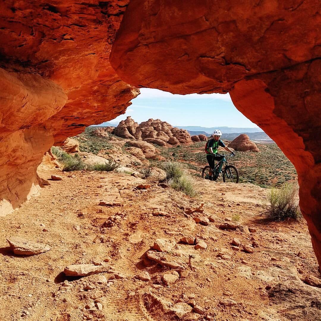
The trail leaving the parking area is a wide track for about the first quarter mile until a signed intersection where you will turn left (south) onto singletrack and start your ride parallel to some red rock ledges. The trail is fairly smooth and has nice flow as it crosses up and over small ridges and down through gullies. A couple spots have been rerouted for vegetation rehabilitation but these are clearly marked. At about 1.7 miles you will run into a very sandy hill, this sand section will last just about 100 yards and then is done, in the middle of it is an intersection with the Spanish Wash trail, any equestrian traffic that has been on the trail will more than likely exit here. Continuing on stay right on the main trail when you encounter a small singletrack that takes off to the left. The intersection with the Church Rocks trail will be an obvious T, although ride-able either direction I recommend taking a right and doing the loop counter-clockwise. You will ride back towards the north for about a mile but higher up on the hillside so there are more slickrock sections mixed in. You will come to a large U turn and the trail goes up a short but steep rock section and then takes off south up the ledge. Once on top you have over a mile of slick rock ledges and bowls to play in all the while making your way south down the ridge. Upon reaching the end you will all of a sudden notice large black volcanic rocks strewn about, these are very evident because all you have seen for the last hour or so has been red. Its advisable to go down the wash to get off of the ridge and start heading back north. Once at the bottom you will notice a couple other trails, these are the other access trails mentioned in the directions. There will be a couple different routes up the slick rock, just follow the tire tracks in the sand or make your own fun route, they all end up towards the top at the same place. Just look for the main trail at the top of the hill marked by large carins and all the other tire tracks, follow it north back to the Prospector trail.
added on November 28, 2009 by AK_Dan
Map   Videos   Photos  

SIMILAR TRAILS

Riders who liked this mountain bike trail also liked:
 
Gooseberry Mesa in St. George
 

TRAIL REVIEWS   review this trail


reviewed by pernicious on December 10, 2010

Pleasant surprise. Was not expecting much and had a fun ride. No real climbing still fun, a little sandy in spots. Should be a blue circle less difficult. It's close to a great camp spot at Red Cliffs, it's BLM camping but has water and bathrooms, super cheap, hard to beat,

* Review edited 12/10/2010


reviewed by matthewloveland on November 25, 2010

The Prospector section was an easy rider with few technical areas, while the Church Rocks loop had a Handful of technical sections. I really enjoyed the ride and highly recommend for all types of riders. Parts being difficult for the beginner to intermediate rider with all parts being walkable.


reviewed by AK_Dan on November 28, 2009

The Prospector trail actually starts another 3 miles north of the described trailhead. If that type of open, x-country riding appeals to you by all means start there for a longer ride, just add 6 miles to the trip total. Continue on the old Hwy 91 for another couple miles and look for a small road on the left across from a trailer park that runs through a single lane tunnel under the freeway, follow this towards the Red Cliffs Campground 1 mile to signed trailhead, park alongside the road.

MTB Trail Dashboard

Tags (comma separated)

cancel

Widget Code
copy and paste this code onto your website.
Horizontal Vertical Trail Name


Site Map | Advertise | Partners | Contact Us | Terms | Privacy
Campground Reviews | Hiking Trails | Trail Running | Skiing / Snow Sports | Mountain Biking
Copyright 2012 Blue Spruce Ventures LLC | Atlanta, GA
singletracks.com is yet another slick Review App
 
time: 0.052793025970459 seconds