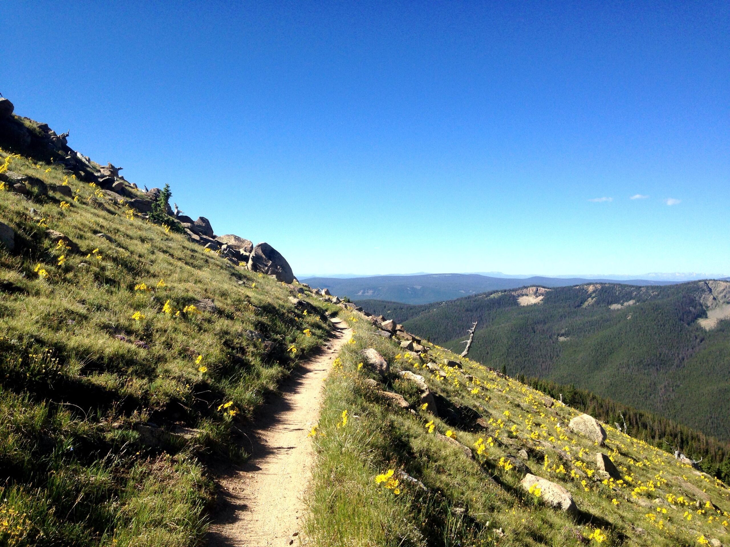
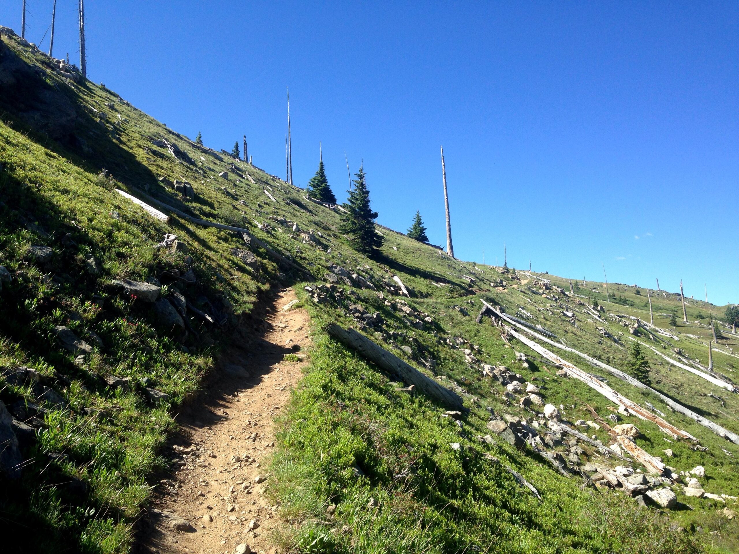
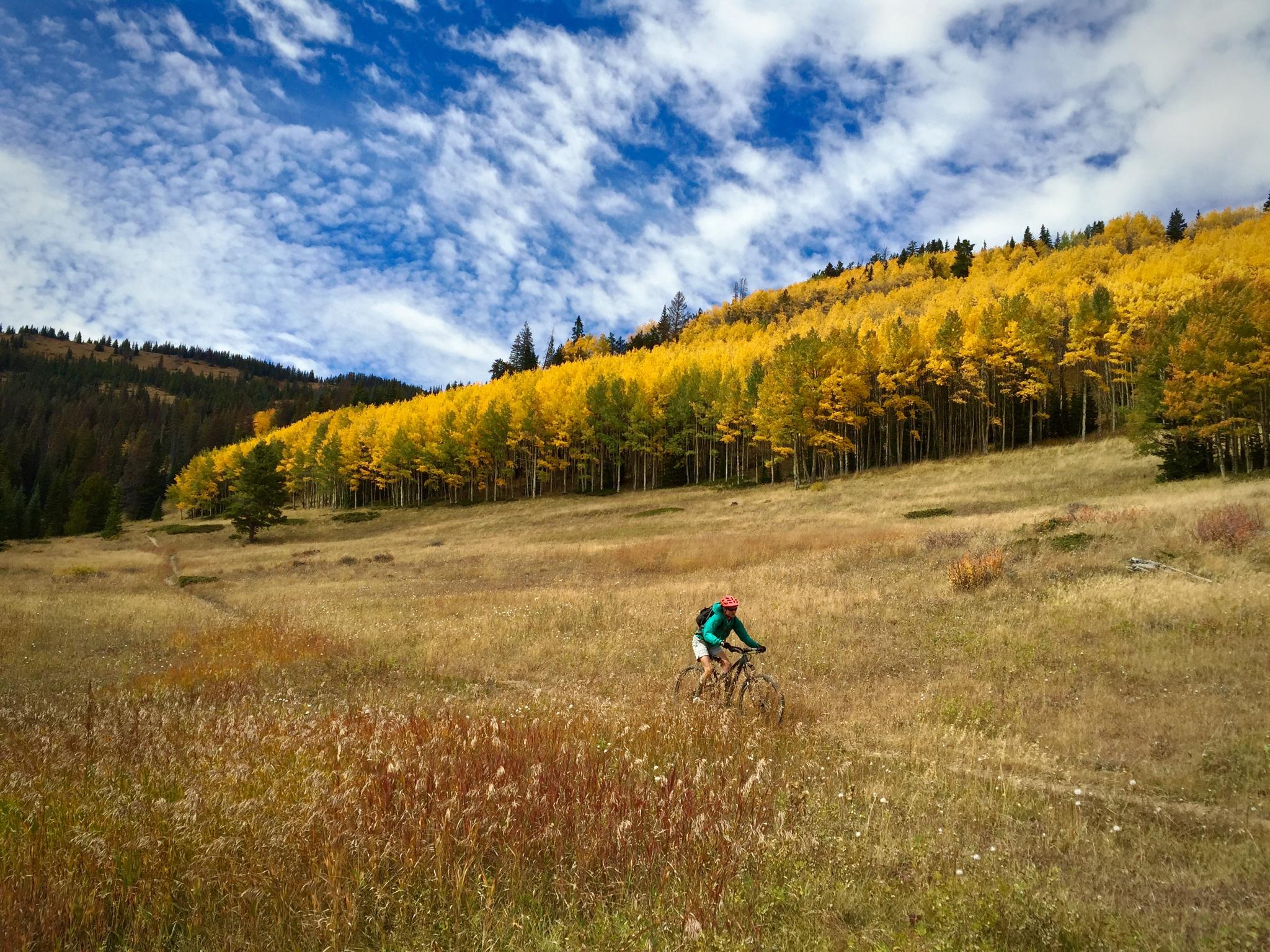
This is one of the premier shuttle rides in the state and with good reason. With over 30 miles of mostly singletrack trails and all of the best scenery Colorado has to offer, this trail is a must ride. As a shuttle ride you'll climb about 2,300 feet (much of it above 11,000 feet) and you'll descent about 6,000 feet total. The first part of the ride is above treeline and is not technical in any way. You'll top out at about 11,960 feet and then begin the first major descent down an old fire road to Marshall Pass (this is about the 10 mile mark). From here you can choose to descend down more fire road to the bottom or you can climb up the Rainbow Trail (recommended). Here you'll find some dense forest sections and some steeper climbs. Finally, head left onto the Silver Creek trail and follow this baby all the way down to a forest service road. The Silver Creek trail is pretty technical with some large scree fields, switchbacks, and some rough sections of trail. At the end of the singletrack you'll ride through a large streambed and out to the forest road. Go down a bit here until you see a sign for the Rainbow Trail. Here you can take the Rainbow Trail back to US 285 or stay on the road for a quicker descent. An awesome ride, do it if you get the chance but watch for thunderstorms and be prepared for a long day. Shuttle services are available, check the internet for more information. Trail is usually open (read: clear of snow) from July to August.


 26
26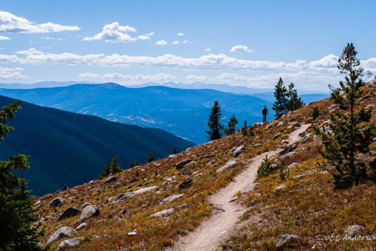


Just do it!!! Fall especially!
| ThankDude you suck
| ThankOne of the best rides in the country, you want to make sure it's not snow covered when you ride it. You can arrange a shuttle from one of the local bike shops, you can find a rental shop online at TripOutside.com for this area as well.
| ThankBeautiful views, thin air. As someone that lives at 700' above sea level, we rode the crest on our 2nd day in Colorado. It was fun but would have been better had we acclimated a few extra days first. The downhill to Marshall Pass is a blast. We rode back to town on the old D&RGW rail bed. It was an easy cruise with beautiful views. Highly recommended.
| ThankSecond ride here and loved the variety and obviously the views. Hard to beat for an epic mountain bike destination ride.
| ThankBig, all day ride with great views
| ThankAfter riding along the crest you have to choose one of several trails to descend back down to civilisation. We went down Starvation Creek and ended up on hwy 285 which we took back towards Salida. There are several other options but that one was excellent - not too extreme or long at 30 miles and lots of variety. The ride along the crest undulates and has some rock garden action but is generally mellow. The views are stupendous. The descent which required advanced riding skills included everything from fast dirt trail through forest to chunky scree..
| ThankA classic!
| ThankOne of the all time classics! Its just has some of the best high altitude riding you will ever do. Riding above treeline to screaming flowing descents. What more could you ask for!
| ThankDon't be fooled by the specs of this ride. It feels a lot tougher than 2,000 ft of climbing on other trails. I do a ton of riding on the front range on trails with more vert but I was definitely feeling it in this one. Great views, nice flowy singletrack, and awesome dirt. Highly recommended but be prepared! Know which trails you are supposed to take ahead of time because "monarch crest" is not a label you will see anywhere.
| ThankDefinitely allow yourself to acclimate to the surrounding area before hitting this one! An arduous long climb brings you to some amazing views of all the surrounding area and bevy of fourteeners that surround this spot. Hardcore locals might just ride up Monarch Pass to the trailhead but most shuttle. It's got a little technicality to it but nothing for your enduro bike. Once you're up top there's a myriad of trails for your choosing. You really have a menu of trails to choose your own adventure back down to town.
| ThankThe trail climbs through several variances in the biome of the area and allows for challenge in your climbing skills. Once up top you're back in the traditional dry Colorado forest. No doubt you'll come across some of the local bikers training on their preferred routes. Don't forget to link up with the Rainbow trail for some swoopy fun action on the way down! Finish up with a beer at Subculture and enjoy the town.
The Crest trail is one that should be on everyone's list. Not technical except for a couple of places. Where it gets you is in the elevation and sustained climbing. But man, what views. Epic. And once you start downward you'll have the time of your life. The descent is not too technical either really but depending on the route can go for many miles and gets steep and a little sketchy in a few places. It can be 75 and sunny but you could end up wading through hip deep snow up top ship take more clothing than you think you need.
| ThankAfter wanting to ride this for a decade, it went beyond my expectations.
| ThankIf you do the Silver Cr / Rainbow version, be prepared for 5 hrs or more out on the trail, and a surprising amount of stiff climbing.
I will have to say that the above tree-line portion of the ride was shorter than I thought it would be...
One of the best rides you can do. You get a sampling of a bunch of different terrain and ecosystems.
Amazing views. Great trails.
Remember that you are in the high country, so be prepared with a rain jacket at a bare minimum. Best to get started early in the day to avoid the frequent afternoon thunderstorms.
| ThankThe views don't get any better!
| ThankWatch the video
http://getsomeadventures.com/ride-the-divide-the-monarch-crest-trail/
This is an amazing ride, one of the best backcountry rides I've ever done, right up there with the Whole Enchilada, but completely different! Be prepared for quite a bit of high-elevation climbing. We swore it was 50/50 climbing/descending, even though our GPSs indicated otherwise. The decents go by very quickly! A lot of the climbing is short bursts of uphill sprinting, so it's not totally unbearable. There aren't many real long slogs. The Silver Creek descent is sweet! Rainbow trail gets kind of annoying until you cross the road, then it gets good. Losing the last few hundred feet of elevation on the main road is a bummer for sure. Overall, there isn't a lot of technical terrain. A few of the downhills are rocky and rooty, but nothing scary, you just have to pick good lines. You definitely want to be acclimated and in shape for this ride or you'll get a beatdown!
| ThankTruly epic. If you can suck in oxygen at 12K feet it doesn't disappoint. Rode it in July and still had to push through a couple snow patches. Not a downhill run even though it shuttles for $20. Buy the map with photos from the shuttle driver and don't skip Rainbow.
| ThankOne of the Best Trails I've ridden. My wife and I have an adventure travel blog and are riding the top 100.
| ThankMIND BLOWING!! Best ride I've ever done, and probably will ever do. It has some significant uphill, but it stays at a relatively low grade so you don't notice it that much. Plus the views from it's nearly 12,000 foot above the treeline summit are amazing! The Silver Creek's techy descent changes things up a little. Finally, you end with icing on the cake, The Rainbow Trail. This portion is by far some of the most flowy singletrack I've ever ridden, and I rode 18 road the day before.
| ThankThis is a fantastic trail. There's something special about riding on the continental divide; it feels like you're riding on top of the world. Of course, you get to follow this up with a raging descent that is a ton of fun. Make sure you bring plenty of food and water so you can take your sweet time and truly enjoy this trail. Still, make sure you get below the tree line before the afternoon thunderstorms. Also, don't forget to spend some time in Salida. It is a town of only 5000, but it has 3 awesome bike shops. I could definitely live there.
| Thank