Crest Trail is so yesterday! Last year I rode Canyon Creek Trail instead and wasn't disappointed. One of the best rides of the year maybe ever. It was the perfect MTB ride for me. A ride up an old mining road almost to the top of Tomichi Pass. An alpine hike-a-bike. Ten miles of true downhill ! Mostly smooth singletrack with some fun technical sections.
Start riding up CR 888 following the road to Tomichi Pass.When the pass comes into view watch for Canyon Creek Trail to take off to the left (west). You can ride a short distance then it's a 1 hour hike-a-bike to the top. The 10 miles of downhill is so sweet! One more little hike-a-bike some fun switchbacks and you're back on the road. I thought route finding was easy but a wrong turn would be costly so get the guide book and a map. Saw no other MTB riders but this trail is open to motorcycles and I saw a couple.


 9
9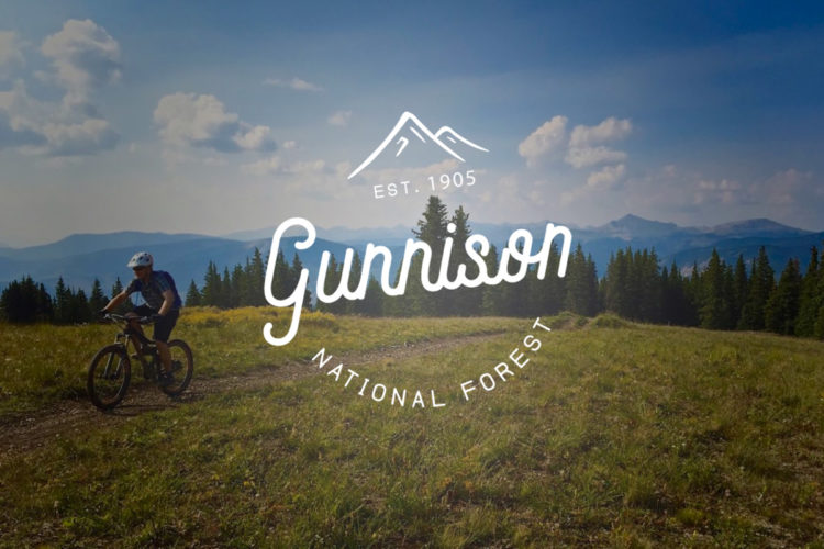


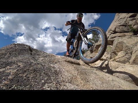
This trail takes you high and allows you to look down on the rest of the world but it won't appeal to most mountain bikers... The climb up is steep and relentless on a nasty 4wd track followed unridable singletrack. When you reach the summit at nearly 12,600 feet you will certainly fell exhilarated and be able to echo the famous words of Sir Ed Hillary when he conquered Everest: "We knocked the bastard off"...
The ride down varies but here is the truth: if you're an intermediate rider you'll get maimed, if you're an advanced rider you'll survive, if you're an expert rider you'll be able to make the most of it. It's a demanding high altitude adventure ride for people who like a serious challenge and don't mind lots of steep, rocky bike pushing.
| ThankEnjoyed your review which you posted on your blog. Looks like an amazing trail. Definitely adding this to my wishlist.
| ThankThe descent is amazing, one of the best I've ridden in Colorado. The climb up, however, is tough and involves significant hike-a-bike toward the top. Don't forget, there is a short climb right at the end of the loop so save a little gas in the tank to make it back.
| ThankOne of my favorite rides. The climb starts out mellow on a smooth gravel road, but once you make it through the village of White Pine, it gets a lot tougher.
Huge rocks are embedded in the road and there are smaller, loose rocks in between those. It's pretty steep in some sections, so I ended up walking quite a bit. Coming from only 1,000 feet above sea level to over 12,000 feet added to the challenge!
Once you turn onto the actual trail off the road, you're in store for a pretty stout hike a bike. The amazing views make it much less painful. Take your time, soak them in, and save your energy for the descent.
The top of the descent is rocky and steep with plenty of exposure. You don't want to crash here as you're in the middle of nowhere.
Once you're back in the trees, it mellows out a bit, but there's still the occasional rocky section. The last couple miles of the descent are super flowy and swoopy on decomposed granite. You can really rip in this section.
At the end there's a punchy little climb to get back over the ridge to the road, but at least you get a handful of switchbacks to finish on.
| ThankRode it yesterday. Awesome. A must do.
| ThankAwesome, looking forward to them! Yea, i figured the climb would be a bit easier on the 29er but the DH was worthy of the Santa Cruz. Maybe just ride pedal clips to make the climbs easier.
| Thank@zr140th, Definitely the full sus 6" bike. The climb is going to suck either way, but when you get to the top and point it down there's plenty of chunder and rocks on the upper half to warrant a lot of travel. Even on the lower, flowier half, having a slacker-angle bike is still a ton of fun! I still need to pull a few stills from some video I took on a few of the rock gardens... Stay tuned....
| ThankLooking to hit up Canyon Creek Trail soon, just wanted to get your opinion on which ride would be best to take up there: 29er HT (80mm) or FS 26 (6"). Looks like you had a blast!
| ThankRode this last week. Not closed unless you want to keep it a secret. Out of the gate you start a slow climb for two miles then after passing through town it really begins to climb for 8 miles, the trail cuts off just short of the pass where you can push or carry for the next hour to the top of the ridge. From there: uninterrupted single track that is middle of big chain ring for 16 miles! A harsh hill near the end interrupts the flow but the bonus is another 2 mile downhill to the car park.
Technically easier than the Crest trail but the climbing and carrying even things out a bit.
| Thank