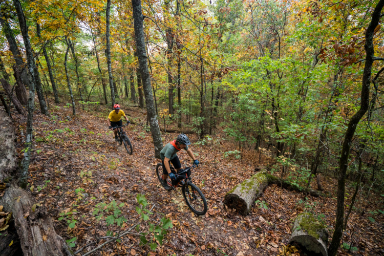
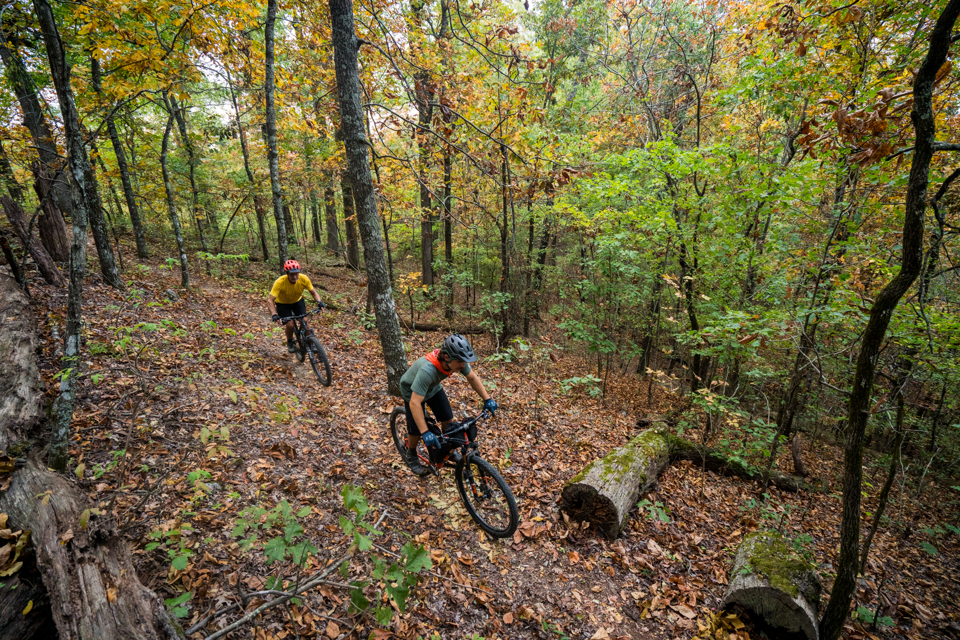
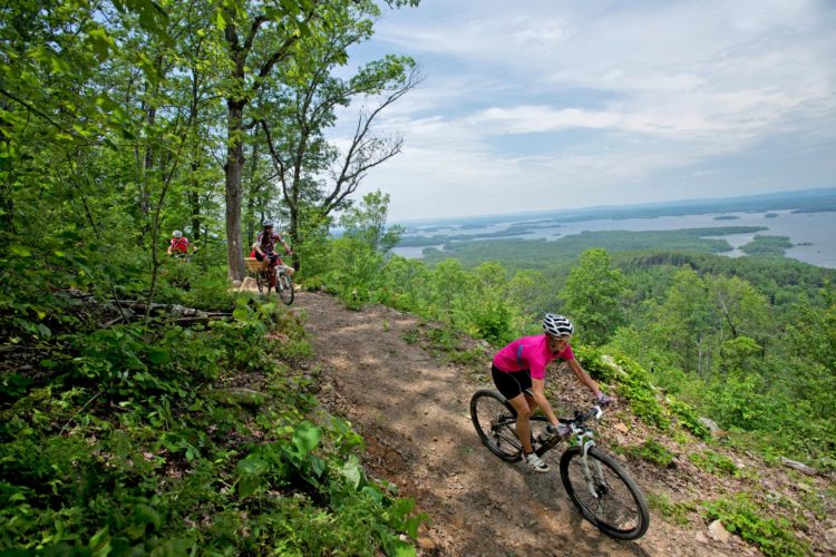
A 37-mile singletrack that rolls east-west along an Arkansas mountain ridge, following the course of the Ouachita River. The trail begins at one North Fork Lake and ends at Lake Ouachita. It pass through the thick hardwoods and dark pines of the Ouachita National Forest, opening occasionally to spectacular bluffs above the river. This is rolling terrain - ranging between 1,000 and 1,600 feet in elevation - but it all adds up. 5-10 hours of riding and 6,000 feet of climbing. It crosses roads at regular intervals, giving new riders an opportunity to bail out if the trail proves too much for them. Considered an IMBA Epic. The Womble is complete, marked with white triangles, milage markers, and signs. It is shared hikers.
 | Round Top Loop | 16 mi |


 4
4


needs a reset
| ThankRode the East end of the Womble today between the hwy 27 bridge just South of Washita and going West from there. Driving South on hwy 27 turn right immediately after you cross the new bridge. About 1 mile on the dirt road, look to your left for a small parking lot. Not much signage. Its a couple hundred feet climb right off the bat up to a ridge that overlooks a creek below. Used my small front chain-ring for the first time today. Beautiful spot. Continue West along a narrow winding trail on the side of the ridge for about 5 miles. At some spots the trail narrows to about 1 ft wide. You better pay attention! Beautiful views near the West end of this section as you climb to the top of the ridge and can see North and South, both directions for miles!! Down the ridge from here to the end of this section of the trail..about another 3/4 mile out to the road. The next section of the trail is kinda boring as it mostly goes thru bottom-land, a couple of deer camps and out to the next road. The way back to the parking lot across the first section seemed to be more to my liking with the upper side of the ridge to my right. This trail is NOT for beginners!! Some spots will test your nerve, as a mistake can bring disastrous results! You could go down the ridge a couple hundred feet in the blink of an eye! Be on your 'A' game when you ride this section.
| ThankThis trail is long, mostly flowy, some rocks, roots and some steep spots. It's a great adventure especially in the spring and fall. Get some friends together and stay in the Fulton house 5 miles from the trailhead. The owners can arrange canoe shuttle too for an absolute epic weekend. http://www.fultonhousemtida.com/
| ThankI read all the reviews and they were all pretty spot on. I started at the parking lot right off of 298 and headed south west to North Fork Lake and then turned around and came back. It was an out and back and was approximately 26 miles. The trail was awesome with everything you could want but nothing of one thing. If you want nice flowy stuff with very little climbing this may not be the trail for you. But if you want a trail that has some decent pitch climbs that will get your heart rate up and some good downhills to get the adrenaline flowing along with a few roots and rocks and a little technical action then this is for you. The trail is bench cut and can get thin in some areas so if you are catching some speed on the downhills(like i was) you should be careful that it doesn't take much to slide off down the hill. Beautiful views(go in the fall/winter time) and a lot of unique scenery that was just really cool to ride through. Trail was fast as the hard pack gravel really helped you get uphill and downhill pretty quick. Hard tail bike is not advised on this trail unless its a fat bike.
| ThankI drove an hour to check it out and i am already scheduling a day so that i can do the whole thing. Took me about 4 hours to do the loop i did so it is doable. Check it out.
One of the many great cross country rides in this area. The Womble crosses some great terrain in a mostly moderate manner. I rode many more miles of it when I did the Ouachita Challenge several years ago, especially the year I was talked into the 80 mile option. One long section has some drainage damage since it looks like the tread itself serves as a water route during rains. Other than that I can find little fault with this great trail. Hope to ride the whole thing some day.
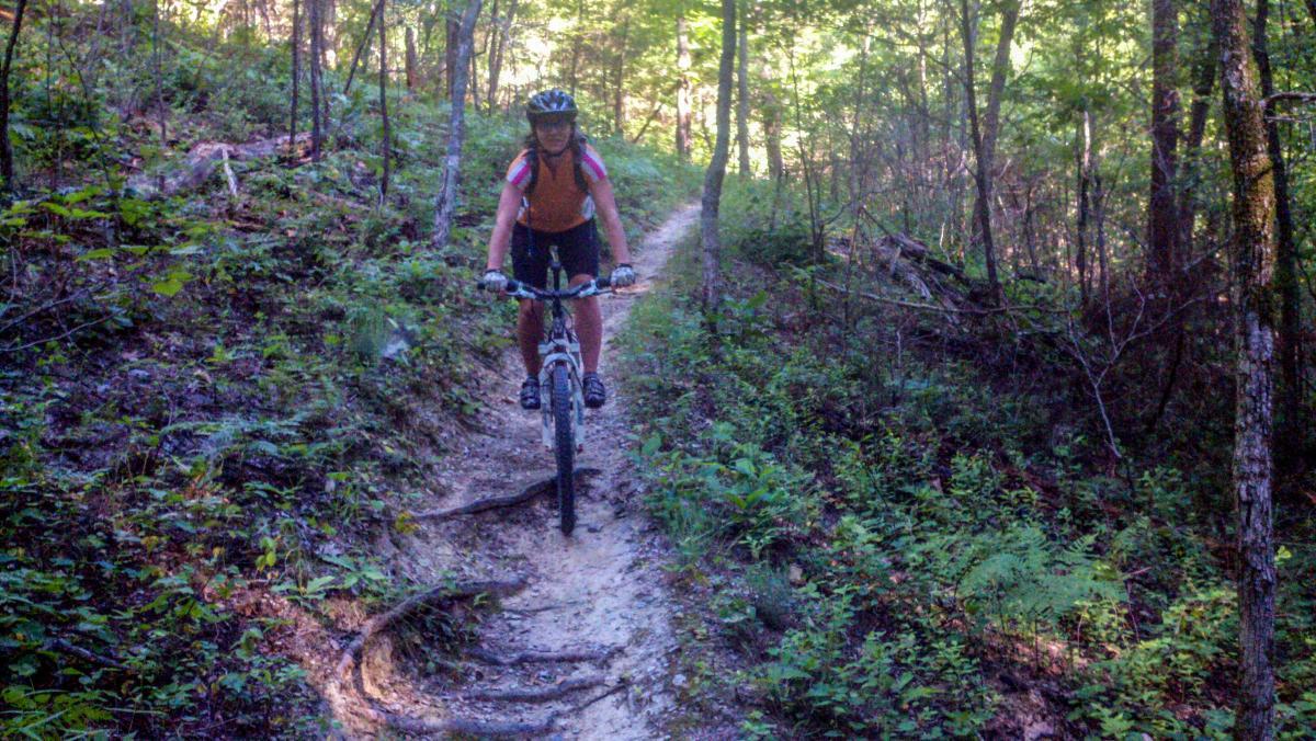
| ThankNote: The phone app does not show the section north of the lake. Cross the bridge and the trail is on the left, just after it. I missed Because I was going from memory and there was construction on the bridge at the time. The WOMBLE is leaf covered this time of year and it is still humid, but cool enough, not to be oppressive. The trail WOMBLE rolls along,, mostly, with the occasional steep climb, of short to moderate duration. Mostly small rocks under the leaves, like big gravel, which made for a rough slower ride. There were a few sections, though, of smooth and flowy trail too and a really cool knife edge ridge that looked down on the river and out across the valley to other mountains. Plenty of roots and exposure, not the fall off a cliff kind,but in places it could be dozens of feet before a tree stops your fall. That really keeps you focused, there is some tech and switch backs as well. Plenty of creek crossings, most of which were pretty dry, due to lower than normal rain fall this past October. Even though it rained the 2 days prior to our arrival.. While the trail is not that difficult, overall, it does have it's moments, hence the rating
| ThankWas a hot afternoon but the only chance for me to ride it. I had my hardtail Carbon Stumpjumper and it made for a long afternoon. 99 degrees no breeze and heavy humidity. The trail was full of roots so the bike I used was a mistake. Also the trail was like a wash board. Had I had one of my suspension bikes it would had been more enjoyable. Allot of the trail I rode was the same thing over and over. I rode SW but on the way back it seemed to flow better. I didn't get to ride the whole trail but what I did was fairly easy.
| ThankGreat trail, lots of scenery and interesting trails. Make sure to pack lots of water. Nice and flowing trails.
| ThankI have read many reviews of this trail and they were all spot on. This trail was amazing! I really enjoyed the creek crossing the most. It had a great flow to it and beautiful scenery. Lots of long climbs but worth it after all you get to fly down afterwards. Can not wait to go back!
| ThankFast downhills and a few creek crossings which is fun. Very scenic! However, the day I went was apparently after some rain. I got drenched and mucky from multiple mud runs and creeks. But I tend to enjoy loop trails more than the out-and-back trails like Womble.
| ThankWorth the drive rode in the middle of summer it was hot and muggy left with poison ivy but a great trail would love to ride in the fall.
| ThankWe rode the womble a few months back and can't wait to go back and explore more of the trail. We started at the TH on 298 and rode towards north fork lake. We actually rode a loop so we didn't get to north fork lake. Rode some gravel roads back to the trailhead. The section we rode was not difficult. Remember its a trail through a national forest, so you will have changes in terrain and elevation. It was great but riding on the edge of the mountain (mauldin) was a little unnerving because the trail wasn't very wide! We want to get back and try the trails on Lake Ouachita. I love riding in Arkansas!
| ThankRode Dec 20, 2014. Can't stop laughing, this ride was fun. It was wet out, but this was my opportunity, so I seized it! With 39 degrees, humid, cool breeze, and leaf covered epic-ness, I mounted up the GoPro and set out for some fast paced, tire-skidding, creek-plowing blast of fun. I'm headed back when I have more time to do the whole thing. Worth the drive through all the off road trails and you will loose cell reception at the trailhead, however get it back like 2 miles in the trail. Great time, just wish someone was there to enjoy it with me.
| ThankAbsolutely epic. My friends and I took a 2 day trip out here a week ago. We didn't ride the entire thing, but the big chunk we knocked out was an absolute blast. Long flowing single track with several creek crossings and switch backs. Very beginner friendly. Great place to work on form and technique riding fast without worrying about intersecting trails or rock gardens. A few long climbs, but equally as many long moderately graded downhills. Most of the trail was dry and compact, but there were a few really muddy and damp spots. This is a must ride for every MTB'er.
| ThankA classic! one of the original IMBA epics. It is one of my favorites trails and I have spent lots of time all over the US. A mix of skatey loose rock and packed trail. I love the catwalk sections, this tread is really tight in places and quite a long fall if you go off the side. The winter is the best time to ride here as the Ouachitas have very mild winters and there are 100's of miles of singletrack around the area.
| ThankI rode this years ago but I remember it being a super lush forest with quartz outcroppings, scenic bluffs, & creeks crossings littering the smooth singletrack while it bombed in & out of ravines. The grade was overall pretty mellow but I do remember a few steepish punchy climbs. I also remember ridiculous amounts of poison ivy everywhere off the side of the trails so beware if you go once the weather has warmed up.
| ThankThe trail is mostly made up of loose rock with occasional areas of hard packed dirt. There is plenty of climbing and a couple of the climbs are steep and sustained especially as you get closer to the Ouachita Trail on the north half of the Womble. The downhill's are a blast some of which require a little nerve as the trail skirts in and out of coves just hanging off the side of the mountain. There are quit a few creek crossings but most are small and easy to cross", the larger creeks have bridges so they are not to much of an obstacle.
| ThankThe trail has been rated as advanced but I have taken novice riders to this trail. I wouldn't say any of the trail is advanced, intermediate mostly with a few places where newbie's can ride.
For more information go to http://www.mtbark.com/womble
Rode the Womble this past weekend from HWY 27 TH near Fisherman's Village to North Fork Lake. Hit the gravel road from there to the Gaston Rd climb back up to the Womble singletrack crossing.I had to throw this part in because of how demoralized I was at last year's Ouachita Challenge at this point. Rode singletrack from there to the 298 parking lot. Nearly 40 miles total. This trail can be accessed from several spots for good rides in either direction. HWY 27 Fisherman's Village to North Fork Lake (roughly 25 miles) is a very nice ride for an intermediate level as long as you are aware of the few big climbs along the way. Your biggest climb of the day will start almost immediately from the HWY 27 TH on Womble Rd. The climb is worth it. The scenic bluffs that most people talk of are right here. The ride will mellow out from there all the way to the 298 parking lot (12 miles in). If it is hot you should have water staged here. Your second big climb will come just a few miles past the 298 lot. This is Mauldin Mountain. You will know when you're there because of the sign. And no, you were not hallucinating just a few miles back. That cactus you saw was real. Again, the views at the top are great. Lots of sprawling farms in the valley below. Enjoy the downhill side, you earned it. You'll cross a dirt road on the downhill side of Mauldin and know that your 3rd big climb is close. I call this Gaston Mtn but that's only because the road nearby has the same name. After descending Gaston Mtn you will soon cross Gaston Mtn Rd (20 miles in). This is another great place to stage water. From Gaston Mtn Rd you're thinking it should be all downhill from there to the lake. Not quite. There is a deceiving upslope to the trail here. It may just be because the last few climbs are still fresh in your mind and legs. But after about a mile or two, you will notice the trail begins to tip down. This a great section to enjoy. Lots of flow. Soon you'll be at North Fork Lake. You can either set up a shuttle from here, make it an out and back and turn around for double the pleasure (the climb out of North Fork is a good one but Gaston and Mauldin seem easier on the way back. and after the climb back up the bluffs at the river, home to fisherman's village is icing on the cake), or ride the road back to Fisherman's Village.
If you choose the road back, it's very easy to navigate. Take the one road out of North Fork Lake. Make a right at the T. This is North Fork Lake Rd. This road will merge into South Fork Lake Rd and will also transition from gravel to blacktop. South Fork Lake Rd will take you all the way to Mt. Ida and directly to HWY 27. You've got 6 miles left to the village with a total of 14 traveled on road.
| ThankWhen IMBA declares any trail an 'EPIC', your certain to find as much adventure & challenge as you can stand. Womble, to be fully appreciated, should be ridden in it's entirety. It is also part of another Arkansas 'must-do', the Ouachita Challenge. Google it & add it to your list.
| ThankLoved this trail! One of my favorite IMBA Epics. I rode it all in one day in 95 degree heat and I was shot when finished. Loved the flow on the lower half and the climbs on the upper half. Just a great must ride. If you have a list it should be on it.
| Thank