Lots of lava rock. Intermediate to advanced. Middle trail is going to be challenging for beginners but it's do-able. Well maintained by the mountain bikers in Chico. North Rim trail follows the fence on the north end of the park boundery, a good climb to Bobby Seals Trail (or sometimes known as Live Oak Trail) which drops down into the valley. Easy to see where you are as there are good views of the valley below. Live Oak connects to Middle trail. There is a "Lower Trail" ( parallels the dirt road) with other trails connecting all three,An easy out if your looking for one.
The best is South Rim Trail, advanced riders like it. It's not easy to find. Located on the south side of the Chico Creek where Centennial Ave meets Chico Canyon Rd. Recommend getting a map of the Chico area.
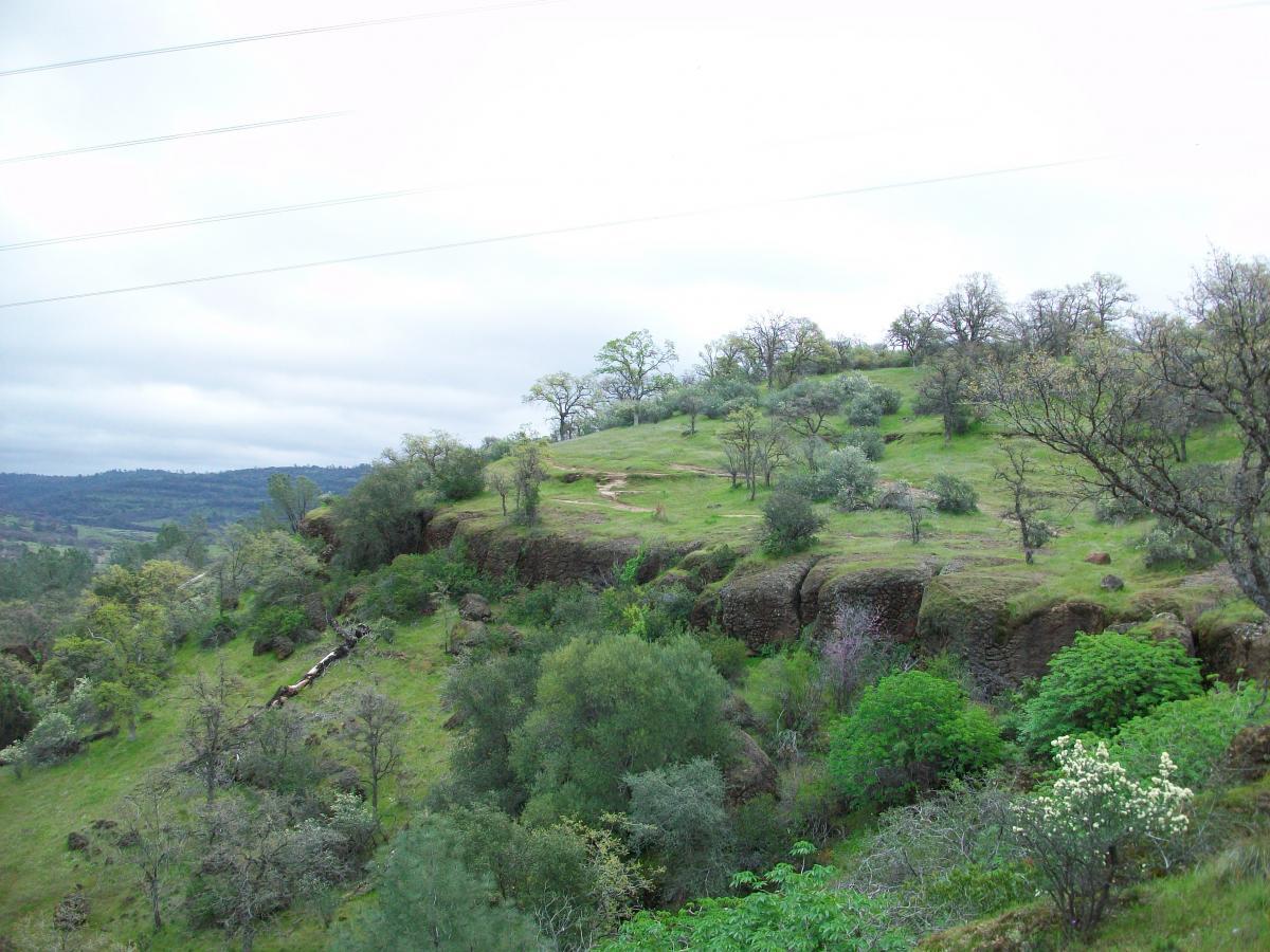
Both North Rim and South Rim Trails will climb 800 to 900 feet from the center of the park in about 12 to 14 miles, out and back.
Chico is full of bike shops. North Rim Adventure Sports 530-345-2453 (Trek, Santa Cruz, Gary Fisher) Chico Sports LTD 530-894-1110 (Specialized) the biggest bike I've seen. Maps of the park are available at these two shops. There are 9 other bike shops in town if you want to find 'em. Also Sierra Nevada Brewery is on 20th street and Chico Brew House is on 250 Cohasset Rd. 894-2149, (my favorite).
I don't need to tell you to bring lots of water. Summer temps can get to 100 deg.
Winter rain will close the trails.
Tred lightly, ENJOY!
 | "B" | 1 mi | |
 | Maidu / North Rim | 5 mi | |
 | Middle Trail | 5 mi | |
| Old Humboldt to Green Gate to North Rim | 24 mi | |
| Wilson's | 1 mi |


Fantastic place to ride. I would highly recommend checking it out, however, be warned there are a lot of rock and the trails can be quite difficult. A good loop that I enjoy, is north rim to b trail and then middle trail back.
| ThankGreat uphill climb. Good way to get a feel for the rocky condition.
| ThankThe Bidwell Bump race that takes place here every summer is a complete blast. The Northrim side features a moderate climb on a lava rock/slab type trail followed by a very technical descent down B-trail onto the park road. Riding to the end of the park road and crossing the creek is followed by a very steep fire road climb up to Guardian trail. After riding on some nice flowing single track for a couple miles you will turn onto Bloody Pin, a moderately technical downhill bit (not as technical as B-trail, but more fatiguing for the HT folks). Bloody Pin will intersect Anne Bidwell trail which follows the creek westward back towards the golf course. The course will finally go uphill again through the "hike-a-bike" portion (a very loose and steep jeep trail) before descending back down to Centennial Ave. Overall it's a very technical and challenging course for anyone riding a hardtail, but it's ridable and fun. Be aware of poison oak in the Spring and early Summer.
| ThankBest trail in the area. Taking the double track north tim trail up to the trail is brutal however. Extremely rocky and tough to keep your momentum. Instead of taking upper road I would take lower road and then bike up a singletrack trail next time
| ThankHas been blowen out for a few years. The new style of sliding not riding has taken its toll
| ThankBeautiful! North Rim to B Trail to the road. Go to to the end of the road wade across the creek, climb and go down south rim. Next time I would go middle trail to road and cross the river and go down guardian. Very rocky! Lava rules. If you are renting, I recommend getting a FS
| Thankfun and steep. great college town at night.
| ThankStarted at 10 Mile House Rd. to Guardian down to South Rim Trail and back. Guardian is a great trail but I doubt it's possible to ascend this trail without hiking. South Rim is a mess of rock (think ascending a creek bottom). I seriously doubt anyone would ride this trail but for the view. Both of these trails are constant climb or descent their is no rolling track period. Great views bad track = good hiking trails (or good downhill).
| ThankToo tough for me
| ThankKinda funny so many people can not ride North Rim, will not even try, uh uh try a single speed,,,,,,ouch
| ThankWow - I was in the Chico area over the weekend for a sporting event and decided to bring my bike. I just headed out on the North Rim Trail and tried to find my way. Lots of nasty lava rock, very little soil or crushed rock on the climb and up top. The trail that I took back down (B Trail I Think) was pretty technical with some very steep drops on a narrow trail, but had more soil and rideable terrain. Vegitation was very overgrown and it was like riding through a tunnel in places. I was amazed I didn't end up with any ticks or poison oak! Take the other posts advice and get a map if your are not familiar with the trail(s). I know that I will next time! It probably could have made a better overall ride experience!
| Thankeast along fence line, double track it will wander to and fro till just before Manzanita Ave, right across bridge. head east across Ave, to Five mile Park cross at bridge, left on road, single track will head west then loop back east.
cross road, take first single track to fist parking area. Head up North rim trail, just over four miles.
retrace you self or the number of options back through park
| ThankStarting near the entrance to Upper Bidwell Park, enter Middle Trail near the
| Thankgate and proceed to the "Cross". Turn uphill and follow 'North Rim" for
approximately 2.5 miles to 'B' Trail. Decend 'B' Trail to the fire road and turn
left. Follow to the creek and cross to 10-Mile. Ascend 10 Miles to the top of
the south rim canyon wall. Decent South Rim and exit.
the truth about bidwell park...... first of all there are many rides in this park. there is the north side, aka "north rim" and the south side, aka "south rim". then there are the many connective trails. on the north side you start by going up from the "cross." a very rocky double track road. at mile one to the right is the trail head for "maidu". a short groomed switch back hiking trail down to "middle trail" very fun roller coaster ride not too technical but you do need some skills. or stay straight and continue up approx. 1100 ft. climb in 4 miles to "b-trail", a technical switch back trail which descends 1.5 miles and connects with "middle trail" first to the right, and the park road next. if you choose "middle trail"......good choice! a super fun descent all the way back to the shooting range, but very rocky with baby heads, poison oak and snakes. about half way down you can drop down to "lower trail" if you wish. also fun rocky single track, or continue on "middle trail" back to the cross. all of these trails are marked and you can and should pick up a map at any local bike shop.......if you are a strong experienced rider go left at the road after "b-trail" to the end where it becomes a short single track section, and dead ends at the creek. cross the creek and ride the steep road up to "guardians trail." this a very hard technical trail recomended for experienced riders and you should not ride it alone. the first 1/4 mile is very easy then it will start to become very technical. after about 3 to 4 miles it drops down to "south rim," also known as "annie bidwells trail" here is where it gets confusing......there are lots of alternative bootleg routes. most of them will take you painlessly back to the shooting range, but you may get lucky and end up somewhere else! when you finally arrive at the five mile go right, cross the bridge/creek, stay right on the road and the "cross" is just ahead where it all began.* Review edited 9/7/2009
| ThankThe North Rim side is more technical, with four basic options; lower (easy), middle (moderate), upper (difficult) and north rim (advanced) trails. If you ride the north rim trail to the end, you can shoot down the B trail. Stunning views. The South Rim side (if you shuttle up to Ten Mile House Road aka Greengate as there is a green gate at the trail head) starts with a STEEP fire road and you tie in to guardian trail. There are extrememly difficult (for me) sections with names like "Bloody Pin". Just be prepared to fall off your bike. If you manage to escape without flying off you probably weren't trying very hard. An absolute blast.* Review edited 8/4/2009
| ThankI always get hurt riding here and always come back for more
| ThankFollow single track out to five mile cross bridge, head up into lower park. first gravel lot leads to North rim,follow it to Blue Oak, drop to Miudo, head east, right on Middle trail, which rocks and rolls along till B trail go right dropping to road.
Gravel road is pretty beat not a lot of rest time, it will dead end, with a single track leading to the river at the very end. Float you pinkies in the river, nice place to tell some stories for a bit in the shade.
Cross river follow single track to fire road climb and take first right up another fire trail, very rustic as you head for next single track to your right heading west, do not let you mind wander there are places to fall through a bush to the rocks and river below, a lot of bootleg it seems so keep heading west, till golf course. We head into town here but you should cross into path which crosses golf course back to Upper park entrance
NOT AN EASY RIDE, DO NOT THINK YOUR AN ADVANCED RIDER!!! BE ONE
| Thankoff of north rim trail there is bloody pin trail. BLOODY PIN TRAIL IS ROUGH! the name is a pretty accurate description. lava rock the whole way, rough as hell, super tight twisty singletrack and the occasional cliff to watch out for. this is the toughest trail i have ever ridden. i ended up not being able to brake enough for a right turn and had to ditch the bike but still ended up falling off a 5 ft cliff drop. i was totally fine but coulda gone very bad and if i was by myself i wouldnt be here today. i love it haha
also humboldt trail here looks pretty sweet. we hike up from north rim trail almost back to the road (hwy 32) and there was some gnarly stuff there
| Thankbidwell is badass. i rode here a few times while visiting freinds. i forget how to get to the place we rode at, but i think it is called green gate. it follows the ridge next to the canyon pretty much the whole way down. VERY TECHNICAL SPOTS a few rock gardens, but very tight singletrack and a few kickers here and there
| ThankYou hit it right on the money - great trails and very linear park. Three main lower trails on North side wtih double track N. Rim trail on upper ledge. Two main trails - now a third option with newly constructed Volunteer trail on South side. Much more technical and a good climb unless you shuttle up on Hwy 32. Nice "epic" is to circumvent the park by going out North side - cross Butte Creek at end of Park Road - climb up South side and bike back out. Overall approximately 20 miles and every type of fun - couple of roller sections, hard lava cap, some roots, couple of good climbs, good downhill and lots of technical.
| Thank