


"Mountain biking in Quebec was born here in Mont-Sainte-Anne," said local elite XC racer Anne-Marie Gauthier. The first trails built on Mont-Sainte-Anne (MSA) were constructed decades ago by the godfather of Quebec mountain biking, Patrice Douin. Douin is also in many ways the godfather of World Cup downhill racing. He not only brought the DH World Cup to MSA, but in the early years of international mountain bike racing competition, he helped write some of the rules for downhill competition that are still used to this day.
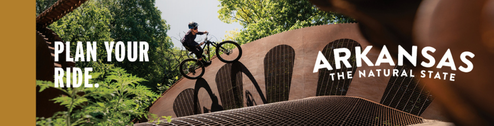
In October 2025, MSA will host its 30th anniversary World Cup DH race. The race drew between 55,000 and 60,000 people the last two years, and for the 30th anniversary, it's expected to be wilder and crazier than ever before.
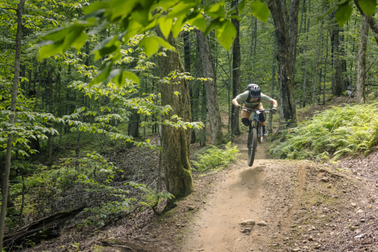
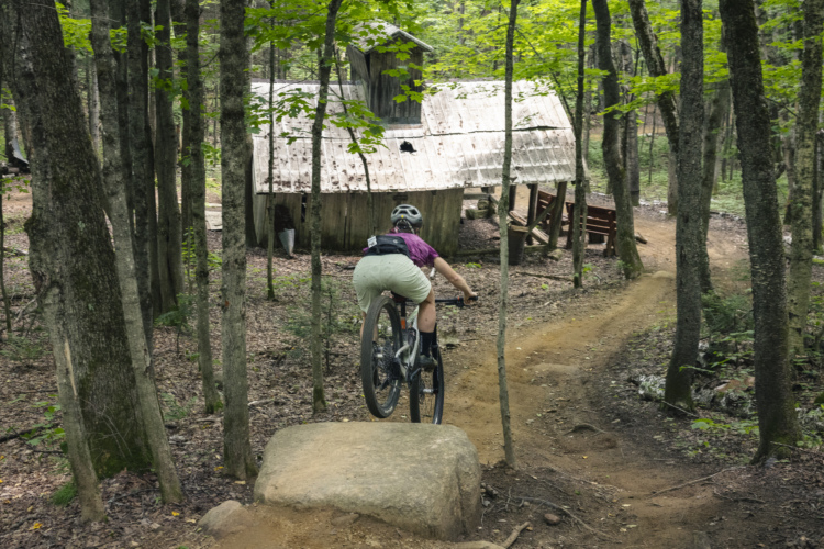
The MSA bike park is the go-to destination for diehard gravity riders in Quebec City. Unlike some bike parks, which might have one token tech trail, the bike park at MSA is veritably filled with pro-level DH race tracks. While for many years, the World Cup track itself was only opened for the event, today, any rider can show up and train on one of the gnarliest DH race tracks in the world.
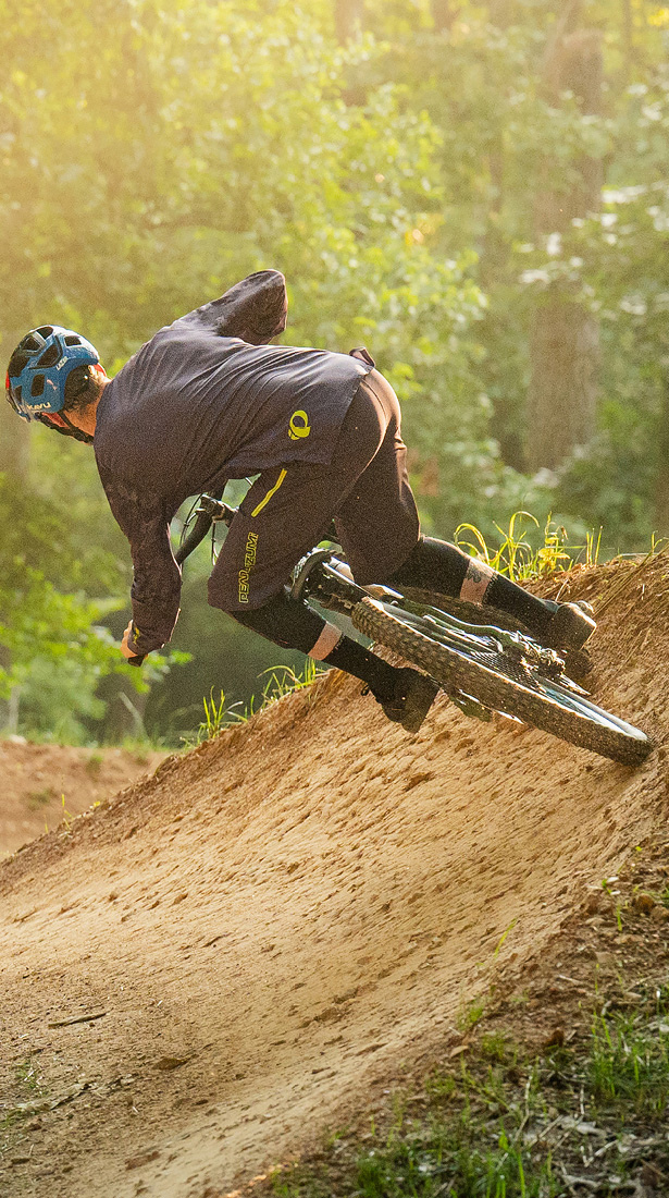
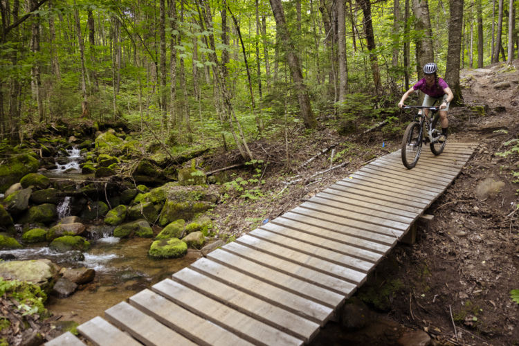
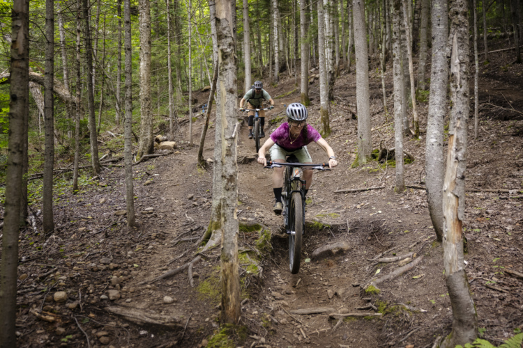
In addition to double black diamond lines, riders will also find a small mix of trails with easier difficulty ratings, ranging all the way down to green. But be forewarned: even the blue and green trails feature plenty of rocks and roots. There aren't any true "flow trails" at MSA, despite what the locals might label as such. Even if you're riding a trail that is more flow-oriented, you'll still need to be prepared for plenty of rock gardens, small slabs, and root webs.
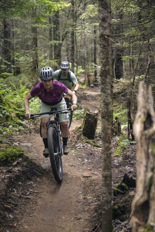
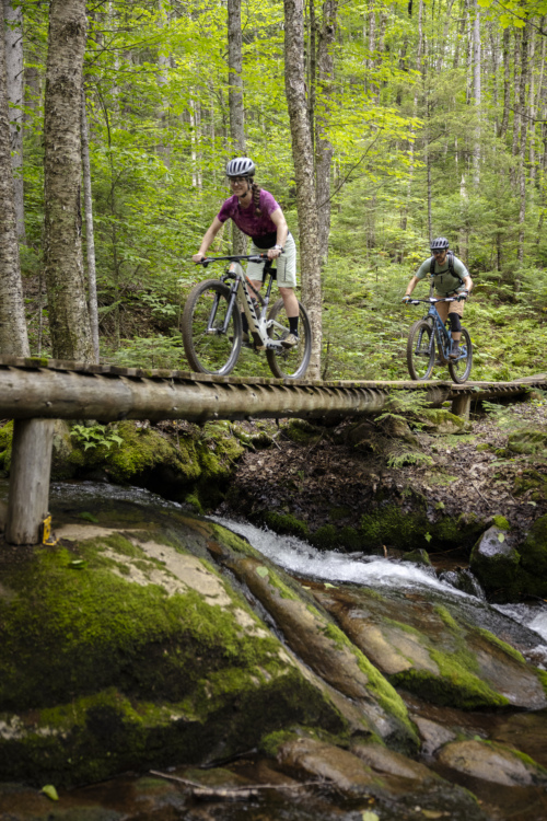
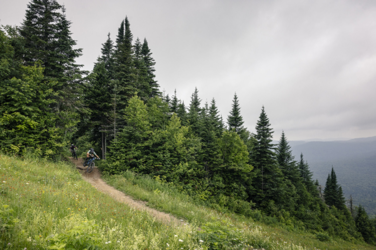
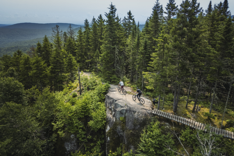
But what many riders don't know is that MSA is home to so much more than just gnarly downhill tracks. In fact, the entire trail system boasts 165km (102mi) of mountain bike trails. While the network is connected to the bike park, the bulk of the trails are XC and enduro-oriented, with plenty of climbs and descents on narrow hand-built singletrack.
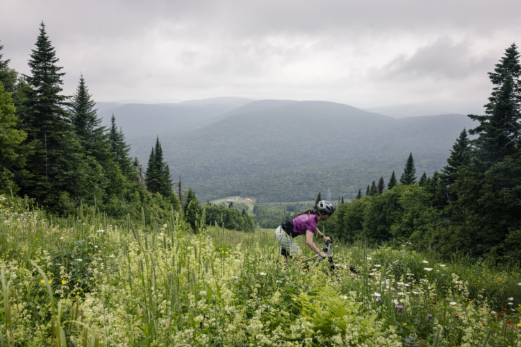
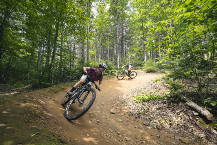
Riders can even use the gondola to create enduro-style laps that mix MSA's 625m (2,050ft) of free vertical with pedal-driven climbs deep in the mountains. And, of course, if you want to go for an entirely pedal-driven ride, there are plenty of options in the expansive network. In fact, MSA also hosts World Cup XC racing in addition to DH, meaning the XC trails are similarly world-class.
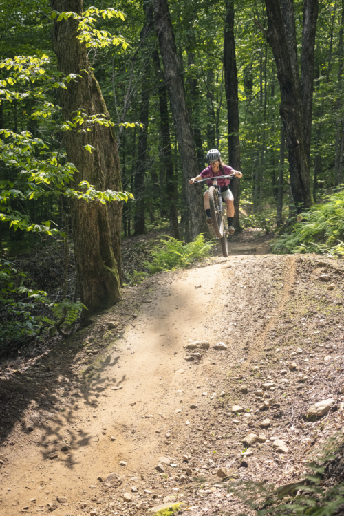
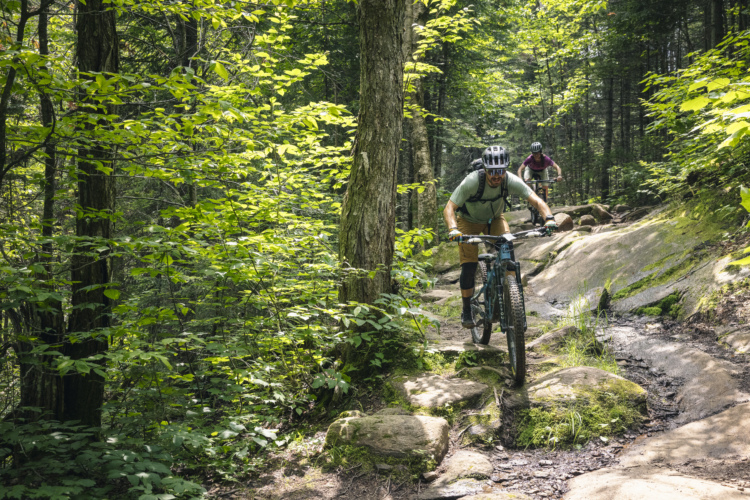
During my time riding at MSA, I had no desire to test my mettle on the double black (or harder) lines, but I still enjoyed single black descents in the bike park, like La Vietnam, and the blue La Bapteme. When we left the bike park for a longer lap with a few pedal-driven climbs, we followed L'échappée to reach L'Adorila — the best flow trail-style descent we experienced on the mountain with great berms, jumps, and a few rock drops.
A full day ticket with unlimited lift rides costs $64 CAD. If you want to pedal an enduro-style itinerary, you can purchase a single lift ride for $52, and have unlimited access to the XC trails. Finally, you can purchase an XC-only pass for $33.
-Greg Heil
 | La Vietnam | 3 mi |


 7
7
Lots of winter fat bike trails open here right now. You can easily put in 40km ride with mostly singletrack. Thank you Sainte Ann for keeping so many trails open
| ThankLike Bromont, this is a place where chairlift accessed DH is at its best. However, this review is for the XC network. First, expect lot of climbing. This is a huge network of mainly gravel doubletracks and nordic skiing trail. Scattered across the network you can find stretches of singletracks. Some are well built, others are more "raw", with less flow. Like another reviewer said, expect lot of roots there. Overall, this is a nice network good for training, but i would not go there for an epic weekend day.
| ThankLarge network of trails, with everything from gravel road to tough single track. Don't go if you don't like riding roots!. Even "easy" singletrack is covered with roots. Good luck finding a route: the trail map/trail signage is terrible and very difficult to navigate.
| ThankSweet pump track at the bottom of the mountain
| ThankCross-country trails will be open on may 19th, downhill on may 26th.
| ThankGreat job from the crew trail this year. Keep it up!
| Thank