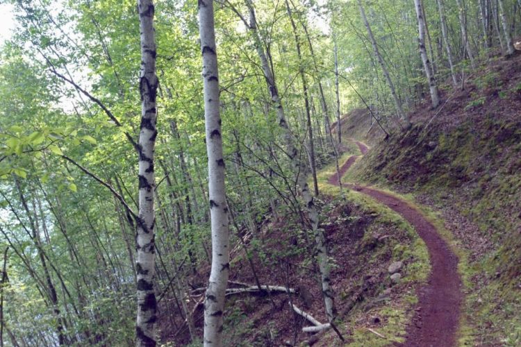
The first 10 miles go thru a lava field making it the toughest part. Beyond there is a picnic area with water and smoother riding and easier. The whole ride is in old growth forest and the water is crystal blue. Waterfalls, pools and log bridges (walk across) and the forest make this the most fun and most beautiful ride I have ever done. Bring a camera. Difficulty is due to length, not climbs.


 35
35

What an adventure this was for my group and I. Come prepared! We rode the whole trail and at the end of 30 miles supplies and water were used and or depleted. Everything from flat tire repair and shifter maintenance, to helping the unprepared and splinting a broken arm with a stick and pump challenged my group and I in preparedness and endurance. The only thing I didn't bring and wished I had was a water filter.
| ThankWow! The most beautiful view ever seen!!!
| ThankBeautiful Sunny day, great trail conditions. Spots Of mud and about 5 wind falls.
| ThankThis is a long and beautiful ride, but definitely not a 5 star for me. The top 10 miles are excellent -- continually challenging, interesting scenery, and wonderfully varied.
The bottom half is something else. It is certainly nice trail through beautiful northwestern forest. However, it gets quite monotonous. Unrideable bridges are far too frequent and the trail gets repetitive. Pedal a few strokes, them bob and weave between a few trees, then pedal a few more, and slow down to bob and weave again--repeat about a thousand times. It's nice for a while, but I found myself wanting it to end long before it did. The trail also crosses many roads, merges with a dirt road for a long stretch and then on the lower section, parallels very closely to, and actually emerges onto, a busy highway.
The other drawback is that the best downhill stretch is a segment hugely popular with hikers, so forget getting any flow going here.
| ThankNorthwests best XC ride very scenic and very fun. Be careful on the upper portion the rock looks to cut you up as it is lava rock. If you have one car shuttle to the top then get your car at the bottom. If you have two park one at the top and or at the bottom.
| ThankNorthwests best XC ride very scenic and very fun. Be careful on the upper portion the rock looks to cut you up as it is lava rock. If you have one car shuttle to the top then get your car at the bottom. If you have two park one at the top and or at the bottom.
| ThankThe most scenic ride ever, but I believe this trail would be way better from a riding standpoint on a late summer weekday than in the early spring during the weekend, especially on the upper (more scenic parts). I encountered way too many people and tons of mud and puddles from lingering snow melt which made it tough to go fast. However I could imagine once it dries out and if there were fewer hikers, the ride could become equally as enjoyable as the scenery.
| ThankWe rode this trail at the end of June and agree with a lot of the reviews that have already been written. I do have a word of caution through and that is cell phone coverage is limited and since most of the trail is across the river from any help should things go wrong, some basic first aid and bike repair kits should be included in any pack.
| ThankGreat trail for the entire trip. The first 3.5 miles will have you smiling with the flowing trail and beautiful Clear Lake. Be prepared to hoof it some the next 6 miles as the scenery of a couple of water falls and the Blue Pool is tempered by lava rock fields that will have the vast majority of riders dismounting multiple times. Upon reaching Forest Road 2672-655 the rough stuff is over and the last 15 miles are a joy to ride. Take time to enjoy the river as you continue to the lower TH. Plan on 6 hours with sightseeing and refueling. Plenty of riders on the Saturday I rode. Would not hesitate to ride solo, but a team of riders could leave vehicles parked at some of the forest roads, camp grounds or trailheads you pass along way with food and extra water making the ride more enjoyable.
| ThankGreat trail!
Got a shuttle from Bend with Cog Wild - recommended.
Liked the tech lava sections more than the mellow forest trails.
Fantastic scenery - lakes, waterfalls, forest. Beautiful.
Trail surface Is much nicer than most trails around Bend, where it is dry and often loose. This forest us much damper, as is the trail surface.
| ThankThis trail lives up to its billing. Wow what fun. While it was hot today 88 -90 the tree cover and cold cold water make the ride bearable. We shuttled with Mike (541)822-6272 for $30 bucks (seems high). He strongly encouraged the riders not to ride the official trail around Crystal Lake but this advise should not be followed. The trail at the top is tough as detailed with the lava but certainly doable. The trail was in great shape. Not many hikers mid-week. Everyone was very friendly. This is a must do ride. 4:15 for me.
| ThankI can't even explain how beautiful this trail is. I only rode the Northern 5 miles of the trail but I think I can safely assume that the rest of it is just as amazing. The trail was both challenging and kept in immaculate shape. I'm counting down the days until I can get back west again so as to ride the entire length of it.
| ThankSharp lava rock in the upper section will keep you on guard and makes for a great challenge. Perhaps the biggest obstacle is crowds, however, with heavy hiker traffic on weekends. If you are able to hit this trail on a week day, you'll enjoy this trail to its fullest potential.
| ThankThis is the best overall trails I've ever ridden, hands down nothing else really even comes close. It combines everything I want in a trail - undulating, damn near pump track like terrain, rocks & roots a-plenty, AMAZING scenery & just long enough to really put your legs through their paces if you ride it like you stole something!
It's a trail that I found the harder you push it to go fast the more rewarding the ride! The top half is considerably more technical & scenic. The bottom portion is more mellow but after bombing through the top I appreciated the easier rolling singletrack.
| ThankIf this trail was 15 miles long, I'd give it 5 stars and like Greg, it might make my Top 10. I love the first half with all the techy lava features. The singletrack and the scenery is purely epic. My issue is with the last 10 miles after the campground...it's beautiful riding along the river but it's pretty much all the same for 10 straight miles. I wish they could make some bridges that you could ride over as well so you wouldn't have to keep getting off your bike every time.
| ThankBeautiful ride! Flowy single track especially at the bottom. More technical on the top half. One of the best rides I have done. Scenery is incredible. Watch out for the lava the first couple of miles.
| ThankIt was amazing
| ThankDespite being relatively flat (1,500 feet of descending, 1,000 feet of climbing, if shuttled) this trail has instantly rocketed onto my list of top 10 trails I have ever ridden. I don't know if it's on the top of my top 10 list, but it definitely competes with the best trails in the nation.
To begin with, the singletrack riding is absolutely stellar. The trail is a very mixed bag, excellent techy lava rock riding up high to hard packed dirt to loamy, flowy, smooth singletrack lower down.
Next, you have to talk about the scenery. The massive roaring waterfalls up high, gorgeous lakes, and the icy blue of the Blue Pool are all just stunning! Add in all the moss and the massive douglas firs that make you feel like a tiny ant, and I have to admit: this trail is a true classic!
| ThankI rode the section from Trailbridge reservoir to Clear Lake and back this weekend. This upper section is much rougher than the lower section. There are many places where lava rock makes it extremely difficult, if not impossible, to ride--especially when riding upstream. The scenery is fantastic (see pictures). The trail splits into two near the big waterfalls, and the north side is the better one for riding. The views of the falls are much better on the south side, however.
| ThankI love this bike trail. Incredibly scenic and satisfying ride. Lots of fun and the trail is well marked throughout.
| Thank