This discription is for the Table Mesa trail head which has 1.5 miles (N) out on the Black Canyon Trail to the Little Pan Loop. The Little pan loop will take you down to the Agua Fria river and this loop length is about 6.5 miles. Then you head back (S) on the 1.5 mile Black Canyon Trail to the trail head.
If you are not familiar with Arizona mountains then it is a good idea to have a GPS since there are many branch off trails and off road vehicle trails.
Bring a comb for removing cactus needles and a few extra tubes. (Slime tubes are worth it)
There are additional miles of trails to this sytem with a total of 62.
 | Black Canyon Trail - Little Pan Loop | 24 mi | |
 | Emery Henderson | 16 mi |


 2
2
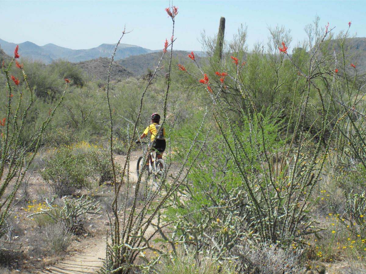
A very cool example of central AZ cross country riding. No downhillers delight, technical trials, or aerobic assaults here. Just some good old fashioned cross country pedal mashin here. Trail is very readable and easy and I follow. Although the individual segments are not labeled, the overall trail has good signage and is easy to follow. Starting from the Warner rd trail head and doing an out-and-back with the little pan loop being the turn-around gave 18 miles and 2200' of ascent/descent. Using this trailhead allows you to swing into Rock Springs Cafe for an absolutely insane post-ride piece of Jack Daniels pecan pie!
| ThankGreat views, fun trails. I did the little pan loop. There's some long downhills with good flow. Had a refreshing river crossing. Some tech to make it exciting. Careful you don't slide off the trail down the side of a mountain! Worth the trip there.
| ThankMy recommendation: Skip the little pan loop and just ride BCT as an out and back. The little pan loop portion was not that great and very grown in, I took many cactus to the arms and fist. I would wear a long sleeve also, too many branches sticking out to wack you. Also bring extra water if you're even going to attempt this. I ran out of water at mile 17 with my 3L camelbak. Lots of up and downhill to even get to the little pan loop segment as well as having to walk a good distance in sand across the river.
| ThankVery beautiful and fun loop! If you're not from the area, definitely a scenic track and AZ must do. If you're not familiar with desert (March) riding, be sure to have some rattlesnake knowledge as I rode over one and was nearly bit.
| ThankGreat desert single track, well marked and challenging.
| ThankVery tight turns, terribly marked, thorns, lots of it, locals say it is a great trail. I've seen great trails and they look and are designed very, very differently. Rocks and thorns trail.
| ThankI rode for 10 days in AZ and this was my favorite trail south of Sedona. I started my one way ride at the Black Canyon City connector and rode south for 30 miles. The trail is perfectly built, with great flow. The only place you could possibly get lost is at the river crossings, but even then it's not to hard to find where it picks back up on the other side. Download the MTB ap and use the tracker. (If done as an out and back from Black Canyon City, I'd skip the Little Pan section- which has some fun downhill but also a long stretch of doubletrack- and just go out & back on the main trail. And yes--get a post-ride slice of pie in Rock Springs.
| ThankAwesome trail. Has a good dose of climbing, downhill, ruggedness and good views! Definitely grab a slice of pie from the rock springs general store on your way out.
| ThankIt's a full body work out, challenging and fun. There is not much more to add than what others have stated. Except, it was a war with the cactus. Wear shin and full arm armor. It is impossible to avoid them: feet, hands, arms and legs are torn up good. Worth it 1 time but if I'd did it again I would have picked up the armor.
| ThankThis review is for the Little Pan Loop section of the Black Canyon Trail. This is one of the best trails in the country. It is perfectly designed for mountain bikes with good climbs and fast extended downhills in a beautiful setting.
| ThankDid this trail from exit 242, off HWY 17 . I consider myself an intermidiate rider and found the trail fairly easy, except for the tight switchbacks and exposure. Some sections with some huge dropoffs! You don't want to make a mistake in these sections. Other than that, its flowy single track goodness. Very beautiful trail with some rocky sections for added fun. I would rate this an intermidiate trail. Very nicely made, but more signs for direction would make things easier for first timers. Summertime is not the best time to hit this trail and UST tires and slime tubes are a good idea. Flats really ruin a ride and your bound to get them here.
| ThankWow is all I can say!
| ThankThe best trail I have ridden in this desert so far
We parked at the north trailhead on the west side of the rock springs exit.
Bring lots of h20 and food. Ran out of both and got a little lostish.. 26 miles of fun and excitement! The trail is not marked well at all!! So be warned luckily I was w a buddy that had been there before and we were able to pick up the trail again. Highly recommended trail to get out and experience some single track (as in the entire trail!!)
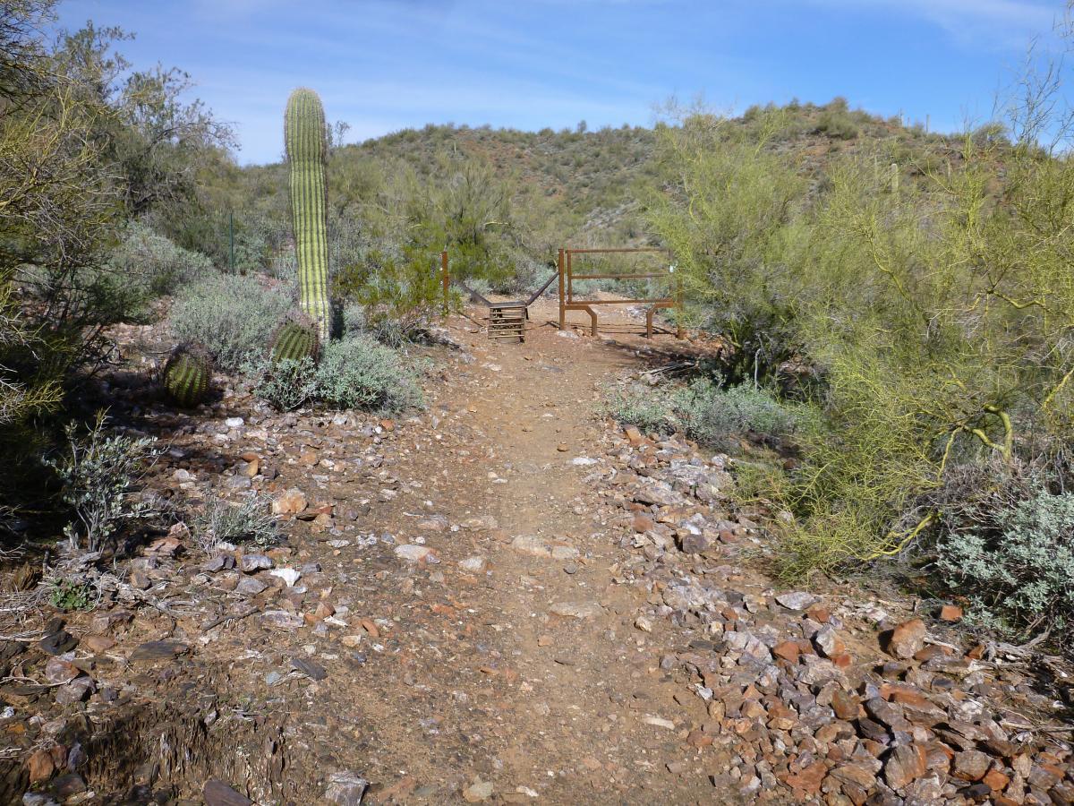
I take exit 236 - Table Mesa - to the TH (FYI - Get the singletracks phone app. It links all TH's to your phone's GPS. Hard to find without it). From there head N. At the fork about 1.4 miles you can either take the standard trail (go right) or head down to the little pan loop at the agua fria river (left). If you head to the river make sure you head immediately right once it comes out of the mountain onto the sandy double track or else you end up on Jeep trail 9980. Follow the rock bridge across to the other side and head due N again. You will pick uo the trail again there. The trail curves in many directions after that but don't worry. Head North and in approx 3 miles you will come to a large out cropping and a dirt road, Turn RIGHT on the dirt road and right after the the big left turn you will see on your right the BCT TH which will take you back to the original fork in the road and back to Table Mesa TH. It is easier to do this in reverse order the first time CCW (take the right at the fork - at the road turn left and get on little pan on your left and ride that down to the river) but i prefer it CW. IT really is an awesome trail. Plenty of H2O, T/R tubes & some CO2 cartridges. It's a long walk. Do not ride this trail from Jun-Sep.
| ThankI take exit 236 - Table Mesa - to the TH (FYI - Get the singletracks phone app. It links all TH's to your phone's GPS. Hard to find without it). From there head N. At the fork about 1.4 miles you can either take the standard trail (go right) or head down to the little pan loop at the agua fria river (left). If you head to the river make sure you head immediately right once it comes out of the mountain onto the sandy double track or else you end up on Jeep trail 9980. Follow the rock bridge across to the other side and head due N again. You will pick uo the trail again there. The trail curves in many directions after that but don't worry. Head North and in approx 3 miles you will come to a large out cropping and a dirt road, Turn RIGHT on the dirt road and right after the the big left turn you will see on your right the BCT TH which will take you back to the original fork in the road and back to Table Mesa TH. It is easier to do this in reverse order the first time CCW (take the right at the fork - at the road turn left and get on little pan on your left and ride that down to the river) but i prefer it CW. IT really is an awesome trail. Plenty of H2O, T/R tubes & some CO2 cartridges. It's a long walk. Do not ride this trail from Jun-Sep.
| ThankI don't give out a lot of 5-star reviews but this trail deserves every one of them. The trail is not overly technical but there are some steady climbs and there is some exposure. Other than that, this is just a perfectly engineered trail in a beautiful location.
| ThankThis trail has many sections and each one is a little different as far as climbing technical and scenery The best starting point is the black canyon city trailhead just off the rock springs exit of I17. You can go north or south from here and both directions are awesome. GO north to bumble bee trailhead and back for a great climb up amazing views, water crossing flawy single track and great downhills. Intermediate difficulty
| ThankFast fun for the most part but lots of tight switchbacks that break the flow. Some 'you are here' signs would be helpful as trail is very repetitive and every section has the same 'Black Canyon Trail' signs - pay close attention to your GPS! Intermediate ride, other than modest exposure nothing technical. Very quiet and peaceful compared to Phoenix.
| ThanktheTraill Is Scenic But Fairly Exposed With Good Climbs And Descents. thE Trail Has Many Right Switchbacks And Overall Is A blast
| ThankAmazing trail! Havn't ridden such a singletrack in a long time. I rode from TH at Exit 242 to the TH at Exit 236. Wish I had a map, so I could make some kind of loop there. Lots of rocks, switchbacks, 2 river (Aqua Fria River) crossing and spectacular views. Even now it was hot and I ran out of water after 15 miles (had 3L bladder filled). Could use water filter if i had it with me. This trail deffinatelly not for beginners. Climbs are technical in spots and steep, but still rideable.
| ThankNorthern part of my ride is smoother and many bike tracks visible. Southern part is much rougher due to more rocks and equestrian use.
Signs are in some spots. Still I'd like to see a map at least on major intersections.
It's the best trail I rode in Arizona so far and I want to come back and ride more here and on similar trails.
Had the opportunity to ride this trail with one of the builders- locals are proud of this trail, and for good reason. A beautiful, purpose-built single track through incredible desert, feeling of being way out there, and a nice, long ride. The switchbacks are rideable, climbs are tough but rewarding. Highly recommended!
| Thank