This was a great ride in a remote area. The crowds aren't here yet. Another undiscovered ride that should not be overlooked. I have driven right past many times on my way to Steamboat. It doesn't get any better than Arapaho ridge! IMO Blows B.C. away.
From the Hyannis Peak Trailhead follow trail 1135 (Arapaho Ridge Trail).Cross the road and begin the gradual climb up Arapaho Creek to the divide. There are a few stream crossings but the trail is mostly sweet smooth single track. At about four miles the CDT joins trail 1135. The junction is obscure and you will probably ride right past without noticing it The trail climbs more steeply as you near the ridge. On top of the ridge trail 1135/ CDT disappears into the tundra then reappears. Continue climbing up the ridge to the east. There are some great views and a fun ridgeline ride when you crest the next ridge. At seven miles the CDT turns to the south and trail 1135 (Arapaho Ridge Trail) barely visible heads to the north following the Arapaho Ridge. Some gnarly technical singletrack! Ride to the big rock cairn where trail 1135 disappears and drops down to the Grassy Run Trailhead. Return as you came. The CDT to the south warrants some more fun if you have time.


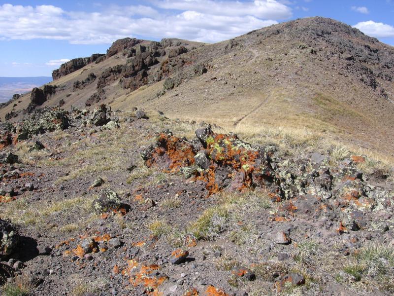

This trail hasn't been reviewed in a while, and some things have changed. First, the road from 40 isn't bad - 18 miles of gravel/dirt from 40 to the trailhead. The trail is brutal. Starts nice, but gets loose and steep. The climb up to treeline is very tough. Few ride the trail, and don't expect to see anyone. As a result, this is a backcountry trail. Some stream crossings and downed trees. Once you hit treeline, the trail goes away, look to the right to find it. The CDT intersection is marked with a post. I kept going along Arapaho Ridge above treeline eventually to a large rock cairn, which marks the descent to Grassy Run trailhead. At this cairn, the trails disappears and I could not find it - I saw a trail sign lower, but rode down and still no trail. This trail will take much longer than most trails you ride, and here I chose to turn around and head back. The singletrack above treeline was tough, exposed, and loose. Flipside is....pretty cool riding your mountain bike above treeline. The descent was fun. I'll be back at some point. I had intended to do a long loop coming back via CDT, but like I said - this trails take a good deal of time. I rode about a half mile of CDT also - similar riding. All in my day was 19 miles and 3500 climbing. Enjoy!
| Thankanother take on this trail: beautiful drive there, beautiful area. the first 4 miles are moderate and fun, esp on the way down. however, i'd call the trail after 4 miles up to the ridge very hard. i see the average rider -- that would be me -- doing a fair bit of bike hikig. it's a serious grind on a rocky trail.
| ThankYou can ride the Arapaho Ridge Trail from Troublesome Pass to the east.
| Thankhttp://www.singletracks.com/bike-trails/poison-ridge.html
This saves quit a bit of driving if you’re into the adventure.
OK..So we finally decided to go the extra mile to find the trail and boy.....what a nightmare to get there!!! IF you are into mad 4 wheeling to get across passes, dodging cows, tight rocky roads then this is the route that you should take. IF not then I suggest that you keep going west on HWY 40 for about 20 more miles and turn east on hwy 14 ( right), keep going until you see a sign for Seymour lake on your right...take this road, bear right along as it turns into dirt and follow it up 12 miles until you reach the trail head..WAY EASIER...
| ThankThe trail was FANTASTIC..worth the drive out there if you have a whole day...* Review edited 8/24/2009