×

|
Rate it:
Tags:
Level:
Length: 2 mi (3.2 km)
Surface: Singletrack
Configuration: Out & Back
Elevation: +574/ -550 ft
Total: 16 riders
Mountain Biking Swingletrack
#943 of 1,372 mountain bike trails in Colorado
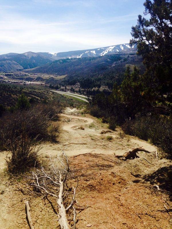
This trail is often simply just called the "connector" trail between Avon and Edwards. Since a common nickname locally for Singletree is "Swingletree," the name "Swingletrack" sounds appropriate (although not official yet). From Avon, you will climb quickly up a drainage and wind your way through a sage field. After riding down through some berms, you will climb up through several tight switchbacks until you are even with the powerlines. Descend from here into Singletree.
First added by [email protected] on May 22, 2013. Last updated Apr 28, 2020. → add an update
Before you go
- Drinking water: unknown
- Lift service: unknown
- Night riding: unknown
- Pump track: unknown
- Restrooms: unknown
- Fat bike grooming: unknown
- E-bikes allowed: unknown
- Fee required: unknown
This trail information is user-generated. Help improve this information by suggesting a correction.
There are 2 entry points for this trail. One is at the end of Nottingham road in Avon, and the other is accessed from June Creek Road just after you pass Chaparral Road on your right.

Loading reviews...View more