Elliot Barker (1) trail photo
See all photos (2)
×
User
Today
 
  |   Rate it:

Tags:
Level: Intermediate
Length: 11 mi (17.7 km)
Surface: Singletrack
Configuration: Out & Back
Elevation: -
Total: 9 riders
 

Mountain Biking Elliot Barker (1)

**   Add a review
#73 of 283 mountain bike trails in New Mexico
#5,172 in the world

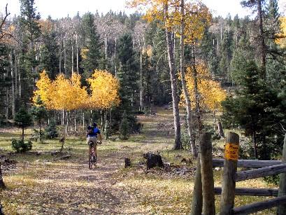
If you are looking for sweet singletrack, this isnít it. This trail is for people who like to do cross-country rides on less worn trails ñ it is really more of a hiking trail, with tread that sometimes disappears, and, except for the ATV or road sections, would never be mistaken for ìbuffî. There are lots of steep climbs that are rewarded with just as steep descents that, in my opinion, too often donít offer enough fun to compensate you for the hard earned altitude.

The trail works its way south along the ridge that borders the western edge of the Moreno Valley and ends at the Jaracita Trail (153) just south of the South Boundary Trail (164). If you ride this trail be careful when crossing the passes ñ you may find yourself going the wrong way. At Apache Pass, go to the very top of the saddle, cross under the power lines and follow the road south into the woods for about a hundred yards. As the road veers to the right look uphill to the left; you should see some rock cairns and a faint singletrack traversing up the steep hillside. At Osha Pass, just prior to where the road enters the woods, on the west (right) side there should be a trail marker and faint singletrack going into the forest. The section between Little Garcia Park and the South Boundary Trail also can be confusing with lots of different trails branching off; just try to stay due south on the east side of the ridge and look for rock cairns, signs with ì1î on them, or bike tracks, and you should be OK.

First added by bonkedagain on Oct 10, 2006. Last updated May 1, 2020. → add an update
Before you go
  • Drinking water: unknown
  • Lift service: unknown
  • Night riding: unknown
  • Pump track: unknown
  • Restrooms: unknown
  • Fat bike grooming: unknown
  • E-bikes allowed: unknown
  • Fee required: unknown
This trail information is user-generated. Help improve this information by suggesting a correction.
Getting there
You can start at the official trailhead on highway 64 near the mouth of the canyon near Agua Fria, or you can pick up the western fork of the track at Palo Flechado Pass on highway 64.
Featured in


Elliot Barker (1) Trail map

Add to or improve this map // Share this map on your website

Local Info

Club Sponsor

-

Trail checkins

little bear (on Jul 13, 2018)
What's this?

Upcoming Events

None.
Add one

Trail conditions

Dry (on Jul 13, 2018)
login to update

Camping & Lodging

Coming soon!

Elliot Barker (1) videos

Add a video
We don't have any videos of this trail yet. Add one here.

Mountain Bike Trails Near Angel Fire, New Mexico

*****
Advanced | 22 mi
***
Intermediate | 2 mi
| 6 mi
*****
Advanced | 22 mi

Add a review

Rating
 
Difficulty
 
Review

Reviews

    Loading reviews...

Rider questions