Tiddlywinks starts at the snow park trailhead (see Google Maps location) and has a short, rolling climb, and then begins to descend! Most of this trail is a gradual, rolling descent with classic buff Bend singletrack. However, there are a few killer sections thrown in, including a half-mile long flow section of downhill with tons of berms, jumps (rollable or boostable), and just flow, flow, flow! This specific section isn't marked on any of the maps... just ride Tiddlywinks and you'll find it.
Tiddlywinks connects to the Funner Trail, Storm King Trail, and the C.O.D. Trail (a part of Phil's).


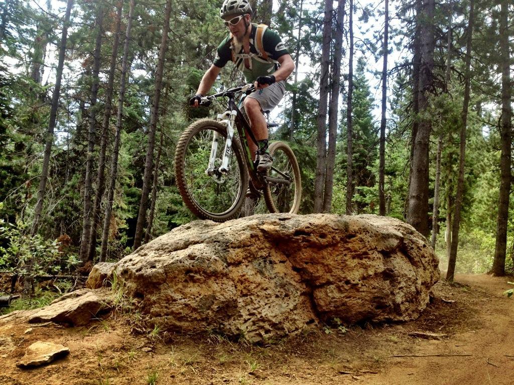


Trail is in excellent condition (dusty though) and ready for the High Cascades 100
| ThankYou could ride this trail 100 times and still want to come back for more. It has everything, rocks, roots, berms, jumps, Drops, flow, technical..... love it!!!
| ThankLucky enough to catch a ride out the Cascades Lake National Scenic Byway to the TH at Wanoga Snow Park. Began a 30 mile romp back to my lodging on Tiddlywinks. Most of the trail was a gentle descent with a few rocky outcroppings thrown in. Just fun, but then the rest of the ride was also. Tied in to Larsen trail-Tyler's Traverse-Catch and Release-C.O.D-Marvin's Garden back to Phil's TH. Added another 4 miles back to my diggs. Super day!
| ThankI only rode the section from Wanoga sno park to Tyler's Traverse. Very little climbing, some great rock sections, and the usual Bend-style flow. Good for any ability.
| ThankNot technical at all amazing flow big jump lines. Classic Bend Riding
| ThankIt was super dry and sandy when I rode, but still a lot of fun. Fast and swoopy for the most part with the odd rock garden thrown in for good measure. The jump line was fun although I was too chicken to hit some of the bigger doubles. The grade is mellow so if you want to go really fast, you're going to need to hammer.
| ThankMostly non-technical trail, with the odd rock garden thrown in.
The jumps and berms section is great.
I started at the Wan0ga sno-park car park, rode all of Tiddlywinks, then returned to the car via Funner.
| ThankI've only ridden out at Phil's twice. The first day we rode a bunch of stuff I can't exactly recall the name of but at the end of the ride I definitely remembered Tiddlywinks! It was such a fun trail the whole way through with a great pump track/jump line thrown in at some point. The next day when we went back & took a different route...at the end of the riding I remember thinking 'we should have done Tiddlywinks again...'
All the trails out there are top notch, but this one was my favorite of the bunch
| ThankFantastic flow trail, super smooth and fast, great support on turns so you can really let fly. Even has a little section of manicured berms and tabletops in the middle (think miniaturized DH run). Could ride this all day.
| ThankRocking singletrack with a killer descent! Loved the flow trail section.
| ThankLocal favorite. Well built trail used for local mtn bike racing
| Thank