×

|
Rate it:
Tags:
Level: Easiest
Length: 4 mi (6.4 km)
Surface: Singletrack
Configuration: Network
Elevation: -
Total: 10 riders
Mountain Biking Plymouth Bluff
#21 of 37 mountain bike trails in Mississippi
Parts of the trail are paved and some have crushed limestone on them. These trails are kept up very well and great for beginner riders. These trails run alongside of the Tombigbee river system so it has some very beautiful scenery and wildlife you will see while riding these trails.
First added by Tstrahan87 on Jul 19, 2012. Last updated Apr 28, 2020. → add an update
Before you go
- Drinking water: unknown
- Lift service: unknown
- Night riding: unknown
- Pump track: unknown
- Restrooms: unknown
- Fat bike grooming: unknown
- E-bikes allowed: unknown
- Fee required: unknown
This trail information is user-generated. Help improve this information by suggesting a correction.
From HWY 82, take exit towards west bank of the Stennis lock and Dam on the Tombigbee river. Drive to end of the road, take a left, and then Plymouth Bluff entrance is a little farther up on the right. Drive up to visitor center and trail heads are clearly marked.


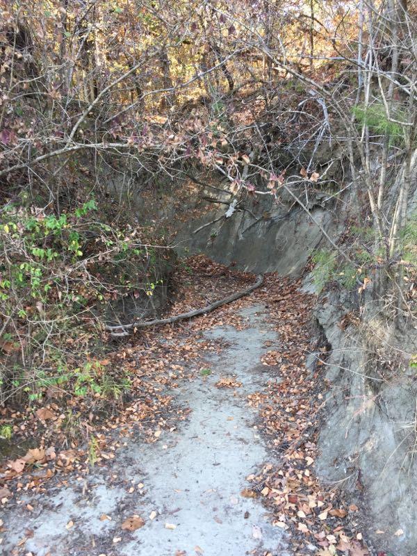

So I rode the Bluff trail yesterday and it was quite fun. Now yes, this really isn't a mountain bike trail, but it's a good trail for beginners. It's pretty fast at times, has nice climbs, and overall wasn't a waste of time. However, the crushed limestone is a huge drawback to this mountain bike trail. Dirt is and always will be superior. If you are an experienced rider looking for new trails, don't waste your time. This trail is great for beginners.
Also, about 3 quarters through the trail, there is a flight of stairs that you need to carry your bike over. Be very careful. There are no signs or warnings of these stairs.
| ThankThese are not mountain bike trails! This is a nature path that is about a mile long of crushed rock some ruined blacktop and some dirt. There are stairs that are not designed for bicycles. Spend your time driving to Lake Lurleen or the Noxubee Refuge.
| ThankEasy trail to ride, went yesterday and had an amazing time. Not very fun when you're alone but it is gorgeous. Be careful of the steps on the side near the river. The bluff trail has not been kept up. Was unable to ride due to it being grown up.
| Thankwent for a run here the other day, these trails are not MTB trails. plymouth bluff is a 1.2 mile loop meant for hiking and running.
| ThankSee other reviews: all true but; this are has 4 trails not one. The Scout Trail is a short segment joining to the river trail (steep in spots but very ride-able). The river trail has a 64 step drop off that is NOT well marked. If you approach to quickly you will be bouncing down stairs with a 90 degree turn in them. Not pretty.
| ThankThere a few places you will be walking/carrying your bike (stairs). Weak riders will be pushing up some grades (20%) but they are not long.
There are 2 nature trails, both are easy to ride, have well marked points of interest (plants mostly) and nicely set up benches with overviews of the river.
Bridges on the Scout Trail are built bike UN friendly. The slats are parallel to the direction of travel and gaps in places are large enough to drop a tire in (skinny tires) or re-direct your path of travel. The gravel on the path is decidedly crowned and loose. Generally a good surface, but traction occasionally is lacking. I would caution a true "beginner" on this.
I was out at noon in 93degree MS heat and this was amazingly cool and shaded. In places so dark I had to take off my sunglasses! The trials looked very underused and were full of spiders, but not many riders go out in the heat! Nice trails; I will be back.
The trail is mainly a hiking trail kept up by the plymouth bluff center, but biking is allowed. They are either paved or covered with crushed limestone. In two spots you have to get off and carry your bike up or down steps. Great and easy ride. These have four sets of trails- lake trail, bluff trail, river trail, and scout trail. All of which connect and have map kiosk at the beginnings of the trails.* Review edited 8/21/2012
| Thank