×

|
Rate it:
Tags:
Level: Intermediate
Length: 20 mi (32.2 km)
Surface: Fire Road
Configuration: Network
Elevation: +396/ -422 ft
Total: 38 riders
Mountain Biking Morgan Territory
#205 of 1,014 mountain bike trails in California
Volvon, blue oak, Manzinita valley view, out back on eagle down highland up coyote then volvon. there is always the other side of the road
First added by Juan_Gear on Jun 17, 2005. Last updated Apr 30, 2020. → add an update
Before you go
- Drinking water: unknown
- Lift service: unknown
- Night riding: unknown
- Pump track: unknown
- Restrooms: unknown
- Fat bike grooming: unknown
- E-bikes allowed: unknown
- Fee required: unknown
This trail information is user-generated. Help improve this information by suggesting a correction.
Off I-580 N-Livermore exit head north. Road turns West take the next right heading north again this is Morgan Teritory Road which is steep and narrow. At the top and to the right is parking. Free maps and roam around, hot, dry, steep, did I say steep


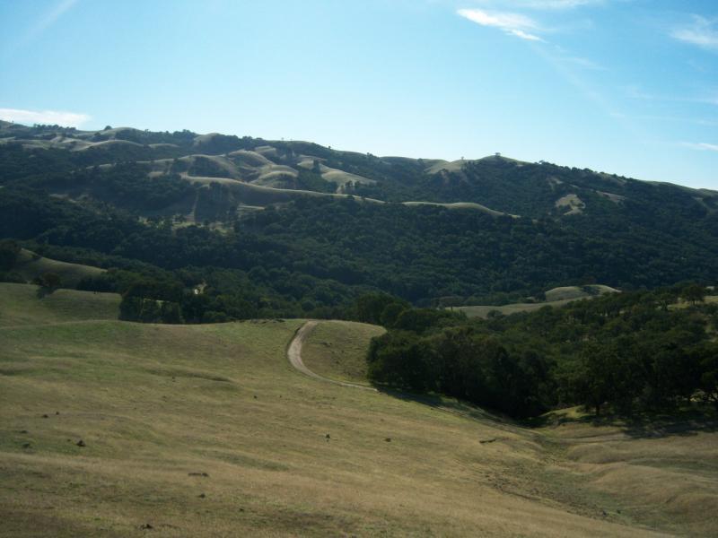

A very dry place to ride in the spring and summer, trees are few and far between cow pasture type riding with a few pretty stiff climbs, you can get a good valley view along the east side of the ridge.not much else to see.
| ThankThis is a huge open territory with a lot of trails leading in all directions. I went on a warm sunny day in May and did the six mile loop. There are many fire trails and single track trails to explore. Be carful because I saw about 4 large rattle snakes and I only road around the area for about an hour. The drive to the park is almost as exciting as the ridding once you get there.
| ThankThe signs on the trails were kind of confusing so I stuck to the fire roads. They were pretty dry and bumpy. Definitely some work going up and down quite a bit. I went in August so it was also pretty warm out there and not much people at all. I am definitely returning.
| ThankThis place can either be really easy, or hard and technical... I like going from the parking area, through the gate by the bathrooms, then taking a left onto coyote trail. Some spots of that trail and fun and flowy, while others you have to walk through because giant boulders are not wide enough to get your bike through. Lots of root and rocks on coyote trail. The fire roads are usually downhill, then uphill, then downhill, and do that for a while... There are some trails that lead off the fire road that can get really technical, and im my opinion, very fun. The dirt after it rains is the worst, it sticks to your tires and make your bike weight 100lbs, so i suggest wait a day or two after it rains if you go. Lots of beautiful view over looking the valley and Mountain Diablo.
| Thankusual coastal riding, steep uphills quick downhills, i swa some singletrack, but even some of the fire roads were a bit challenging. I think you can ride all the way down to concord if you want, not many people out there
| ThankCattle gets in the middle of Miwok trail, Doah!
| ThankNice valley views near on the eastern portion. Mostly smooth fire roads. Steep climbs for those into pain! I've ridden it 3 times and there is usually little traffic.
| Thank