Midland/tay Trail System trail photo
See all photos (12)
×
User
Today
 
  |   Rate it:

Tags:
Level:
Length: 13 mi (20.9 km)
Surface: Other
Configuration: Out & Back
Elevation: +10/ -10 ft
Total: 10 riders
 

Mountain Biking Midland/tay Trail System

  Add a review
#226 of 312 mountain bike trails in Ontario
#13,948 in the world

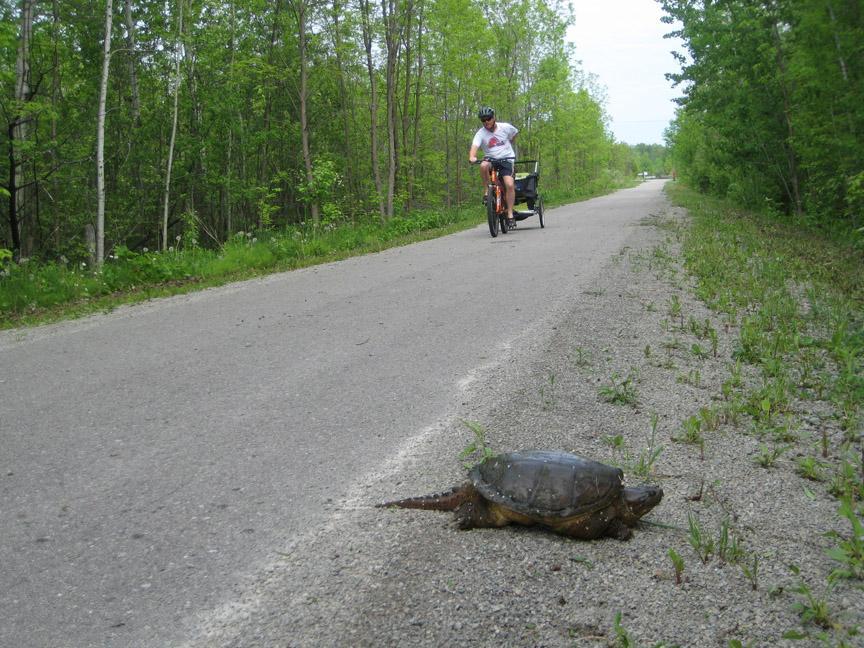
This scenic trail begins at Robertson Park. You can leave your car here all day at no charge. The first 6 kms (4 miles) is actually “The Midland Trail” but it seamlessly connects into the “Tay Trail System” for a total length of 22 kms (13 miles) one way. The entire trail is paved and follows mostly along the waterfront. You’ll pass over and under bridges, through marsh areas and farmland. Since it follows a railway path, the trail has little to no incline making it great for the casual rider. This trail is very lightly used especially during the week. When you pass the Midland portion of the trail, you will lose most of the other bikers and walkers. Not many to really worry about. A variety of birds can be spotted along this route due to the diverse terrain. Since there are no roots, rocks or sand, I’d have to rate this as a #1 for the hardcore mountain biker. Yet you can still get a good ride out of this trail as just a general workout and another trail away from the traffic. Enjoy!

P.S. There is only one washroom facility on this trail approximately 4 miles from Waubashene.

First added by zonesystempro on May 28, 2011. Last updated Apr 28, 2020. → add an update
Before you go
  • Drinking water: unknown
  • Lift service: unknown
  • Night riding: unknown
  • Pump track: unknown
  • Restrooms: unknown
  • Fat bike grooming: unknown
  • E-bikes allowed: unknown
  • Fee required: unknown
This trail information is user-generated. Help improve this information by suggesting a correction.
Getting there
Once you arrive in the Town of Midland, just go down the main street (King Street) to the waterfront. Follow the street on the waterfront to your left or going west (Bay Street) to 4th Street and turn right. Continue to your first set of lights and turn right on Sunnyside Drive. Take the next immediate right on Marina Park Avenue and then your next right brings you to Pete Petterson Park and the beginning of the trail


Midland/tay Trail System Trail map

Add to or improve this map // Share this map on your website

Local Info

Club Sponsor

-

Trail checkins

adrianwong (on Aug 28, 2019)
What's this?

Upcoming Events

None.
Add one

Trail conditions

Dry (on Jul 10, 2015)
login to update

Camping & Lodging

Coming soon!

Midland/tay Trail System videos

Add a video
We don't have any videos of this trail yet. Add one here.

Mountain Bike Trails Near Midland, Ontario

| 2 mi
****
Advanced | 10 mi
***
Easiest | 13 mi
****
Beginner | 9 mi

Add a review

Rating
 
Difficulty
 
Review

Reviews

    Loading reviews...

Rider questions