×

|
Rate it:
Tags:
Level: Intermediate
Length: 5 mi (8 km)
Surface: Singletrack
Configuration: Loop
Elevation: +3,380/ -756 ft
Total: 59 riders
Mountain Biking Lovell Gulch
#217 of 1,429 mountain bike trails in Colorado
Loop is relatively short, but you will spend the majority of your time climbing steadily from 8500 ft to just over 9200 ft. The trail is very well marked, when you get to the sign where the loop starts (< 1 mile in), keep right to avoid some super steep uphill. The trail is mostly singletrack (not too technical with the exception of some rooty parts) until you get to the top. Here, take a left at the gate where the trail changes to doubletrack. Be prepared for some screaming downhill that can be rocky or have loose gravel in sections. Before you know it, you'll be crossing the creek and back where the loop started. Be sure to stop and smell the wildflowers along the way!
You can also go camping nearby at Meadow Ridge.
First added by searsandrewj on Jan 1, 2003. Last updated Apr 30, 2020. → add an update
Before you go
- Drinking water: unknown
- Lift service: unknown
- Night riding: yes
- Pump track: unknown
- Restrooms: unknown
- Fat bike grooming: unknown
- E-bikes allowed: unknown
- Fee required: unknown
This trail information is user-generated. Help improve this information by suggesting a correction.
From Colorado Springs, take I-25 and Hwy 24 West towards Woodland Park. Once in Woodland Park, turn right at the McDonalds onto Baldwin Rd. Head straight through several stop signs for about 2 miles. There will be a sign to turn left into the parking lot for the Lovell Gulch Trailhead, which is adjacent to an animal shelter.


I was pleasantly surprised with this trail. Actually, it is a small trail system with four main trails running east and west up and down the slopes of Rampart Range. From south to north these four trails are: Upper Ridge and Lower Ridge together, Lovell Gulch, Power Line, and White Gulch. Plus, there is the wonderful Roots and Chutes that is the preferred option at the top of Lovell Gulch. Together, these trails cover 10.5 miles. All of them are mostly singletrack, except Power Line. Power Line is part of the featured ride/loop everyone talks about for the system. But imo, Power Line is clearly the worst of all the trails. The Lovell Gulch downhill, starting with Roots and Chutes (dropping off Rampart Range Road) and running all the back to the parking lot is a first rate 2.33 mile downhill. 5 star fun for sure. White Gulch is a good downhill too, but there are about five logs across the trail currently. Most of them are on the lower half. So be a little careful.
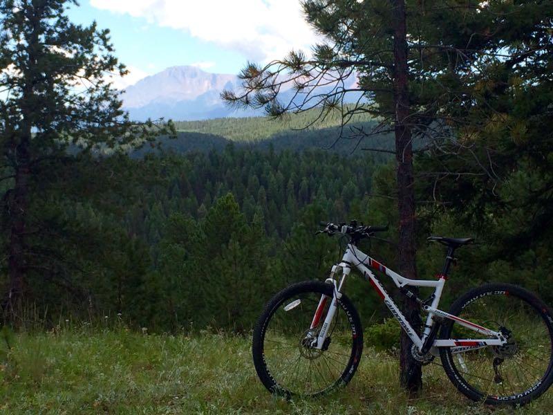
All the trails are beautiful except Power Line, but even it from its upper 1/3 provides some spectacular views of the mountains to the west and of the North Face of Pikes Peak. The forest is beautiful throughout the system and is mixed conifer composed mainly of ponderosa pine, spruce, aspen and limber pine. The photos posted for the trail do not do it justice. Finally, in addition to the 10.5 miles of trails running east and west up and down the main slope, there are also some small trails running north and south that connect these main trails. Don't miss these smaller connector trails. They are fun too. Again, all in all, I was pleasantly surprised with the system as a whole. I will definitely add this to my regular diet of Front Range Trails near Colorado Springs. One final thought, there is scree here, but it is not deep and rarely an issue (mostly just on Power Line).
| ThankLovell Gulch is a nice 5 mile loop...6.5 miles if you start at the park on Valley View Rd.
| ThankIt's a long uphill climb and then a fun downhill.
It can be crowded, mostly on the weekends but almost everyone is friendly and courteous.
It is a good ride for getting your legs and lungs in better shape!
Looking forward to trying a few of the trails that you can take off of Lovell Gulch.
If you go counter-clockwise, you ride up the single track and down the double track. There are a couple of creek crossings, but they are easy. It's a good grind uphill with a couple of real lung-busters, but nothing too bad. Not very technical, though there are a couple of rooty/rocky sections but nothing really hard. There was one root that was really fun to launch off off on the downhill. Not a lot of drops or jumps to be had. There are some steeps and the downhill going counter-clockwise is fast and furious. As others have mentioned the double-track doesn't feel like double-track. Beware of loose granite in places. A fun ride overall.
| ThankFantastic easy access trail, especially if you live in Woodland Park. I prefer to ride the loop clockwise, even though the climb is harder. The climb going clockwise is less technical, but it is very steep and is loose in spots. The downhill on the very narrow singletrack through the aspens is super fun, and can get tricky at high speeds.
| ThankHere's an alternative and still fun if you're like me and maybe not as skilled or as fit as some of the reviewers. After you cross the creek, head right. When the trail goes left and hard uphill after .5 to 1 mile, take a right onto a narrow singletrack that also goes uphill into the trees. This trail stays with the creek and features nice aspen groves and and easier climb. You'll eventually come back around to the left and to the top of the trail at Rampart Range Road. I use this as a fun downhill turnaround, but if you want that steep and more challenging loop, follow Rampart Range Road up another 50 yards or so. You'll see a gate on your left and be back on the Lovell Gulch trail for the steep downhill others have described.
| ThankThis is a fun, casual trail that you can knock out in less than an hour. I rode it CCW but I think it would be cool if you rode it the other direction as well.
| ThankThe Aspen groves are awesome. A few tricky spots for beginners, but overall very modest technically. I will definitely ride counterclockwise again. You get a nice reward at the top for your efforts (views), then some great downhill stretches and easy cycling to finish.
| ThankOne of the best parts about Lovell Gulch is the various routes you can take that eventually leads you back to where you started. White Gulch, Old car Trail, and others are all connected and if you have time and energy to explore those "forks" at Lovell, I recommend you do it. There is actually a trail that can get you all the way to Manitou Lake (9 miles) north of Woodland Park.
| ThankI might frequent this trail IF I lived in Woodland Park. If you're driving from anywhere else, you can probably find something more entertaining closer to home. The loop is short, the surface is the worst of the Pikes Peak gravel you'll ever want to find, and the scenery is less impressive than other rides in the area. It's a fine trail, but nothing special compared to other nearby options.
| ThankReally great ride. There was some really sweet downhill on this trail. The uphill is constant for about two or so miles, but it is worth it for the downhill. There is some doubletrack on this trail, but the way that it is set up it rides like singletrack.
| ThankI rode this trail today and really enjoyed it. I rode it counterclockwise and plan on doing the opposite direction next time for variety. The uphill was steady and nothing too gnarly, although it has a couple of short technical sections with roots that keep you honest. It passes through some great Aspen and boulder fields that make for great scenery. Once you hit the top there is some super fun DH with little mini jumps you can take at high speeds; watch out for fallen trees ahead because getting impaled sux. Just past the 3.5 mile mark there is a view that is truly spectacular and is worth a pause (it's after a steep climb anyway). The double track on this trail is also nice, as it does NOT feel like a road and gives you space to go around hikers and dog walkers. You can expect to see hikers at the bottom of the trail, so heads up!
| ThankI decided to check this trail out on my way back from Buffalo Creek today and I knew it was a quick 5 mile loop. I didn't have my trusty guidebook with me but I figured it wouldn't be too hard. Apparently I did the loop in the reverse direction and I was really hating the climb. There were a couple of hills I had to push on and when I reached the top I was relieved that I could at least just scream down Rampart Range Road back to the car if I had to. Imagine my surprise to find the awesome singletrack back down the hill! I really think the trail is best ridden clockwise even if you do have to push. The downhill on the narrow singletrack is really awesome compared to the doubletrack climb. Definitely check it out for a quick run!
| Thank