×

|
Rate it:
Tags:
Level: Intermediate
Length: 9 mi (14.5 km)
Surface: Doubletrack
Configuration: Network
Elevation: +908/ -493 ft
Total: 47 riders
Mountain Biking Boundary Waters Park
#122 of 414 mountain bike trails in Georgia
About 9 miles of moslty doubletrack with some short sections of old forest roads thrown in for good measure. According to Douglas County Parks and Recreation, there are currently 3 marked loops and several extra unmarked "side trails". The Blue loop is about 1.1 miles and easy. The yellow loop is 2.4 and a little harder but still relatively flat. The red loop is where the real fun is at 5.1 miles with some very punchy climbs that will certainly get your heart rate up. All trail loops are pretty well marked and even if you do shoot off on one of the "side trails" it will quickly bring you back to one of the three main loops. Pretty easy to navigate and reasonably well marked.
First added by GoldenGoose on Feb 9, 2011. Last updated May 9, 2020. → add an update
Before you go
- Drinking water: yes
- Lift service: unknown
- Night riding: unknown
- Pump track: unknown
- Restrooms: yes
- Fat bike grooming: unknown
- E-bikes allowed: unknown
- Fee required: unknown
This trail information is user-generated. Help improve this information by suggesting a correction.
From Atlanta, take I-20W to exit 41, Lee Rd. Turn left and head south on Lee Rd for 3 miles. Take a left when Lee Rd dead ends into Fairburn Rd/Ga 92. After approximately 2.5 miles, turn right on Ga 92/Ga 154/Ga166. Continue another 2.5 miles and Boundary water Park will be on your left. Park in the far right corner of the parking lot in the rear of the complex. Trailhead signs here.
System trails (1)


I hate to say it, but these trails have gotten pretty bad the last time I was there. They were "OK" when built, but what made them ok were the steep climbs that wore you out pretty quickly. Those steep climbs have just turned into a washed out mess. Dougless county needs to put some TLC into these trails to bring them back to life.
| ThankGood trail for douglasville lot
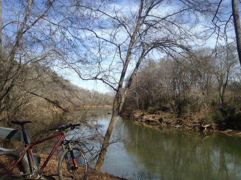
| ThankThe description is pretty accurate. Mostly flat until you get to the back loop on the red trail, that's where your climbing skills will be tested. There are go arounds where folks are complaining about the ruts, welcome to the world of mountain biking. Overall, I like the place for a good workout. Those steep climbs are followed by steep descents on the otherside. The blue is pretty short with almost nothing in the ways of fun, the yellow loop is a good flat speed loop if you just want to run flat out and the red will having you wish you had something lower than 1st gear in a couple of spots. If you want skinny singletrack fun, probably not the place for you, if you want to test your climbing ability, give the back side of the red trail a shot. Plus there's a nice ride back along the river.
| ThankI was pleasantly surprised as their are some steep climbs on the red trail. Good workout but their a very few areas that I would consider difficult
| ThankYellow and blue trails are light and easy but red trail is very tough and steep at times. Beautiful surroundings and quite a bit of wildlife. Trail is for biking, hiking and ... horses. So watch out for poop. :-)
| ThankWet day on the trail - was some tough mudding, but the shade of the trail and cool air made for a nice ride. After a rain you will find a bunch of mud and some tough to navigate bogs. A couple short steep hills make for a fun ride. Trail head is behind equestrian parking near soccer field.
| ThankMostly double track that stays wet a long time after it rains. Climbs are short but tough.
| ThankI ride this trail 3 to 4 times a week because its only 2 miles from my house. The blue trail is basic double track for about 1 mile and is really only used to get to the yellow trail. The yellow trail is two different trails, the back side that runs along the property line is pretty much a swamp and takes a good two weeks without rain to dry up. The other half is mostly dry with a mixture of sand, rocks, and clay. The whole yellow trail loop runs for a little more than 2.5 miles. The red trail is the real beast of boundary waters. It runs for about 5.5 miles up some really steep hills and ruff terrain. The trails were really made for horses and runners so biking can be a challenge at some points. The forest is still pretty wild so you will see all sorts of creatures while riding. Deer, rabbits, chipmunks, snakes, squirrels its a wild trail. They have recently finished a 1.5 mile paved trail that goes around the lake, I pretty much use it to get to other trails. When I ride I usually combine the marked trails and the unmarked trails and have developed a 9.5 mile loop. Lots of free parking, Douglas county park patrol is always patrolling the area and the trails are usually kept up pretty well. It's a great place to ride if you want a good workout. Just be prepared to have to wash your bike after every ride, fun stuff.
| ThankThis trail, as described, is nearly entirely doubletrack or old fire road. You can definitely get going fast on the flat sections. The climbs are some of the most savage I've encountered as they are not really designed for bikes and frequently go straight up.
If you're in the mood for that kind of riding, it's a pretty good place for what it is. If you are looking for sweet flowy singletrack, this is NOT the place. I'd suggest going when it is rather dry - it is unpacked bare dirt, so you lose a lot of speed when it is moist as you sink in a bit.
| Thankdefinately not closed. Riding is good. Smooth, fast and tough of you do the red climbs.
| ThankThis is a horse trail first so watch out for the poop. Mostly double track with some good up and down hills. This is the closest trail to me and I like to use it for quick workouts. The red trail has the hills, while the blue and yellow are primarily flat.
| ThankI use this trail, since it's the closest southside trail... Unless you are completely out of shape, or want some cross training, park near the lake and head straight to the red trail, which I would rank more towards the intermediate side only because of the climbs, which number around 5 or 6.(primary and secondary trails with a variety of trail surfaces. (Rock, gravel, sand, dirt, roots, ruts) and a couple of very fast downhills. Since it's doubletrack you can really fly. It maybe doubletrack, but you'd be hard pressed to find better climbing in the metro area.
HORSES... You are in horse country and these trails WERE built for horses and they are allowing mtb, so please work with each other. Many of the horses there are not used to bikes, so my advice is to give way to them. If you go early on the weekends or anytime during the week, you won't run into them, so keep that in mind. Also the sooner you get to the red trail, the less likely you will see anyone or anything period... well except for deer and rabbits. For that reason, I would go to this trail over Sope Creek, any day.* Review edited 11/4/2011
| ThankNot as enjoyable as MacIntosh to me. There are some good hills for climbing, but almost no techinical stuff
| ThankThese trails are fairly new and built by the county and it seems without much input from the biker community. I'd like to spend some time in there cutting some more technical trails. What's there is fun and can be good workout on the red trail. Some trails run parallel to the river giving a nice view for a bit. Lot's of free parking and tails maps posted at several of the trail intersections. Mostly all double-track but a good amount of trails.
| Thank9-10 miles of legal doubletrack within 30 minutes of Atlanta. If you live ITP in Atlanta, I know I just got your attention. About 40% of the trails out here are beginner level but the red trail is easily be rated intermediate and could even be advanced if you really pounded out the climbs. Good, quick elevation change in the red loop. Trails see little use by bikes but there are apparently a couple of equestrian riders who frequent the area judging by the horse manure in spots. Luckily they haven't destroyed the trails. If you are nearby, you owe it to yourself to check this one out.
| Thank