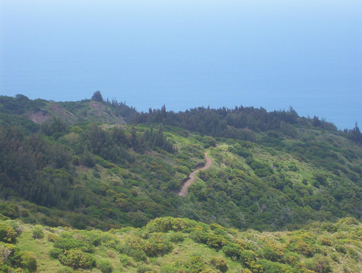
We did this ride in great anticipation to see what Oahu had to offer by way of mountain biking, yet it was early spring and many of the trails were still very wet. We were sent out on this trail because it was mostly dry. The first section on Mokuleia Access Road is paved blacktop, but is an intense, steep climb of about 3 miles. If it is hot and humid at the time, you will surely be challenged. You can go all the way to the top of the mountain (end of the road) to see the weather station up there, and also get some great views from the top. Then, descend back down the road until you see the sign for Public Hunting Area Unit E as this is the turn off for the jeep road on Peacock Flats. This begins a convoluted route of jeep roads and cutoffs which have a GREAT possibility of getting you lost out there. We didnít have a map with us, and it was only through great luck we were able to find our way to the Kealia Trail which leads down to Dillingham Airfield. However, I strongly recommend that you pass on taking the Kaelia Trail, and opt to return the way you came. The reason is that you will be forced to walk your bike down this steep series of switchbacks and bleed off all the climbing you did with absolutely no payoff whatsoever! It would be much better to return to the paved path and coast in a nice leisurely fashion all the way back down. Our descent on the Kealia Trail was miserable!
I canít stress enough the need to get a good map of this area. The views are great from the top of the trail and you can certainly get some fantastic pictures from up there. However, the jeep trail itself is rather dull, with ups and downs inside the forest canopy as the trail hugs the top of the ridge for most of the distance. If it is even slightly muddy, you will see some of the nastiest slippery mud ever! The combination of mud, a horrible descent, and bad directions combined to make this ride a real dog. It does have some potential if done as an out and back, but even at that, the best I can rate this trail is a 5.


Great Trail!!! Great scenic views and well worth it!
One problem with the description "...Kealia Trail which leads down to Dillingham Airfield. However, I strongly recommend that you pass on taking the Kaelia Trail, and opt to return the way you came. The reason is that you will be forced to walk your bike down this steep series of switchbacks and bleed off all the climbing you did with absolutely no payoff whatsoever!"
I took the Kealia Trail, which was one of the coolest parts. There are some sections that you have to hike down, but I still rode most of it. If you're on Oahu, this place is a must!!
| ThankFirst did this ride in 1991 one of the few MTB trails on Oahu at the time. Fun ride but not so much when it's wet.
| ThankThis is a great ride and when I lived on Oahu I'd ride this quite often. First time was in 91' or 92' actually took Ned Overend on a ride there once and he seemed to enjoy it. Fantastic views.
| ThankMay 2010 GoPro helmet cam footage available on Youtube. Kealia Trail (the singletrack section) is one of my favorite technical rides on Oahu. The steep descent down Kealia Access road to the the single track is possibly the most dangerous part of the ride because it will allow you to hit excessive speeds. Watch out for hikers and 4x4's on the blind corners.
| ThankI have to disagree with previous reviews. My friend and I ride this trail often. You have a 3 mile steep paved climb at the start so even if it's to wet to ride at the top, you still get a good workout. Once you at the top (jeep road) the fun begins. If you now where to ride, it can be great. I will agree with previous post that you can get lost if you don't know the area so ride with someone that does. If you want an easier ride, stay on the top jeep road. If you want to have some fun, go for the lower (seldom used, extreme 4x4) road. Don't forget to bring plenty of water as there is no water available on top. If you like technicle riding, then you will love the Kealia trail. It's my favorite part of the ride. I have ridden it several times the whole way without stopping, although usually I have about 3-4 stops/dabs. I guess it just depends on your skill level how much you will enjoy this ride. By the way, you can even try riding up the steep switchback if you like. It's mostly rideable up. Hope you enjoy, Aloha
| ThankI've ridden this trail a few times myself. I agree with the aforementioned ride down the paved road. Make sure your brakes are good though. The views are amazing.
| Thank