×

|
Rate it:
Tags:
Level: Intermediate
Length: 9 mi (14.5 km)
Surface: Other
Configuration: Network
Elevation: +662/ -662 ft
Total: 146 riders
Mountain Biking West Magnolia
#248 of 1,429 mountain bike trails in Colorado
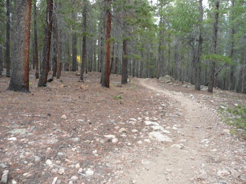
Take a compass or GPS, as this is a substantial trail network. There is forested single track, double track and a smattering of access roads. Grunt climbs, fast, twisty downhills, both technical and not, it's all here. Most of the trail is in the trees, with great results when the Aspens turn.
First added by Rob on Sep 27, 2006. Last updated May 11, 2020. → add an update
Before you go
- Drinking water: unknown
- Lift service: unknown
- Night riding: unknown
- Pump track: unknown
- Restrooms: unknown
- Fat bike grooming: unknown
- E-bikes allowed: unknown
- Fee required: unknown
This trail information is user-generated. Help improve this information by suggesting a correction.
From Nederland, take 119 South for about 1 mile. On the West side, across from Magnolia (County Hwy 132) is the trailhead.


Fun rewarding loop with fast descents and a secluded feeling.
| ThankA nice network of trails not too far from Boulder, but still feels remote. Bring a GPS app like MTB Project cause there are several intersections and not much signage. A mix of some flow and some technical rocks. Pretty high elevation around 7k feet. Some nice scenery, but not necessarily epic. A good trail system if you want to get away from Boulder without driving too far.
| ThankThis is a great network of trails near Nederland, CO, only about 30 minutes outside of Boulder. This is a series of interconnected trails that will connect you between Nederland and Rollinsville. Love the Super Magic Bus loop. There's a little bit of everything on this trail for riders of all levels, including plenty of technical rock sections.
| ThankDefinitely need some type of GPS so you do not get lost like I did. The trail I took had long uphill with a record amount of exposed roots. Ended up going too far south east and backtracking. So many better trails than this one.
| ThankIt has been a few years since I moved away from the area, but when I lived there I rode these trails for a good 16 years or more. It had changed a lot when more people started finding them, and then when the forest service started marking them, but there are still some really nice and challenging trails back in there. The area has everything from nice swoopy trails thru the trees, to crazy technical climbs, to chest to the seat steep & technical downhills.
Finding the trails can be confusing as one reviewer said, and maybe that it why he gave them a "mediocre" review. I used to see people blow by trail entrances all the time and just keep riding the forest roads. Some of the secret trails have been found and marked, and others seemed to remain a secret.
Oh, I will mention that it is quite possible to run across people camping out in the middle of nowhere, some who might put you on guard. There definitely had been some crime problems at times. I think usually people ripping off other campers, but be aware.
| ThankThese are some great trails , especially if you are looking for something different than the typical Front Range rocky climbs followed by sketchy downhills. Recent trailwork and cool obstacles built on Root Canal made it clear these trails are being maintained. I parked at the trailhead on Hwy 119, then rode road 1mi down trail 925A to the 2nd trailhead. I then took Observatory to Trail 927 and rode that trail (aka; Hobbit 3, 2, 1) around to Root Canal. Then left on dirt road back to Trail 925 and took that back to the car.
| ThankThis trail system is pretty awful. Just a confusing and ugly network of fire roads, campgrounds, and mediocre singletrack. After two years of riding the front range I can say I have never given a trail two stars but this place is a waste of time considering all the great places to ride in this region.
| ThankThe trails are decent, even with all the tree removal work done in the last year. A bit bumpy where the equipment has crossed. Sections are quite steep and rocky, and you will do some hike-a-bike there. The Hobbit trails were pretty good; Hobbit 2 had almost no trees now.
| ThankI couldn't get into a very good flow for much of the trails south of Haul Rd; steep rocky sections interspersed enough. Re-root was good, but again, much of the tree cover is now gone.
The trails north of Haul Rd really are rough and up/down quite a bit, with more horse activity in the east sections. (Stable right there near the main road)
I think the trail surface may improve some as more people ride them.
For me, the 50 minute drive is a bit too far to be worth it to come back.
THe maps at the TH match the trail marking numbers. I couldn't find a map like this on the ForestService site. I used a Boulder Mtn Bike Club map, which was pretty good.
A nice change of pace from the Boulder and Lyons trails. A solid 3.5 stars. I enjoy the high country so I rated it a 4. We parked near the main road and biked about a mile to the trail head. You can drive to the trail head and save about a mile but either way it's no big deal. Bring a GPS device or a good map. Our Runtastic app on our iPhone helped us navigate through the area. Lots of campsites and logging roads also.
| ThankI ran out to catch this one before the USFS closes it for the summer, maybe longer. As a highly touted trail network close to other trails I really like (Sourdough, S. St Vrain, Buchanan Pass), my expectations were high. In the end, I found it to be an okay ride, but not worth the drive. There were interesting spots, but long stretches of less interesting trail inbetween. I'm sure it's better to go with a local who's mapped out the best routes. Even taking that into account though, I can't account for the popularity of this trail.
| ThankA LBS near Boulder recommended this trial instead of Betasso. I wasn't disappointed. Found our way to Sugar Magnolia for a good down, then up hill romp. The TH map is vague and outdated, but re-root was great fun. Some sand, yes, but not much. Check out the videos
| ThankI rode this today for the first time and it blows. There are logging trucks everywhere and sand pits around every bend. Driving up there from Boulder was a big disappointment. Should have just ridden the Betasso like I usually do...
| ThankAwesome Trails!!! I will be coming here a ton!
| ThankGood flowing singletrack. The key to avoiding the sandy trails and trails more heavily use by equestrians is to stay south of CR 132. More parking is available down CR132 not just by the hwy. Some newer trails are available where Root Canal is listed on the map called Re-root. Most of the trails in this area outline the camping areas. These trails often cross jeep trails accessing the campsites. The jeep trails offer easy access back to your car or to other trails.
| ThankIn response to the "negative" comments: The trick to enjoying the Nederland area trails is to know the trail network. There are LOTS of trails in the West Mag area of which the perimeter trails are the most interesting and fun, some run as far south as Rollinsville (Schoolbus comes to mind) easily building up to a 20, 30+ mile ride. Those trails are more technical and rewarding than just dinking in the immediate West Mag spaghetti network as those reviewers have. The East Mag trails (Red Dot, Blue Dot, Reboot, etc.) are not as popular or shown on most available maps and tend towards more challenging, technical and steeper climbs and descents. There are several spots I challenge one to ride over (log crossings, rock drops, etc.). The locals (myself included) don't readily advertise all the biking possibilities around Ned, of which there are many (including trails that bring you back to Boulder), and prefer it that way! Having said that, the best map to purchase is the "Boulder Nederland" one by Sky Terrain. Even then some trails are not listed and the best bet is to talk to some locals to find them...* Review edited 9/4/2009
| ThankVery fun twisty trails. Some good climbing and quick descents and a nice speedy run through an aspen grove. there is some sand in sections that you have to push through but nothing to kill your buzz. Very pretty in there, the forest is sort of magical feeling and earns the names Hobbit 1,2 & 3. My friends were complaining about too many unnecessary tight turns on the trail as it does snake a lot.
| ThankGreat trail network. I used to think there was nothing too tough here, but every time I go back I ride new trails and this place has everything; tough climbs, some fun downhills, real nice stretches of singletrack, rock gardens. Easy to get lost in this network, but that's half the fun of riding. Good place to explore some trails, as there has to be about 40-50 miles of trails back here. Go mid-day and explore like crazy.* Review edited 9/30/2009
| Thankwas not impressed with this trail what-so-ever. kind of view it as a waste of time. cool campgrounds though. trail was loose, and someone along the way babied the trail and doctored some of the very few "obstacles" to make them easier to get over. at one point the trail comes pretty close to a private home, looks like the kids that live there are experimenting with north shore ladder bridges and what not, give them a few years experience and that might be the plus to this trail, the only one
| ThankThis trail is really fun. Nothing spectacular though. Nothing really in the way of climbing or crucial decents but some nice rolling, twisting singletrack in sections. Worth a look. You can put in 15 to 20 miles easy winding through all the trails and dirt connecting roads
| ThankNot sure what arnolda14 is smokin', but there are so many trails up here, West Mag, East Mag, Dot Trail, it's easy to get turned around. Good thing is at any given point, you're not far from where you parked. Lot's of tight sweeping trail, some quick descents through tunnels of trees growing over the trail, and some stellar views of the Indian Peaks and occasionally Longs Peak. Lot's of trail and routes up here to explore.
| Thank