


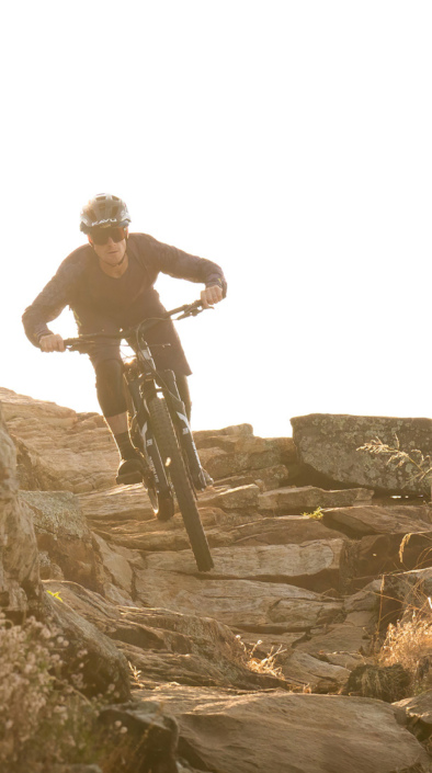
This section of the TRT is open to bike riders on even calendar days only, please be cautious of hikers as this is a popular trail in the area. Having said that, this is one of my favorite trails in the entire Tahoe region with several options for finishing the ride from the intersection with Tunnel Cr rd. The Traihead at Tahoe Meadows starts at ë8750 and slowly climbs to right about ë9000 in the first mile and a half. From this point the trail has very few climbs as it winds in and out of valleys and over ridges. Some technical areas, some rock steps thrown here and there an a few switchbacks scattered throughout the next 7 miles, a fairly fast and challenging trail even for experienced riders. Bring a camera, plenty of water, a bag lunch and take your time, find a big rock to sit and enjoy the view. The trail cris-crosses the crest of the Carson Range giving you spectacular views of Lake Tahoe one minute and then Washoe Valley and Carson City around the next corner. At 9 miles you come to the intersection with Tunnel Cr rd which is clearly marked, from here there are several options to get back to your car at Spooner lk. Continuing on the TRT south involves climbing ë700 then dropping down ë800 to Marlette Lk, take the Flume Trail north back to Tunnel Cr rd or the FS road south back to Spooner. By turning right at the intersection of Tunnel Cr rd will take you past the north end of the Flume trail (another option back to Spooner) as it drops a white knuckle ë1800 in three miles back to highway 28 and the east shore of Lk Tahoe. The shuttle will pick you up at this point and give you a lift back to Spooner at pre determined times. The free map from the shuttle company is detailed enough to help one decide which route to take on the return.


Super awesome Epic Ride. Take shuttl up to meadows and ride to Marlette Lake. Many options we dropped down and did Red House Flume Trail to Marlette, I took Flume Trail back to Tumnel Creek. 24 miles of pure bliss.
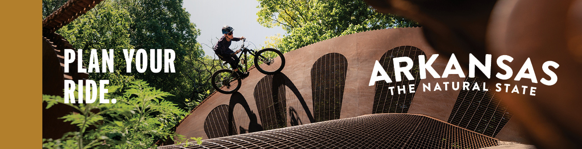
| ThankTRT is open on even days only. Call flume trail bikes for shuttle reservations. Intermediate and above. Not a beginner due to length, altitude and technical sections.
It's a great ride, well worth it's reputation. It goes through both forest and open country. You may even spot some wildlife. The views along the Flume trail are to die for.
| ThankCan only ride this on even days. Difficult to do as a loop. Fun to ride from here to spooner then shuttle back. Spooner downhill can get sandy and busy during the summer months. The trail starts at the end of the meadows just before 341 turns down to incline. Park there and the trail heads south climbs a bit 1.5 ,miles then descends to the intersection with tunnel and the flume trail.
| ThankWhat an amazing ride! Middle-of-nowhere feel, incredible views, great rocks to play on, and fast, flowy singletrack/gravel/sandy tread. The $20 for the shuttle was $20 well spent! It'd be really easily to shuttle this on your own with a couple of friends, though.
| ThankUnparalleled for scenery and holy crap views. . . Half the time when you are riding, you want to just stop and take a picture or soak it all in! Not the best ride in the world. I went north, and the climb to get up there was hell for a weekend warrior from flatland. The long sustained climb and elevation factor made me have to actually walk some sections, I think what the guy at the shop referred to as "cardiac hill." Once you get up there, it's a lot of fun. We stopped at Marlette lake to take it in, recover, eat some energy bars/blocks, and then on to the flume. Turns out you didn't need the energy after that. The Flume trail was not hard or technical at all, with the exception of some areas where you are close to the edge and the treacherous section they make you walk. It is all worth it for the view though! After that it is bombing down the other side with some erosion table jumps and sketchy corners with sand when you are going that fast! Best ride in the world? No. Worth it for the view, experience, and crossing a legendary top 10 trail of your bucket list? Definitely!* Review edited 2/18/2012
| ThankIf your up for an super epic ride this is the best Trial I have ever done.
| Thankhttp://www.theflumetrail.com/ridingmap/ ... gh_res.jpg
Start on top of mount rose ride the Tahoe rim trail South all the way to hobart road, then bring the flume trail back to tunnel creek road then bring the Tahoe rim trail 9 miles back to your car.
This is a lollipop configuration. The last 9 miles to the top of mount rose is very gradual but will beat you up. Have fun.
Great trail. Starts off slight uphill and turns to rocky climb uphill. There are some very nice technical downhills with lots of rocks to maneuver. At the end the Tunnel creek road is a straight but fast downhill. Just be careful the sand can get really bad as time goes on. Overall a great trail to get a good ride in on.
| Thank