×

|
Rate it:
Tags:
Level: Intermediate
Length: 3 mi (4.8 km)
Surface: Singletrack
Configuration: Lariat
Elevation: +112/ -90 ft
Total: 12 riders
Mountain Biking Sourwood
#142 of 412 mountain bike trails in Georgia
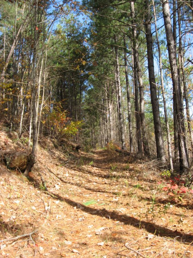
This is a great singletrack trail that can be looped with some gravel roads for about a 3-4 mile lariat (see Topo map). The singletrack is excellent quality--much better built than Ladyslipper and much more fun to ride. The trail runs past some cool places as well, including a waterfall and a picturesque creek.
First added by Greg Heil on Jun 10, 2009. Last updated Apr 28, 2020. → add an update
Before you go
- Drinking water: unknown
- Lift service: unknown
- Night riding: unknown
- Pump track: unknown
- Restrooms: unknown
- Fat bike grooming: unknown
- E-bikes allowed: unknown
- Fee required: unknown
This trail information is user-generated. Help improve this information by suggesting a correction.
From Cornelia, head North/Northeast on Dick's Hill Pkwy (Hwy 13) and hang a
right on Lake Russell Road across from the Lake Russell Convenience store.
go 2.5 miles, and hang a left at the sign. go left at the fork and park over by
the group campground. Follow the signs pointing towards Sourwood.


This is a fun trail, to bad there is not more of this in the area. The reason for the 3 is its just short. When the old paved road that you ride in on from Nancytown lake takes a hard right, the trail begins to your hard left. If there is a sign there, it is small. After the first mile or so of climb you will cross a gravel road. You will then have a pretty nice downhill before coming to another gravel road. Take a right here then a left where the road forks and you will be back to the trail entrance. There is a freshly dug re-route that appears to have been done well.
| ThankHopefully one day Ladyslipper can be improved and tied into Sourwood. The area has lots of potential for more trails like this so maybe we will see them in the near future.
Low land is definitely overgrown. Trail is easy to follow. high ground is great, this trail is very rideable. It just needs some traffic to break it in again. Tough up hills to start but some great downhill with some roots and rocks to keep you exited. Great ride just needs some tlc.
| ThankTrack was as described. Little grown up and the first sustained climb is rutted. However for a hometown trail on a Saturday morning it can't be beat. The detour to the waterfall is worthwhile. Two Eagle Scout benches are there for a peaceful break. Pics added
| ThankSourwood is a nicely built trial with pretty scenery along the way. The trail marking says that it is for hikers only so I'm not sure if that's something that has changed recently or what the deal is. The trail itself was very well worn into the ground so there was no guessing game of where you're going. Overall the trail is pretty short so to get in a good ride you will have to do Lady Slipper and Lake Russel as well.
| ThankThis is some of the best true singletrack in the area and should not be missed. Once it was only open to hikers. Now, the Lake Russel WMA decided to open this trail and Lake Russel Loop up to bikes. Sourwood is VERY tight and it's easy to miss the entrances. Most people ride it clockwise and that entrance is on the left side of FS 92 just before you cross a small creek. Keep your eyes open as the sign is REALLY small. The marker for this trail says "155". The exit is about a mile down FS 92 just as you pass another creek. The map I have from natgeomaps.com lists the trail as 2.7miles and my bike computer seems to agree. Expect lots of tight, technical riding with a few hard climbs and downhills. About halfway through the trail you'll cross over Nancytown Rd so don't be thrown off. Just find the trail on the other side of the road and keep riding. You'll come to a sign that will detour you to the Nancytown Creek falls if you'd like a rest or you can turn right and head to the end. If you want to quickly add this trail to Ladyslipper you can make a left at the exit and continue up FS92 until you see 191 on your right behind the gate. That will connect up to Ladyslipper and you can continue your ride.
| ThankRode this trail today with a buddy and it was awesome. Hiked it once so I had an idea of where to go. Trail is in great shape. And yeah, it was about 4 miles according to my GPS. Tacked on Lake Russell Loop to finish out the day. Which was also in great shape!
| ThankDid this ride again today, and managed it without getting lost, now that I know where to turn. So if you don't get lost, this is a really fun ride! And like the person right below me said, 4 or 4.5 miles would be a better mileage rating than 12. Sorry about that.
Old description:
I seriously recommend riding this as an out-and-back in order to not get
| Thanklost. The map I was operating off of (out of Jim Parham's "off the beaten
track") was incorrect, and the sparse road signage did not help, turning
what would have been my last 40 min loop into a 4 hour nightmare!
However, that being said this contains some incredible singletrack, great
views, great descents, and an awesome ride! The quality of the singletrack
on this trail is excellent, unlike the Ladyslipper trail. While ladyslipper's
"singletrack" runs down old road beds, this is beautiful purpose-built trail.
Sourwood Trail is an old hiking trail that is now also available for bikers. Although there are several options, the trail is basically a loop that includes singletrack and old forest service roads. One way to ride is a clockwise loop starting from the Nancytown Lake campground: Turn right onto Nancytown Rd, turn left at the trailhead onto singletrack just before the first bridge. At about 1 mile, the trail emerges onto a gravel road - go straight across the road back onto singletrack - follow the trail another 2 miles as it again emerges onto a gravel road near a small waterfall. Turn right and stay straight on the gravel road back to the parking lot.
Great trail in both directions
| ThankThanks to Goo's review I decided to brave this trail today. It was fantastic local fun! I have to believe more would the Lake Russell system if it had decent signage. It's terrible. So, I went exploring and my route went like this: (all distances from parking lot) go right until gravel fork, take left on 92, go up road, after about a mile, you'll see a trail that turns off road uphill to the right. Follow this trail through the forest until you reach a gravel road again (3.5miles into ride). Take right onto it (it's 591) and travel less than .5 mile back to original fork you took and go straight back to parking lot. Total trip for us was 4 miles. Don't know how Goo got 12 out of it, unless it was the 4-hr debacle. Think I'm going to try and add some markings to this trail. Will update w/ instructions if I do. It loses a star for lack of signage.
| Thank