Approximately 31 miles of hiking, biking and equestrian trails. Bikes are permitted only on paved and unpaved roads over eight feet in width.
Within Shell Ridges is the Borges Ranch, a site on the National Register of Historic Places. A working cattle ranch complete with farm animals, it provides a glimpse at life a century ago."
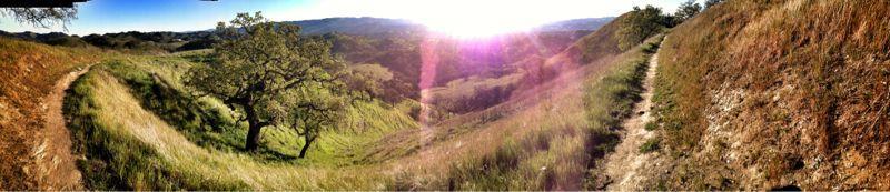
You will ride through three (3) connected parks. There's plenty of Single track to poach. Be courteous to the hikers and equestrian riders.
From the Sutherland entrance, you head East on Fossil Hill, at the first fork take the left and descend a small hill and veer right onto the Indian Creek Single (along a small pond..it is dry by late Summer)....head up and out of it, you'll come to fire trail, bear right onto Joaquin Ranch Trail and go around until you come to a street crossing. Bear left and the trail will start on the other side of the side of the street approx, 30 yrds up. Take that trail (paved) to the next trail head. Bear right and at the next fork, take the left..it will be one of the Twin Ponds trails. Climb to the end and at the next junction go left and then right again and start a nice steep climb. It will take you to the Ponds. Head up and out Hanging Valley Trail to the Briones-Mt Diablo fire roads and climb past Macedo ranch to Wall Point trail, descend into Pine Canyon/Stage Rd and ride the creek and creek crossings back to Shell Loop Trail back to Briones-Mt Diablo Trail. At the Borges Ranch Trail, head left back down to Twin Ponds and then take the Twin Ponds upper (North)trail....it will end at the same road as before...head West along Rock Spring place and retrace yourself back onto Indian Creek single track. Cross over Fossil Trail and connect into the last section of Indian Creek. It will connect to the Western section of Fossil Trail, turn left and climb back to Sutherland entrance.
Single track can be busy at times....most hikers will tell you it's illegal to be there...just nod and say something in a foreign language and move on.
 | Briones to Mt. Diablo Trail | 9 mi |


Dirt, sand, concrete, multiple creeks, awesome place to ride as a beginner.
| ThankI only been there one in your truck to be there but I do now to go there because there's no good truck to ride your bikes on he is a fund for walking hang out with your friends for my bike
| ThankUnfortunately ALL the singletrack is illegal but in the half year that I've ridden here, I've only seen a ranger once...my friends have built a lot of the DH singletrack here but it's pretty hidden and not on the map. On the map: If you want really flowy and well maintained XC single track Indian creek trail is perfect. For more DH stuff, ridge trail is good. A few other fun trails: twin ponds and sulfur creek. Nothing here is over the top, I ride my hardtail here all the time. My favorite thing to do is take twin ponds trail down then connect to Indian creek trail and go down that. It's all XC with some rock gardens but it's long and really fun. Water at Borges ranch, lots of trailheads. Just look at the map online. Shell ridge is honestly a hidden gem, only the locals really know that
| ThankThis is also my backyard and I ride it year round. Some decent climbs to test legs and lungs. Don't bother riding in or soon after rain. Clay gloms onto everything making it impossible to turn a wheel.
If it's wet, ride castle rock instead. It's only a couple miles away. Fun creek crossings and trail is not clayey.
| ThankGreat loop ride to Rock City and BBQ Terrace then back down. Make sure to get past Borges early cause the next couple miles there is no shade and cooks in the summer months.
| Thankpretty good dh.. lots of trails for xc not very long but long enough. hot in the summer bring water
| ThankThsi is my backyard. BE WARNED: WALL POINT is serious climbing. In the summer, deep powder between rocks gobble your tire. In the winter, faggetaboutit...Also, Secret Trail is really fragile in the winter. if it's wet, expect serious mud boggage...when climbing, best to stay right cause DH'er mob WALL POINT and there won't be time to move out of the way...just sayin.
| ThankI love that whole area for riding. I would 5 star rate it if the single tracks weren't illegal (Note, hit the trails between 5 am and 7 am and you can ride any single track you want without confrontation).