At the mill, the trail head is well marked with a sign across the street from the parking lot. On Riffle Ford Road, you need to travel south on the road to see the sign at the trail head there on the opposite side of the road from the parking field.
Once you are on the trail, it is well marked with red blazes and metal posts every so often. There are one or two intersections, but sticking with the well traveled path will keep you on the Ridge Trail.
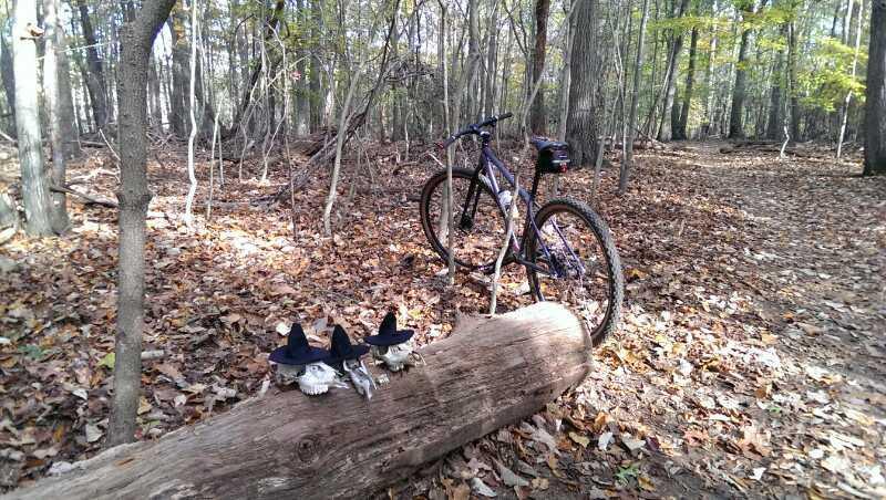
Overall, it is a fun trail, with plenty of good climbs and downhills. There are a fair share of at grade creek crossings to splash through as well as a few nicely put together bridges. There are nice pump sections created by the natural layout of the area and a few fallen trees that can be climbed over. The trail, as a whole, does not have a lot of technical features, but the rolling dips, long climbs, at grade crossings and switchbacks make it a very fun trail to ride.
GPS data logging gave an vertical climb over 1000' or so. I can't remember the exact number at this time, but despite the relatively even start/finish height, there are plenty of hills to climb and zip down.
It should be noted that this trail runs through managed hunting acreage. Luckily it is bow hunting only and not rifle, but still, care should be taken during prime hunting season to avoid issues with hunters. Wear hunting orange, maybe put a bell on your bike, make fewer deer noises while on the trail, and be courteous to the hunters in hopes that they will do the same in return. More information about can be found at the link below.
http://www.dnr.state.md.us/publiclands/central/rf_br.asp


A few updates: The trail has a new (2018) reroute that bypasses a section that was frequently eroded by heavy rains. The trail also connects to the new Pepco trail which connects to both the Germantown Rec (to the north) and the Muddy Branch trail system to the south. Excellent job by MORE.
| ThankI concur with the other reviewers. The SRT is fast, flowy, occasionally scenic, and not crowded. The trail is mostly hardpack with little in the way of roots or rocks. There are a handful of creek crossing and deep "whoops." The most strenuous section is Germantown Rd to Black Rock Rd. which is particularly hilly. The trail is not technical, so intermediate and even many experienced novices should be able to ride the entire 12-mile out and back without needing to dismount (with the exception of one fairly large log across the trail at the moment).
It's not world-class riding, but it's up there with some of the best riding I've experienced in the greater DC metro area. The links to other trails (Seneca Bluffs & Schaeffer Farms) is an added bonus. Thanks, as always, to MORE for their great work building and maintaining these trails.
| ThankFor my $, the best trail of the 4 trails I've tried in MD (comparing to Schaeffer, Rosaryville, and Cabin John). I do the out and back from Riffle Rd. and it's a quick climb and then some really fun, rolling sections. A few water crossings to keep things interesting and really great views along the way. It never seems too crowded (though I do ride early). The blazes keep you on track and it has the added benefit of linking up to Schaeffer for extra terrain, but for me the 12 miles - out and back - is plenty. You may encounter some hikers/runners near the Mill, but seems to be mainly a manageable amount of mountain bikers. Well worth a visit.
| ThankThis is without question my favorite trail system in the central MD area. I'll take Seneca Ridge over Schaeffer Farm any day. This trail absolutely rips!!! It's not technical at all, but it's nothing but super fast, flowing singletrack. There is pretty decent elevation throughout so you should always get a workout, especially if you go all the way down and back. I usually park right off rt 28 as parking near the mill can fill up fast, not to mention the downhill from 28 is fun. Love Seneca Ridge!
| ThankThis is my go to trail! It is flow heaven, no huge climbs, no suicidal descents, just miles and miles of flowy single track, you go up some you go down some over and over for six miles each way. Plus as a bonus you can connect to other trail systems in the area for longer rides.
| ThankI really like this trail. Although listed as 6 miles, it's a 12 mile ride (out and back). Very nice flowing singletrack. Nothing too difficult or technical (there's one climb on the last mile heading back toward Black Rock Mill that's somewhat challenging but certainly doable.) You can really pick up some speed on the downhills and keep your momentum for extended periods. There are a few stream crossings to keep it interesting. Only heads up is that the trail tends to dry slowly so it is not uncommon to have quite a few muddy spots in the spring or after a storm. This trail is a great extension to a ride at Schaeffer and connects with other trails in the network as well.
| ThankAwesome fast flowing trail and a great addition to a day at Schaefer Farms or Seneca Bluffs. Great trail to ride in either direction best when not too crowded so you can maintain speed.
| ThankA fun trail, good for out-and-back if you have the time, or team up with someone and park a car at each start/finish point and enjoy a quick but overall satisfying workout.
| ThankThis trail is awesome! Just rode the whole trail yesterday with my 11 year old son. We started at Black Rock Mill and
| Thankrode in the eastbound direction before turning around at Riffle Ford Rd for the return trip. Lots of fast singletrack with some nice gradual climbs and beautiful scenery. Mostly through peaceful, dense forest. This trail does not yet have a lot of exposed roots like nearby Schaeffer Farm. Congrats to MORE and everyone that has worked hard to make this a great trail!