


To ride Red Run (extremely technical, difficult, wilderness type trail), leave the overlook and ride east of Rt.150 for 1/4 mile and take Gauley Mountain Trail for 3 miles to the junction of Red Run. Go left onto Red Run and make your way down the mountain through everything a mountain can throw at you and a little man made stuff tooo. Once at the bottom of the 2.5 mile Red Run, go left (actually straight through) onto Right Fork Trail. Follow Right Fork till you come to an intersection with a sign showing Right Fork Connector. Do not go straight through on the Connector, it hasn't been used for years and is extremely overgrown. Go right at this point and make a short steep climb into a beautiful meadow on top the mountain. The sign at that turn will have HSH150 on it, meaning Highland Scenic Highway 150. Ride for about 1/4 mile through the meadow which comes out directly across from Little Laurel Overlook.
If you want to add more to this ride, you can turn to the right up Tea Creek Mtn. Trail just before you reach the road. If you have a vehicle parked at Tea Creek Campground you can ride down Tea Creek Mtn. Trail and shuttle back to Little Laurel Overlook.


This trail is more of a hikers trail based on our experience.....overgrown, unsafe bridge crossings and some hike and bike. It needs some real maintainence to get back to its glory days. Ride the Gauley mtn trail or props.
| ThankJust rode Red Run in a new loop on the 18th of July '09 and Red Run is as ridable as it gets. Even though it rained hard the day before the trail wasn't very wet at all. It's still difficult but more ridable than usual. We started at the overlook on 150, rode up to the Gauley Mtn. trailhead and took Gauley Mtn. Trail to Red Run. Down Red Run to Right Fork. Note: Right Fork was grown over pretty bad but still ridable. If you don't mind some weeds and trees in your face from time to time go for it. When we got to the top of Right Fork, across from the overlook, we turned up Tea Creek Mountain Trail (most awesome boulder field in WV on top of mountain) rode the boulder field and then the nerve racking, arm and hand numbing 2 + mile, narrow with steep drop on left, downhill all the way to Tea Creek Campground. We had a shuttle there to take us back up to the vehicle at the overlook. Nearly 12 miles for this loop. See the gps map. Awesome !
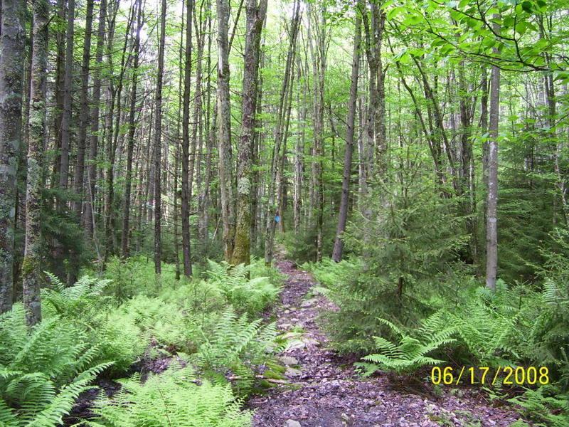
| ThankRode this trail near the end of August/08 during a mtb weekend. This trail is very rocky, and rooty, and there was only a little bit of mud even when everything is very dry. Great fun if you enjoy that sort of thing! Remember, momentum can be your friend! At certain points, the trail cuts between Sapling pine trees (about 4 to 6 feet high). You can squeeze thru, but these branches should be trimmed out of the trail.
| ThankOur loop started with the Gauley Mtn. Trail from hwy 150, out to Red Run Trail, out to Right Fork trail and back towards Hwy 150. The Right Fork trail contains several creek crossings and hike a bike situations. We also included the Tea Creek Mountain Trail in this loop to make it a meaningful ride! About 12 miles total but a difficult 12 miles.* Review edited 9/18/2008
Though Red Run is only 2.5 miles long, the loop described is about 8 to 9 miles total. It will take longer than a usual 8 miles due to the rugged territory. Enjoy ! If you like technical, mostly natural trails with plenty of obsticles, you'll love this loop.
| Thank