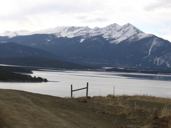
This trail connects Dillon and Keystone. The rolling terrain of this trail is great for beginners. This ATV/ wide singletrack has awesome panoramic views of Dillon Reservoir and the Ten Mile Range. The trail is pretty much on contour with several small climbs and takes you through sage brush, aspen and lodgepole forests. There are some fun waterbars on this trail! Heavy motorcycle traffic at times.
From the parking lot head up the hill turn right and ride through the Dillon Water Plant. The trail starts on the other side of the plant. Ride over several small ridges on this smooth trail. When you reach a 4 way intersection continue east under the power line. There are many spur trails but the trail is generally under the power line towards the landfill. Shortly past the landfill Oro Grande Trail ends at the power station that emits loud weird noises to keep the birds out. From here left leads up Frey Gulch right leads to hwy 6 either way you can get to Keystone. From here options are many. I usually ride the bike path back or hook up with Aqueduct Trail


A decent green ride. No major challenges, even for my amateur status.
| Thank