first thing you have a killer climb for over 1 mile. followed by some sweet twisty singletrack then a descent with some rock sections and some nice sweeping turns. the second loop is easier and faster with one major climb half way followed by some fun rollercoaster type fast and twisty downhill. building more trails across the river. look for the bridge in the campground


 2
2
I was just talking to someone who was thinking about visiting this trail. Came back here to re-read my review. Wow, can't believe that review from a few years ago was deleted. Negative reviews now allowed, eh?
It's not a bad trail, it's just lacks reasonable uphill/downhill balance. Lots of long, fairly steep climbs, followed by steep quick descents. The flatter sections were uninspiring. I found it no fun at all. It's a beautiful park, I'll never go back to mountain bike. Go to Vulture's Knob if you are looking for fun.
| ThankPretty average, typical midwest, trail. Its a state park trail, so its basically a hiking trail that was cut with mtb traffic in mind. Easy climbs and pretty decent descents. There is camping along the trail which is a plus, but if you go in the summer there likely won't be any free sites. Its first come first serve and its usually full. The main campground is basically a KOA trailer park in the on season so if you're looking for any kind of privacy or a nature experience while camping, look elsewhere. Exception being early spring or late fall. I camped once just after the snow melt, and had nearly the entire place to myself.
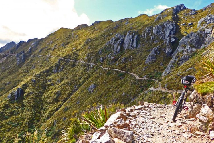
| ThankEpic cross country trail with increasing technical challenges the further you go. Plan on some long uphill climbs and great ridge top views. Bring lots of food and water if doing the complete trail.
| ThankMohican is a great trail and is just a short drive from Ashland, Wooster, or Mansfield. I love heading down there for a great workout, no matter if I have 30 minutes or 3 hours to ride the loop.
| ThankReally great trail system- nice technical climbs, great rock gardens, roots- and flow. Nice work!
| ThankAn excellent 24 mile single track loop. Well so gained and has a little of everything and a lot of elevation. Challenging and yet fun.
| ThankThe Poto trail is literally doable on a road bike.
| ThankGreat cross country loop!
| ThankRode Christmas Day with my single speed icy spots but rideable did mile 15 to 21 and back
| ThankProbably the best place to ride in Ohio! Great trails!
| ThankWell done , Mohican & the club! Well done, Ohio. This trail has it all and compares to rides I've done in Pisgah-DuPont, NC. It has technical switchbacks and climbs both up and downhill. Some ridgeline riding and fast flowy stuff. It's also a complete 24 mile loop. It's one of the most well marked trails I've ridden.
Not for beginners.
| ThankI could not disagree more with this review. Mohican has a perfect balance of up and downhill and great flow for a 15 year old trail. Also, if the first half took you three hours, you're frankly not ready for this place. The entirety of the loop has about 4k of climbing and can be completed in 2-2.5 hours by a rider in halfway decent shape.
| ThankI totally agree with your review. The only difference is that you said it in one short paragraph. I said it in four long paragraphs. LOL. Nice post.
| ThankI rode the full trail today, solo, for the first time. It's early fall and the colors were great. The trail was in good shape... But very rooted. Sections are exceedingly rooty. Miles 21-23 are the most challenging with some rocky areas. Challenging.... But fun. All in all a great trail it would be more fun if I had time to ride it a few times.
| ThankAwesome trail. I am a local here and after yesterday's ride, I just want to say I think it is pretty rooty. Never thought so before but after riding a few other trails then going back, lots of roots.
| ThankLots, lots, lots of roots in beginning. Trail starts out pretty well marked with a sign for each mile. I missed the turn off for the 8mile short loop but I think it was where the singletrsck crosses a double track which I was flying at the smooth downhill in this section. My favorite was mile 9-11. Fast, super fast flowing downhill singletrsck with a decent germs on the outside of these corners. Come out onto the pavement at mile 12ish. Lost the trail for a but here (kept riding circles around the over roads looking for the trail) at this point but if you cross the covered bridge and continue past the walking trail you'll find where the trail shoots up a short incline back into the woods.
| ThankOne of the longer continuous loops in the upper Midwest region. I did not feel this trail was as technically challenging as many reviewers. If you are looking for real technical challenge in the area go to Moraine in PA or Schooner in Brown County,IN. A good intermediate level ride, except maybe for the length. Really feels like you are on a journey. Longer mostly gradual (IMBA)climbs ( some steep switchbacks) with longer gradual downhills ( a few very short , steep , rocky exceptions ). Well marked trail, bring a map ( can be bought for $2 at park entrance / campground office) really in case you need to bail. In other words, staying on the trail is easy , finding your way back to where you started after leaving the trail early may require a map. PierreR gave a pretty good description of the trail on Oct 13,2013. I thought the section after the bridge to mile 15 was better than described , Overall trail IMO is about 65% good stuff and 35% not so fun pedaling (doubletrack/ old road) . Don't miss the last mile , a little more funner than most of the trail. Better trail than one would expect in this part of Ohio.
| ThankOk, now for my counter review. For me I think the Mohican trail is missing its mtb potential. Although there are a few very good stretches, like dropping into the gorge before the covered bridge, the trail lacks the speed and structure that it could have in many areas. The trail seemed to consistently and unnecessarily double back on itself, and thus, unnecessarily scrub your speed. A little bit of this is fine, but it was overkill imo. Too many unnecessary tight turns do not make for a great mtb trail imo. Similarly, the builders added many many short ups on potentially long downhill runs. These seemed completely unnecessary and again killed your momentum and a lot of the downhill fun potential.
I can understand why some Midwest trails double back on themselves all the time simply because they are dealing with a lack of available land. But one thing Mohican SP does not lack is land, even where the trail is currently laid out. Mohican has available land and superb topography to build an exceptional mtb trail. IMO, they need to reroute various portions of the trail, opening it up in some places and using the hills more in other places. All in all, I feel Mohican is a great workout in a BEAUTIFUL forest, but not a great ride. In comparison, I feel that Berryman in Missouri is a similarly big demanding ride in the Midwest, but with a much better lay out. And the Potawatomi in Michigan is not as demanding and hilly but also has a much better lay out. Finally, here is the most helpful map I have found for Mohican on the net. The state park map is not very helpful. http://s230.photobucket.com/user/i69whitey/media/mohican.jpg.html
| ThankI'm going to give two reviews on Mohican because I have many thoughts and mixed feelings about the experience at Mohican. First, the gorge is an amazing formation and the park itself is absolutely beautiful. The old growth forest is filled with huge straight yellow poplars, tall pines, stately oaks, massive maples and charming hemlocks. I have been to the park several times in my life. There are great accommodations at the lodge, cabins and campgrounds. The primitive campground (Class B) near the covered bridge has a beautiful setting and is cheap, but there is no rsvp possible. It is first come first serve only. The lodge is a bit pricey, but a great option if you are traveling with your wife or loved one. So the park - accommodations and nature - are first class.
The ride itself is long which is nice. To ride for so long in such a beautiful setting is a great experience in and of itself. IMO, no one climb is very demanding (except maybe the climb out of the gorge from the covered bridge at mile 12), but the ride as a whole will challenge many riders' endurance. There are some fun technical places along the way. Some of the switchbacks are especially fun. There are roots throughout to keep you on your toes. Another positive is that the trail is super well marked with a mile marker at every mile and directional markers at every intersection. You simply can't get lost. Once you get to the campground (near mile 23) if you can't find the trail, like jessums struggled with, just start asking campers or a park staff, and you'll quickly be on your way.
| ThankBeautiful and well kept trail. Loved how diverse and suspenseful the ride was. I was kept on my toes the whole time having to react quickly to what I found around every turn. The trail is not well suited for beginners but I think it would be a great place for someone with some experience to practice their technical skills. Theres nothing to scary but you can't just roll over everything.
My biggest complaint about Mohican is that logistical it is kind of a mess. The trail is one big 24 mile loop with very few good places to get off it. Make sure you park your car by the mile 1 trail head because it is by far the easiest place to navigate back to. I started from around mile 16 from a parking lot and was confused when I found myself at the trails end at mile 24 with no real indication of where to go to continue my ride. I went to the park office to get directions. They were very helpful and gave me a map. It wasn't until later that I realized that the map they gave me was grossly outdated and I was having a hard time navigating to an exit point that would put me close to my truck. I ended up turning around and having to ride 4 miles back on the road. I wish the trail looped back on its self more to avoid problems like I encountered on my ride.
| Thank