Mississippi River-Levee Track trail photo
×
User
Today
 
  |   Rate it:

Tags:
Level: Easiest
Length: 75 mi (120.7 km)
Surface: Greenway
Configuration: Other
Elevation: -
Total: 11 riders
 

Mountain Biking Mississippi River-Levee Track

  Add a review
#41 of 51 mountain bike trails in Louisiana
#11,486 in the world

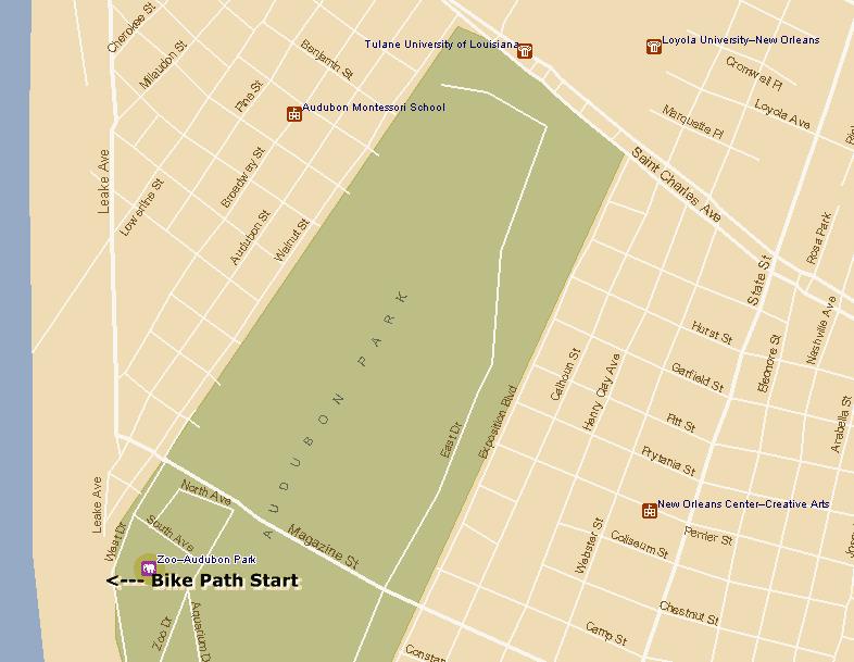
If I was start all over again on this track, I'd start at Audubon Park.

Begin by taking a warm-up ride around the 2-mile track a couple of times to soak up the glorious day your having & to have a look-see whos running today.

Then cross Tchoupitoulas St. (watch out, can be a little tricky. Ride with the traffic a ways to yield over to the other side instead of just trying to slice right through the traffic).

This will take you past the big Oak Trees to the huge parking lot of the Audobon Zoo.

A two-way lane leads you all the way up to the Mississippi River Levee.

At this point you can either turn left at the junction to see some more collegiate sun-bathing or make a right onto the beginning of a very long & winding track.

This track will then lead you & your pack of elitist through 3 surrounding cities outside New Orleans: Metairie, Kenner & Destrehan. Be carefull & BE CONSTANTLY ALERT for oncoming cyclist. These other Guys & Gals move at the speed of light. An accident will occur if you inadvertantly veer over the midpoint of the track. Also, parents, keep your kids leashed or close to your side. Many times I have come close to vehicular man slaughter by the carelessness of kids their parents.

Well, its been a good ride so far. Even though the wind may be a bit fierce at different orientations its considered good training for the legs on climbs & such.

Have a good ride and make some friends along the way.

First added by Chris-Go on May 20, 2005. Last updated May 6, 2020. → add an update
Before you go
  • Drinking water: unknown
  • Lift service: unknown
  • Night riding: unknown
  • Pump track: unknown
  • Restrooms: unknown
  • Fat bike grooming: unknown
  • E-bikes allowed: unknown
  • Fee required: unknown
This trail information is user-generated. Help improve this information by suggesting a correction.
Getting there
Get to the New Orleans Audobon Park to Mississippi River Levee from Magazine St., Tchoupitoulas or River Road....Google Beta it.


Mississippi River-Levee Track Trail map

We don't have a location for this trailhead yet. Help us get it on the map.

Local Info

Club Sponsor

-

Local Bike Shop

-

Trail checkins

luckystarz (on Sep 28, 2019)
What's this?

Upcoming Events

None.
Add one

Trail conditions

Dusty (on Oct 14, 2014)
login to update

Camping & Lodging

Coming soon!

Mississippi River-Levee Track videos

Add a video
We don't have any videos of this trail yet. Add one here.

Add a review

Rating
 
Difficulty
 
Review

Reviews

    Loading reviews...

Rider questions