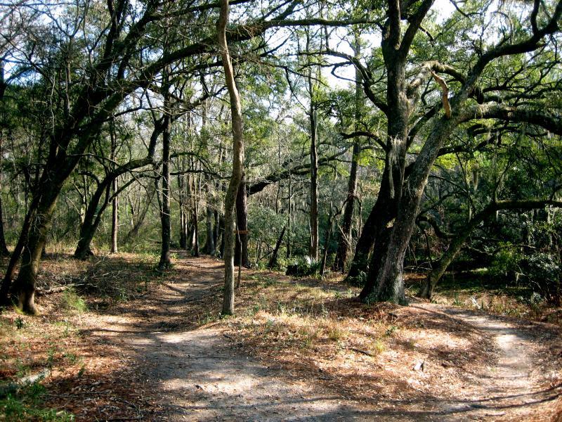
At the trail head, you'll find a posted map. There are usually maps in the mailbox at the trail head sign too. The trail is primarily single track. The main loop, which is well marked with red hash's on the trees and mile markers, is twelve miles that takes you through a pretty well maintained singletrack. The trail is considered pretty rooty (as described by some who have rode several more trails in this area of SC than I have). I didn't find the trail technically challenging. However, it's a good workout trail and there is enough scenery to keep the ride interesting.
I haven't seen "him" yet...but I understand there is a section of trail on a berm where one or two aligators like to bask in the sun :O....
There are two (or three) alternative routes that cut the ride a bit shorter (to about an 8 mile ride). These "short cuts" are marked in blue. As I discovered, after a good rain, you'll want to cut the back area of the twelve miles off and take one of the alternative routes, as that area is dubbed "The Amazon Swamp" for good reason. Although the area isn't impossible, the ride is not enjoyable due to deep mud (not to mention how it ruins the trail) It does look as if who ever maintains the trails are looking to remedy the trouble area's by raising the trail and putting down a one foot thick sand base over the worse area's.
There are a few jumps, berms and possibly a "pump track" near the last three or so miles for those of you who want a bit of "Free Riding" or BMX style riding...


I love Marrington. It would be easy to not expect much from a bike trail in the low country but the Fat Tire Freaks have done an exceptional job here. The place is impeccably maintained. Long flowing sections of Singletrack encourage full speed ahead for most of the ride and anyone at an intermediate level or above should be able to let it rip. The yellow side trails are awesome as are the 'drops'. Foster creek is a must do if you are here. There's not much elevation change but it's maxed out on foster creek, toss in some big roots and it's the most technical section of the trail system. I did this on my full rigid today and gained a great deal of appreciation for the quantity of small/medium sized roots at Marrington. My insides got tenderized. Can't wait to come for more on my next visit to Charleston.
| ThankFlat and a fair number of roots. A few manmade features (eg., teeter-totter) along the way. Overall a good ride.
| ThankReally fun. The Foster Creek Loop added some real difficulty to it. This is the closest thing to mountain biking this side of Columbia.
| ThankRoad here for the first time last weekend on a new to me Rumblefish I bought locally and wanted to try out. I was greeted at the main parking lot by one of the main maintenance guys from the Fat Tire Freaks. He was super helpful and gave me a recommendation on the ride. They have done a great job with the maintenance of the main trail and seemed to have cut a lot of the roots out that were causing issues. while not technical it is a fun ride. There is only so much you can do with flat land on a Navy base. I plan on riding it again when I am in that neck of the woods. Just keep an eye on the trail conditions as they have a strict wet trail policy.
| ThankThe trail is very rooty, and mostly flat. there is some fun to be had tough. There is a nice "drops" section were there are five 3-4 ft drop offs. If the rest of the trail is mondane, riding it just to hit the drops would make it worth it for me.
| ThankVery well kept and fast mostly flat trail. Excellent trail for beginners. However, for advance riders maybe not as challenging although their are technical areas within the Marrington trail system for advanced riders.
| ThankTrails are monotonous and boring. If any type of technical difficulty is what you are looking for, then look at different trails. In addition to this the trailbuilders have an incredibly poor additude about trail usage. If fun, challenging single track is what you are looking for, then look elsewhere.
| ThankGood for getting some miles in.
| ThankLoved riding this trail system during my time living in the lowcountry!
| ThankThis trail is okay. Youll peddle pretty much the entire time. Not fast pased. Very easy. Technical track could use maintinence. Dont get me wrong it is fun and very beautiful. And for a quick ride close to town its perfect.
| ThankFun. And beautiful. Lots of roots in trail.
| ThankThis trail was much better than wannamaker park alot less roots. Trail rides alot faster with more smooth hardpack corners. Scenery and wildlife will keep the ride interesting throughout. Taking the yellow makers off the sides are the most fun parts
| ThankI have ridden this trail several times and it truly is one of the great single tracks in the Charleston area. The only issue I have is that you have to obtain a pass from the recreational center since the trail is on government property (military weapon station land). The process to get a pass can take you up to 3 weeks to get and that's if you pass the background check.
| ThankThe many times I have ridden there was without a pass but this is on the weapon station and I'd rather hate to think of what would happen should one get caught without a pass.
Ever since the new Wannamaker Trail opened, I have not been to Marrington since.
It is a great trail but to get a proper pass can be a headache.
Squeezed in a few rides during a long weekend visit to Charelston and this place was my favorite ride. Well marked, fun flowly singletrack in the swamp lands...what more could you ask for.
| ThankThis trail has potential! http://youtu.be/xrPe4mFh-4Q
| ThankNot sure who has been writing these reviews. First off, this was by far one of the most fun "sea level" trails i have ridden. Great flow. It is about 13.2 miles long. If you add Fosters Creek (orange) new loop you can extend it to about 18 miles. The red trail is fairly easy. Small roots everywhere make for a bumpy ride. The trail is pretty wide in some spots. The yellow offshoots make it more challenging. The blue "alternates" are fun to explore. The orange trail is a ton of fun!!! A little less ridden...more "climbs" and more technical than the red. Definitely go orange!! I've been riding a long time and was bery suprised to gind this great of a trail so close to Charleston. I'd do ot everyday if i lived here.
| ThankTake it for what it's worth: single track. No elevation gain or lost, but fun to get out. Not hard aerobically or technically. I guess not really "mountain biking" at all, but I guess it's what is available near Charleston.
| ThankOld Faithful among the lowcountry riders (Charleston). This trail has been like church to mtn bikers around the area for years. consistently a fun ride, gets better everyday with some dedicated trail work and there's always someone on the trail to ride with. A+
| ThankIts fun, its Charleston, its all we got. Bored? Go faster!
| ThankFlat and simple. Could be good for introducing beginners to the idea of mountain biking.
| Thank