×

|
Rate it:
Tags:
Level: Intermediate
Length: 5 mi (8 km)
Surface: Singletrack
Configuration: Loop
Elevation: +334/ -274 ft
Total: 86 riders
Mountain Biking Lewis And Clark Monument
#6 of 103 mountain bike trails in Iowa
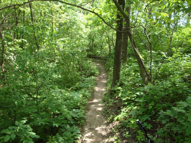
The trail begins on the north side of the monument for a demanding and hilly singletrack. You will find this trail to be technical and well built.
First added by woodiebikes777 on Mar 21, 2005. Last updated May 8, 2020. → add an update
Before you go
- Drinking water: unknown
- Lift service: unknown
- Night riding: unknown
- Pump track: unknown
- Restrooms: unknown
- Fat bike grooming: unknown
- E-bikes allowed: unknown
- Fee required: unknown
This trail information is user-generated. Help improve this information by suggesting a correction.
Take Broadway st. to 16th st. and turn north. Turn right on Big Lake rd. where you should watch out for the low R.R. bridges if you have your bikes on the roof of your car. Left at Mynster Springs rd. and then another left on Rainbow rd. to the monument entrance.


This is a compact, solid trail system. Many thanks to THOR for maintaining the system. I only got lost once but figured it out after I did a lap so it's marked nicely. For the Midwest, this trail has lots of climbs, drops and twists thanks to the Missouri River valley. Some of the downhills are challenging and the climbs can seem to be straight up. I cased a few hill drops and several were not walkable, meaning you're going down on wheels only. Also, there are two jump sections, one with a ride around and another one without that are for advanced riders. The drops are, if measured straight down, at least 6' in height but with speed, they're a lot more than that. As this is built along the bluffs above the Missouri River, there is a lot of elevation changes and as others have said, there are some tougher climbs. All doable for the intermediate rider. You can get up a lot of speed and that's needed to make it up some of the hills. All in all, great trail system and I can't wait to come back.
| ThankNot for beginners. Fast up and downs, an active and widely used trails. A lung burner on a few of the climbs. Many optional wood features.
| ThankFast and flowing
| ThankI have just started mountain biking again since 20 years ago. The bikes are so much better. This trail can put your bike and you thru it's paces. There are lines for all levels of ability except really advanced. The trail markings could be better but I think if you ran they it a few times it would be OK. I live 60 miles or so away but will make it a point to get back as often as possible. Makes me want more of a full suspension trail bike than a cross country hard tail.
| ThankI really enjoy the heck out of this trail. Lots of fun. Wish it was a little better marked so you know your going the right way but overall it's a great ride
| ThankGreat trail as advertised. I rode it twice this morning. Very high on the fun meter. LOTS of technical nuggets with short steep ups and short steep downs and even some places to get some good speed though they are short. There are some good places to get a little air too. It is the kind of trail that you want to ride very aggressively, but it requires a lap or two to get familiar with it because your line of sight (at least in the summer) is usually quite short and it is quite narrow. So there is not much room for error. To nail the short steep ups, I definitely had to shorten my front shock. All in all a fun challenging trail.
The only thing lacking may be sustained periods/stretches of high speed. But this is a small urban park, so that is a bit much to ask for.
I will post a couple of photos of the trailhead to supplement what others reviewers have said about its location near the entrance/gate of the monument.
There is one steep llittle chute (see photo) into a little ravine that you don't want to miss. You'll know it when you see it. It is off to the side of the trail and has a dirt wall you bank up onto immediately after you drop into the chute. It also has a nice surprise hidden around the corner -- a big wooden jump. And that is followed a couple of more non-jump structures. Don't miss this part of the trail.
| ThankI was driving from NY to Colorado and wanted to find a place to ride each day of the drive. I spotted this local on Singletracks and sought it out. This place is awesome! the quality of the built trail and the amount they have squeezed into such small acreage is amazing. The berms, jumps, pumps had me squealing like a kid. It's only downside is the limited number of miles. Expanded and this place could be a destination. Met some of the trail builders after my ride and they were great. If you're in the area definitely check this place out. You will be glad you did.
| ThankTrail entrance is really easy to miss. Right after the gate look to the left for a little sign - this is an entry point. It's built on very hilly terrain but climbs are not too difficult. It's more like rollercoaster. Don't let Black Diamond fool you - even beginners could ride this trail.
| ThankRight now trail is rideable only in the morning when frozen. I think it would be muddy in afternoon.
In general, very intertaining system and I would recommend to ride it for those who passing by Council Bluffs. Never thought I could ride such a good trail in a "flat" Iowa
Trailhead is almost hidden. Literally about 10 feet inside the gate to the monument on the left side. You have to drive in to park, then ride down the hill to the trailhead. No signs were posted to the trailhead at the parking lot either.
Not being from the area I brought my bike and decided to hit a bunch of trails in the area. This being rated the most difficult I made it my first day. The rating is right on, for a irregular, recreational rider this is a tough trail. Technical in the manuevering and steep both incline and decline. Cardio will be tested here. The climbs are not wildly steep but there are so many of them it will get anyone panting.
This ride had considerable "pucker" factor. Within the first 20 minutes you get moving downhill at a good speed and there are "steep consequences" should you go off the trail down the bank. The dropoffs/ steep banks along the downhill side the trail at some parts also make this an advance trail rating. This time of year the trail is covered in fallen leaves that make the downhills difficult to control, be aware the leaves will get between your tires and the dirt and you will slide if braking hard.
RECOMMEND RIDING WITH A GUIDE YOUR FIRST TIME. Ride with someone who knows the trail. The trail markings are great at first, then they get confusing and what was a tree branch barricade you then go over and it is easy to lose your bearings and your patience.
| ThankSo far this is my favorite trail this year its really fun and fast. It just has great flow who ever built this did a great job. The only thing I would like to see is a couple of 1 foot tall rollers 5-8 feet before a couple of the drops for some fun flowin step downs. Btw the trail head is wrong in the description. It is right at the entrance on the south side stay to the left the exit is on the right.
| ThankGreat, fast trail had no problems following the trail. There are a lot of good flowing sections, and you can get real fast. Over all had a great time. Good job to the trail builders.
| ThankNo markings at all on this trail. Got lost several times and barely got in 3 miles. There were some fun sections.
| ThankReally a fun trail. Lots of fast flowing sections. A few short climbs but nothing too bad.
| Thankworth the short trip over the river
Very fun intermediate/ advanced trail. lots of tight flowing single-track with steep gullys, bermed turns and logs thrown in. Good bike handling, and braking skills required to ride this fast (that's the fun way to ride it). No need for a dropper post here, just drop the seat, and leave it down. Drains well after a rain, 24 hrs should do it. Do to all the trail in a small area it can be a little confusing at first, just go ride, no worry of getting lost.
| ThankI rode this trail today and it was a lot of fun. The trailhead starts at either of the Green Signs that you will see to the left side of the road in the woods as you're driving towards the Monument. The parking lot is further up towards the red signs on the right. As for the trail, there are some nice fun descents with speed and some climbs as well. If there were some jumps added, it would be even more fun. Some log crossings in the trail too. Nice tight switchbacks on climbs and descents. Bring a friend or a group, it's a nice ride. Glad I made the drive across the river from Omaha. Well worth it and I will be going back again. Better than Jewel in my opinion. Here is the address in case you would like to GPS it: 19962 Monument Rd. Council Bluffs, IA 51503.
Remember (prettyvoise1) doesn't like you riding on their property, tear... Stay south of the monument and you'll be fine.* Review edited 1/28/2012
| ThankThe map that is posted for this trail is wrong so don't use it. It shows the old trail that is CLOSED BECAUSE IT IS ON PRIVATE PROPERTY! Please remove this map from your website!
| ThankThis was my first time here and I have to say it was really confusing on where to start but after I found the trail I was really surprised!!! The chutes at the beginning is a blast!! It's kind of short but well worth the time. It's fast it's fun and well maintained.
| ThankThe north trail along the bluff, as well as the majority of the north trail, is private property and is closed. Please respect posted Trail Closed and Private Property signage.
| ThankSeems the trail head has moved as Most of the Trail has been deemed Private Property. The new entry point is to the left of the entrance to the Monument. It's different than it was and most of the route has been redone...Since I usually start from the top of the trail I was a bit confused on the new "correct" route. I'll have to follow some other people next time.
| ThankLocated in the bluffs overlooking the Missouri River this trail offers long downhill sections and equally long climbs to test riders of all abilities. The trail kicks off at the top of the bluff with a downhill run through deep gullies and bermed turns that will eventually end at the very bottom of the bluffs. A series of switchback climbs and downhill stretches gradually take you back to the top. The last climb to the top is a 200 yard gut buster known as Mount Never-rest!
| Thank