×

|
Rate it:
Tags:
Level: Advanced
Length: 1 mi (1.6 km)
Surface: Singletrack
Configuration: Network
Elevation: +428/ -423 ft
Total: 121 riders
Mountain Biking Jim Branch Trail #41
#78 of 554 mountain bike trails in North Carolina
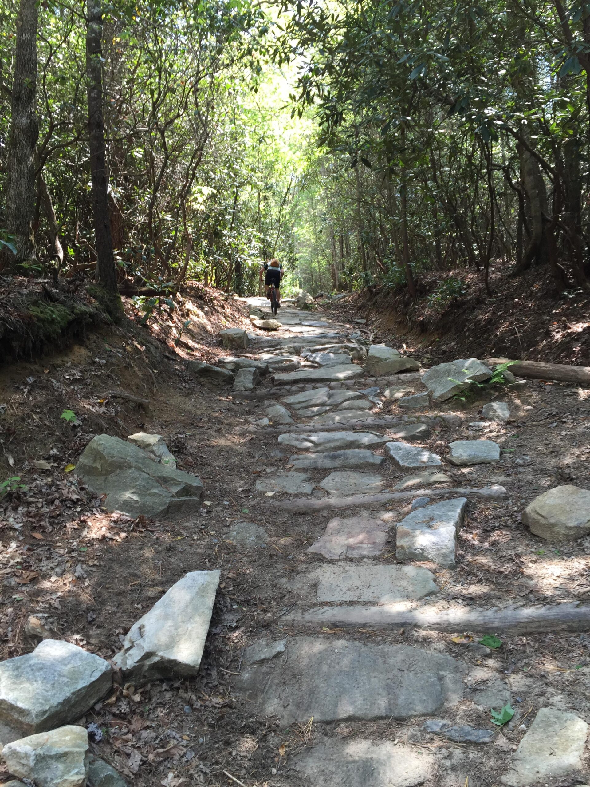
Jim Branch immediately climbs steeply up rocky singletrack armored with old
bricks and logs. Don't be intimidated, though: it gets easier after that. The trail
climbs steadily on smooth, machine-built singletrack that is perfectly designed
for mountain bikes! The turns and switchbacks are perfect width, and the
grade is rarely too steep to pedal.
First added by Greg Heil on Mar 26, 2011. Last updated Apr 28, 2020. → add an update
Before you go
- Drinking water: unknown
- Lift service: unknown
- Night riding: yes
- Pump track: unknown
- Restrooms: unknown
- Fat bike grooming: unknown
- E-bikes allowed: unknown
- Fee required: unknown
This trail information is user-generated. Help improve this information by suggesting a correction.
From Brevard, head South on Highway 276 into Cedar Mountain. Hang a left
on Cascade Lake Rd. Drive down into the forest and hang a right on Staton
Rd. Drive past two trailheads and park at the third major trailhead on the
left.
This is the Lake Imaging trailhead.
Connect to this trail via Lake Imaging Road #45.


Really fun to ride down. I head some screaming coming from the wood line and I entered the Dupont Forest system. As I turned the corner, I hear kids laughing until they were out of breath as they came down this trail. My only goal that day was to find the top. I finally found the top and had a smile on my face just like the kids did. Great downhill section with a big rock garden at the bottom.
| Thankgood trail. maintained very well. wouldn't consider it very difficult but did have nice flow
| ThankI wouldn't consider this trail advanced...if you hit that rock area at 25 mph it would be, but not at the speed accumulated from the decent beforehand. Hey, I thought it was so cool that after riding up that stretch of rocks, I turned around and rode down it before continuing!
| ThankDon't let the beginning scare you off, because it does get a lot easier. Please note that these trails are very crowded.
| ThankThis is a fairly easy cross country trail. The beginning has some huge rocks, which you may hike a bike, but the rest of the trails is pretty smooth and enjoyable.
| ThankThis trail is a real jewel in the Dupont trail system. This trail was definitely designed by mountain bikers, for mountain bikers. The grade is near-perfect while still being challenging, and the flow of this trail is apparent, even on the climbs. Sure, the bottom sections is super steep and very daunting, but overall this trail is a must-ride!
| Thank