The High Altitude Racing Loop has a great mix of steep climbs, smooth singletrack, and wicked fast downhill sections. The high altitude (9,000 + feet) makes it pretty challenging. Begin at High Altitude (bicycle/clothing shop on Burro Street) and head to the town dump (see map). From here, the narrow singletrack begins, where a steep climb brings you near a radio tower. A tricky descent drops you into a utility road- head LEFT and then turn RIGHT where the singletrack picks up again (see map). Yet another ascent begins after this. A smooth downhill section of singletrack leads you into the Pines Campground. Ride through the campground and you will once again encounter singletrack. A series of climbs and descents follows this. NOTE: due to excessive logging, this area can be confusing; you may want to ride on the highway that parallels the trail instead (see map). Both routes lead to a forest road. When the road comes to a fork, head RIGHT. Continue on this mild ascent until you reach a cattle guard with a (locked) gate. Ride past the gate and turn left. To your right should be a vast pasture, a very pretty sight in the summer months. After a brief period of riding, singletrack will appear to the LEFT. This is the highlight of the trail- a LONG, fast descent into Bailey Canyon. After this downhill section of sweet singletrack, head left onto yet another forest road. A particularly painful ascent will follow. Expect to climb for close to half an hour! A trail marked by the Forest Service will appear on your RIGHT (see map). A short yet technical ascent follows. Shortly after this, a great section of singletrack drops you into Osha Canyon, a beautiful sight. Continue past the wooden bench in the meadow and turn RIGHT (see map). You should begin a short, steep ascent, the final section of singletrack. After this climb, take the forest road RIGHT. This road passes the Osha trailhead and drops you right in the heart of downtown Cloudcroft, ending the loop.


A series of singletrack, double track, and fireroads that combined together make a fun loop starting and ending in Cloudcroft.
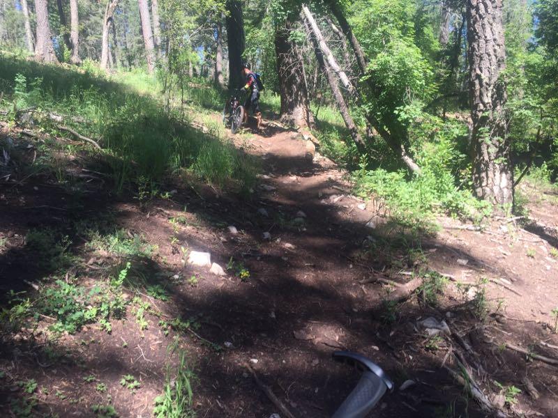
There are large portions of the trail that are unsigned and the day I went (May 2010), the first mile or so (near the large radio antenna on the hill) had lots of downed trees which basically meant that I was hauling my bike over terrain for the first 1/2 hour or so.
I was tempted to abandon the trail, but am glad I did not. It got much better.
Lots of rocky sections, which is pretty much the rule in this area, but nothing really that technical.
There was also no really killer climbs. The worse climb was at the bottom of Bailey Canyon, climbing back up a fireroad to access the Osha trail to get back to Cloudcroft. It was just a long, sun-exposed climb that kind of sucked. The good news is ripping down Bailey Canyon was fun enough to make the climb back up worth it.
All things considered this was a fun little ride through the woods. Probably the c***piest thing about this ride is there were several times where the trail sort of "disappeared" and you had to use your intuition of where it might be. I think this was mainly due to lack of maintenance and being so early in the riding season. I talked to the folks at High Altitude about the trail and they said they encountered the same conditions a week earlier, and that they were going to round up some folks with dirt bike and chainsaws to open it up again.
At any rate, trail condition will get a star decrease from me, and even if it were in primo shape, I still don't think this is a 5-star trail. Most of the time it didn't really feel like I was on a course built with mountain bikes in mind; the flow isn't really there. At several points while I was riding I couldn't wait to get through the current section to see if the next part was going to be any funner.
Good trail. Just not great.
| ThankThough riding for years, I have never ridden in this altitude and the thin air was the most challenging aspect of this course. Only managed a couple of miles into this course before wisely turning back. Snow and ice was still on the course and it made the sweet singletrack more challenging. Felt defeated but fueled the passion to return prepared someday. This is no doubt a great trail, but take its name as a warning.
| ThankAir is thin and course is challenging or difficult for a novice.
| Thank