×

|
Rate it:
Tags:
Level: Beginner
Length: 15 mi (24.1 km)
Surface: Singletrack
Configuration: Network
Elevation: +299/ -331 ft
Total: 10 riders
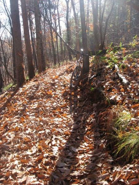
Mountain Biking Frady Branch
#204 of 412 mountain bike trails in Georgia
There is a pretty sizable network of trails here. Jim Parham's book details a ride that loops around the perimeter of the system, and it is just over 10 miles long.
First added by Greg Heil on Nov 13, 2009. Last updated May 11, 2020. → add an update
Before you go
- Drinking water: unknown
- Lift service: unknown
- Night riding: unknown
- Pump track: unknown
- Restrooms: unknown
- Fat bike grooming: unknown
- E-bikes allowed: unknown
- Fee required: unknown
This trail information is user-generated. Help improve this information by suggesting a correction.
From Toccoa, head out of town on Currahee Mountain road. Cross straight over 17, and turn left on 184 after 0.5 miles. The trailhead will be on your right 2.5 miles after you make the left hand turn onto 184.
System trails (8)


Rode Frady branch loop 8/9/16 trails was in good shape, deep ruts and some wash out. But all in all it a fun ride through the wood. It was raining when I rode, very muddy
| ThankConstruction has begun on the bridge. And the trail is much need of maintenance.
| ThankRode this a couple of weeks back and honestly it should be turned back to nature. Horse riders have ruined any part of a trail that was here. Easily 1 ft deep horse tracks where they have went through after this winters snows. Shame because it might have had potential but this is a wasted effort.
| ThankWhile this is NOT in anyway single track with the crappy weather its great to have some awesome fire roads to go out and ride instead of tearing up the trails. Good if you wanna train through the winter months even through ugly weather.
Side note - Trail and area says closed but unload and ride it if you want to- area officials said they didnt care.
| ThankMore fun to ride than the trails
| ThankBetter than the trails. A number of rollers to launch off of and catch some air.
| ThankLame
| ThankHistoric sites are cool, but the riding sucks.
| ThankEasy. Not anything near a decent singletrack trail.
| ThankEasy.
| Thank3 stars for one rocky hill, would be fun to ride down. Black diamond for that same steep nasty hill
| ThankSingletrack? Maybe there USED to be singletrack here, but there isn't any more. It looks like a skidder with a 5 foot wide blade has bulldozed all of the trails sometime in the last month or so leaving all of the "trails" as super highways through the woods. You could easily drive an ATV down these trails. The only thing slightly cool about this place is the abundance of historical sites.... but the mountain biking? The mountain biking sucks.
| ThankDid this trail today. The trail head parking at Frady Branch is closed, but if one is willing to fjord the creek where the road is washed out, it's worth the effort. There are other ways into the LRWMA that allows access to this trail as well. It can be accessed via Pear Tree Orchard Rd off Currahee Mountain Rd I believe. Though the conditions are not the best in some areas, so waiting for summer may still be advisable.
| ThankThe paved road up to the start of the USFS road that you want to ride is currently closed down. It is possible to reach it but going up 365 and cutting over on a gravel road, or if you are coming from the Cornelia direction you can make it far enough to access the Currahee Mountain road.
At the time I did the actual ride, the gravel road itself was in relatively good shape.
| ThankThis morning, a drove over 50 miles to come and ride this trail. I got there, only to see the parking area closed off, with a sign saying "Trails closed due to damage caused by recent heavy rains." I wasted a lot of time getting here, and I didn't even get to ride it. Hopefully the Toccoa area riders will get this place back up and running soon so I can go check it out. So if you had heard of this place and were thinking about going to ride it, you may want to wait until next summer or so.
| Thank