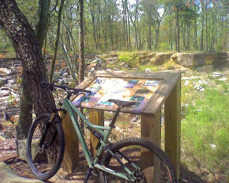
Pick up a map from the country store to help. Or, park at the lodge and ride towards the cabins to enter Gilliam and Chalet trails. These two trails combined are about 5 miles total when you loop back to the lodge parking lot, therefore make a good warm-up for the remaining 14 miles. Gilliam loop includes a pump track, bike teeter, and a few skinny's. Once back at the lodge parking lot, head down the road towards the country store. Directly across the street from the paved entrance to the country store, you will see the entrance to the trail system. The next 4/5 miles is the most technical section of DeSoto - good climbs over rocks and roots. Now the remaining of the system is well-marked with mileage totals and the names of each trail. You'll hit the family loop first, then go across the road and see entrances to 3 seperate trails, one of which takes you back to the camping area and the country store, the other two are loops. Again, all of the system from here on is marked well with orange metal signs.


Being new to MTB my review should be taken VERY lightly! I've ridden/walked/carried by bike on all the bike trails in Desoto and had an absolute blast. Beautiful scenery to look at while I was catching my breath on the CCW Quarry loop. The closest to my skill level were the Gilliam and Family loops. I hope to come back with more skill and without my gravel bike!
| ThankThese trails are tough!! There are a few that are close to being single track but for the most part they are more like hiking trails that they allow mtb on. Tons of roots n rocks. I wanted to rename the trails to roots rock n no ragae !!! Not for beginners either. I took my kids on the "family loop" trail.... Lots of wrecks and carrying bikes over rocks. The potential is here but these trails aren't mtb ready yet.
| ThankRode the CCC Quary counter clockwise. Suggest riding to clockwise. Then on to Family Trail, Neverland and the Vizzney loop. Don't let the Family Trail fool you by the name. You will still need to navigate rocks and roots. Speaking of, take your full suspension bike and keep the knobs rotated to full suspension the entire time. Never land was good and Vizzney loop was great. I like flow trials. This place was very cool but could use some TLC. I had a blast riding the trials and would recommend to anyone.
| ThankThe scenery is awesome! The Family Loop is a good warmup/cool down ride. Neverland is fun, but loaded with roots and rocks. Vizzney Land is one mile on the nose and fun as well. Very worth the trip.
| ThankLove the skinnies and bridges along Neverland. Plenty of fun, technical play with a decent flow. Beautiful scenery.
| ThankDidn't care too much for these trails....except the scenery what great
| ThankGreat piece of property with unlimited potential. The new "Vizzney Land" trail is a blast. As of today, it is not on the map. Strava put it at exactly one mile. It is off the Never Never Land trail and is clearly marked. VL (riding CW) is a buff, bench cut trail that is very fast with two down hills, one of which takes you through a fun rock garden. I rode NNL clock wise, I think it would have flowed better going CCW. Still fun though. The Family Trail is a bit miss-named. While not difficult, I can't imagine taking my 10 year olds on 20" wheeled bikes on it. I lost the trail on the Orange out to CCC from the Family Loop. I took the "advanced" option and the trail just ended, I could not find where it picked up. Hoping they add more miles out there! Over all I would rate it "medium" with nothing too crazy, but the rocks and roots will likely make it a little more challenging for a beginner rider. Strava put me at 9 miles which includes probably a mile of back tracking.
| ThankNever Neverland - This trail is so much fun. Roots in some areas. Flow in some areas. Outcroppings and low bridges. Fun fun fun. If you're in the area, don't miss this gem.
| ThankDone this trail today, 10/09/14, family Loop was terrible. Area's had been what looke d like clear cut, a lot of the debris from this cutting was covering the trail. If roots are your thing then you will love this trail. Local guy suggested gilliam loop, I loaded up for the short drv. to TH, loved it. Flowing trail could get some speed up. Very nice.I will be back for this 3.5 Loop. This section is similar to Sylaward/Lake Howard, flowy. Roots are like Oak Mtn. in ways, rooty.
| ThankLove this trail system. I worked at a summer camp a few miles from the trail and would wake up before the campers and go ride for about an hour. This is not one of those huge all day trail systems, but what is there is a blast. Great scenery and also great terrain. Well maintained. Can't wait to get back out to this beautiful park.
I would highly recommend visiting the area. Spend a few hours mtn biking and maybe bring the road bike along as well.
| ThankGood trail system - easily accessible from the campground. Down side is LOTS of rocks and roots on trails. Never-never land had pretty scenery, but fairly technical in some areas. Gilliam Loop was smooth was some nice climbs.
| Thankgood tech. ride, rocks and roots. lots of fun..
| ThankVery nice trail system. Never Neverland Trail is fast and flows well. All trails are a nice ride, nothing more than intermediate.
| ThankVery good set of trails.. the CCC Quary are more challenging with lots of climbs and rocks... Never-never land is fast paced and great scenery.
By the way, I was able to ride 8 miles of trail (not only 5 like specified above) and 2 more miles for the family loop)* Review edited 9/4/2012
| ThankNice trails, gradual climbs give a nice workout. Awesome rock (boulder) garden at the CCC Quarry, but a lot beyond my skill level... BTW, I'm not sure whose children could ride up the 'family trail' on MWF (CC) - a little washed out and a lot of roots - would definitely be a hike. * Review edited 8/12/2012
| ThankSince last year there has been a 3.2 mile loop added that increases the riding distance to approx 8.2 miles. There is also a 2mile loop but it is soft and still needs work. They have added a nice 3ft wide bridge across a section of Rock Garden that previously was impossible to climb. I know like to ride starting at the R trailhead heading couter clockwise as before but also coming back the way you started on the first 1.3miles. The 3 technical climbs become short fast downhills. The new section doesn't have a name, but I like to call it the Black Forrest, in some areas remains me of British Columbia with the moss growing on the ground and the idea believing you are in the middle of nowhere. Its a good ride for anyone in the NE Alabama area.
| ThankTech single track. This trail is sandy and rocky and pretty challenging at times. I really like the new additions to the trail. Get a map with the new sections at the country store to keep from going in circles. Fun allrounder.* Review edited 8/23/2008* Review edited 8/25/2008* Review edited 8/25/2008* Review edited 8/25/2008* Review edited 8/25/2008
This trail has been dramatically improved, and is now the best trail in eastern alabama. A must ride!!* Review edited 4/30/2011
| Thanktrail is 90% single track with short technical climbs and a couple of very technical rock sections, 1 good technical decent and 3 technical climbs that initially look like nothing, hence the name of the first climb "the nothing" but the rocks make it a greater challenge it appears. the last 1.5 miles is all downhill single track with alot of roots and some small jumps that is a blast. If you decide to go the opposite direction and climb the last 1.5 miles then you will be in for a workout.* Review edited 8/15/2008
| Thank