×

|
Rate it:
Tags:
Level: Intermediate
Length: 5 mi (8 km)
Surface: 4x4 Trail
Configuration: Out & Back
Elevation: +272/ -260 ft
Total: 8 riders
Mountain Biking Currahee Mountain Road
#208 of 414 mountain bike trails in Georgia
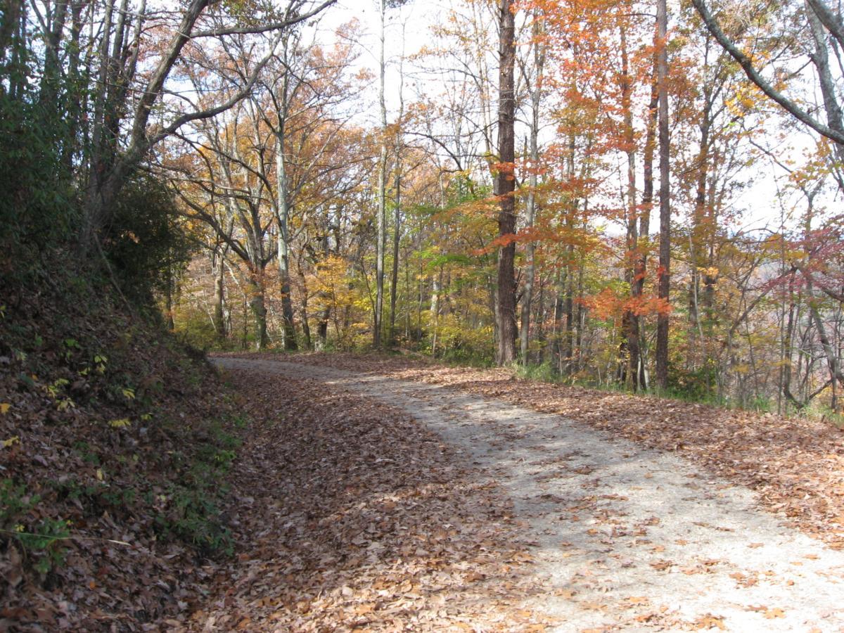
From the Highway start heading straight up the main USFS road (62, I believe). It is a steep 2.7 miles to the summit of Currahee mountain, and the road is often washed out, wash boarded, and rutted. It gets maintained regularly, but can degrade quickly. Elevation at the beginning of the road is 1201'. Elevation at the top of Currahee: 1719'. But it isn't a straight climb to the top, there are several serious downhills on the way up that make you curse the people who built that road, but it is definitely a serious workout. If you are really masochistic, start at the gas station on 17 (elev. 814') and add those 5 miles of paved hill on top of it. But when you do get to the top, you are rewarded with one of the best views in Northeast Georgia!
First added by Greg Heil on Nov 13, 2009. Last updated Apr 28, 2020. → add an update
Before you go
- Drinking water: unknown
- Lift service: unknown
- Night riding: yes
- Pump track: unknown
- Restrooms: unknown
- Fat bike grooming: unknown
- E-bikes allowed: unknown
- Fee required: unknown
This trail information is user-generated. Help improve this information by suggesting a correction.
From Toccoa, Head out of town on Currahee Street (HWY 123/365). Cross over Highway 17 (don't turn with 123/365) and head straight up the hill. (Don't turn left on 184). Almost exactly 5 miles you will see a sign for Lake Russell WMA and probably a sign about the military post that used to be here. Hang a left onto the road, and park there.


The paved road up to the start of the USFS road that you want to ride is currently closed down. It is possible to reach it but going up 365 and cutting over on a gravel road, or if you are coming from the Cornelia direction you can make it far enough to access the Currahee Mountain road.
At the time I did the actual ride, the gravel road itself was in relatively good shape.
| Thank