×

|
Rate it:
Tags:
Level: Intermediate
Length: 9 mi (14.5 km)
Surface: Doubletrack
Configuration: Loop
Elevation: +459/ -499 ft
Total: 13 riders
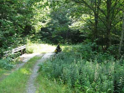
Mountain Biking Cotton Brook
#35 of 148 mountain bike trails in Vermont
We picked this ride off the Mt Mansfield/Stowe mountain bike trail map. This was one of the few
rides on the map that had singletrack so we had to try it out. After climbing a little over 1000 feet
on double track and descending another few hundred feet (still on doubletrack), we finally turned
left onto the singletrack. Steep, fast descent, a few rocks, and very overgrown trail. It was still
great though, all rideable. On the way back down we stuck to the singletrack that parallels the
gravel road and it was crazy up and down. You'll scream down a hill about 1/10 of a mile and then
power right back up for another 1/10 mile steep climb. Nice scenery too.
First added by Jeff Barber on Aug 13, 2005. Last updated May 6, 2020. → add an update
Before you go
- Drinking water: unknown
- Lift service: unknown
- Night riding: unknown
- Pump track: unknown
- Restrooms: unknown
- Fat bike grooming: unknown
- E-bikes allowed: unknown
- Fee required: unknown
This trail information is user-generated. Help improve this information by suggesting a correction.
From Stowe, head south on Hwy 100 toward Waterbury. Go about 5 miles and turn right onto
Moscow Rd. Go about 2 miles and turn left onto Cotton Brook Rd. (gravel). The parking area is at
the gate.


I must have gotten lost, or missed the correct trail (it's what I get for not bringing the singletracks map with me) because I didn't find this to be 11 miles, however what I did ride was scenic and loads of fun, plenty of climbing and great descents too. Cotton Brook is also a place where you can bring your canoe or kayak if you're into that. Also as a plus, it's in the heart of Stowe, so shopping is only minutes away.
| ThankI did not ride the whole trail but what I rode was fun. The gravel road was scenic and not real hard. What was hard was some side trails that were made for snowmobiling and mountain biking. Some places were steep and long. I had to push up a few of the hills. The steepness was doable they just went a little longer than I wanted. Get your wife to drop you off. This is a tourist area with shopping and brousing opportunities. That way everyone is happy.
| Thank