×

|
Rate it:
Tags:
Level:
Length: 14 mi (22.5 km)
Surface: 4x4 Trail
Configuration: Out & Back
Elevation: +2,955/ -345 ft
Total: 10 riders
Mountain Biking Bunce School Road To T33 Crash Site
#987 of 1,400 mountain bike trails in Colorado
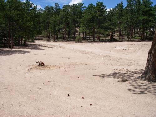
Bunce School road is mostly class 2 except about a half mile in the middle that was loose and steep (class 4). Take FR202 to FR203 to a hiking trail to get to the crash site. 203 has a lot of steep loose rocky spots which may require a hike-a-bike both ways. The crash site has a few large pieces. There was a lot of small fragments in the ground. Most of the plane was aluminum so it hasn't decayed or rusted at all.
First added by MTBKER on Jul 11, 2009. Last updated May 1, 2020. → add an update
Before you go
- Drinking water: unknown
- Lift service: unknown
- Night riding: unknown
- Pump track: unknown
- Restrooms: unknown
- Fat bike grooming: unknown
- E-bikes allowed: unknown
- Fee required: unknown
This trail information is user-generated. Help improve this information by suggesting a correction.
From Lyons head up SR 7 (south Saint Vrain canyon) up to the peak to peak. About half a mile after the road joins the peak to peak highway, turn left onto Bunce School Road (there will be an old school house there). Go past the school and find a place to park.