×

|
Rate it:
Tags:
Level: Intermediate
Length: 26 mi (41.8 km)
Surface: Singletrack
Configuration: Out & Back
Elevation: +520/ -853 ft
Total: 37 riders
Mountain Biking Arizona Trail: Cienega Corridor
#74 of 436 mountain bike trails in Arizona
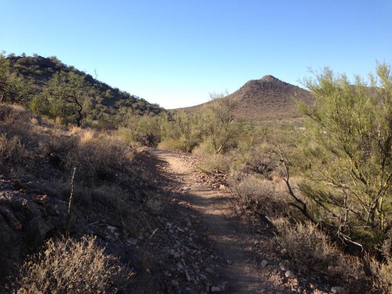
This segment of the Arizona Trail is newly constructed and built to high standard. Weave through saguaros and dodge sharp rocks for over 25 miles (one way). This is an out and back ride, so turn around when you want and head back.
There are many access points, but the closest to Tucson is at Pistol Hill Road (described in directions). The trail heads southeast, around a saguaro studded hillside before dropping into Colossal Cave Mountain Park. After climbing a steep saddle, look for 'the castle' in the distance. It's a private residence, but a bizarre one. Continue on the mellow singletrack to 3 Bridges, then through a rideable culvert under Interstate 10.
The segment ends at the Lakes Road, near some dirt tanks, but construction (on the Las Colinas segment) to tie into the Arizona Trail further south is ongoing.
First added by smorris on Jan 12, 2009. Last updated Apr 28, 2020. → add an update
Before you go
- Drinking water: unknown
- Lift service: unknown
- Night riding: unknown
- Pump track: unknown
- Restrooms: unknown
- Fat bike grooming: unknown
- E-bikes allowed: unknown
- Fee required: unknown
This trail information is user-generated. Help improve this information by suggesting a correction.
The trail crosses Pistol Hill Road approximately 1.5 miles northeast of Old Spanish Trail. From Old Spanish Trail drive downhill on Pistol Hill, a well-maintained dirt road, to a cattle guard. There is room for parking above and below the cattle guard. The northbound trail begins at a gate in the fence north of the cattle guard. It goes to Rincon Creek, approximately 3.5 miles.


A highlight while on the AZT300. After failing in 2016, this section was something that kept my spirit up. I knew it was coming up so I went ahead and crashed at Twin Lakes so I could hit it during the morning time. Super Fun.
| ThankThis is a truly wonderful trail. I've ridden from Camp Hope connecting to the AZT, then at various times, thru Colossal Cave, over the ridge to the 3 Bridges/Gabe-Zimmerman towards the Twin Tanks (going there this weekend). Great scenery with a combination of nice flowing single track to a few rocky technical areas with some climbs.
| ThankRidden here many times, often used as a dog run trail to Rincon Creek if flowing. Moderate tech thru out the trail. Few hard climbs, most are moderate but long. Good spring wildflower area. Several streams and cow ponds in wet weather.
| ThankAwesome trail, super fun and a couple slightly technical sections. Very fast and smooth/flowy. A couple fun downhill sections that can get you into trouble if you suck basically. But easy going and mostly uphill which kinda sucks but it gets the blood flowing and the legs burning. Fun ride recommend to riders of an level.
| ThankRode this from the Zimmerman TH south to the Lakes TH. Great trail for the XC types with lots of fast flowy sections going both ways. It's generally uphill to the Lakes so the way back goes much quicker. Well engineered trail.
| ThankRode this trail from the Three Bridges/Zimmerman TH north over the saddle and into the Colossal Caves Park. Rode 15 miles in just over 3 hours. Lots of slow going, techy climbs/DH's interspersed with smooth flowy singletrack.
| ThankTrail is a nice combination of sweet singletrack and technical slow speed cool moves, not what I would consider a good trail to go bombing on, but there are a few places where you can get carried away. Word of caution: This trail is an out and back, so there will be riders going in both directions, with hikers, trail runners and horseback riders sharing the trail, as well. Some riders are not mindful of this fact, but they should be as a collision could result in a serious fall/injury and help is not right around the corner.
| Thank