The Up segment: N37 32.497, W79 34.9 Start riding in the same direction as you
arrived (eastward) for 2 miles. This gentle climb turns from smooth asphalt to
gravel, netting your first 475' vertical. At the end, you'll note a trail to the right, and
a trail to the left with a bridge. Kiosks describe this as the Apple Orchard Falls trail
(left). The Cornelius Creek trail to the right will provide your return trip.
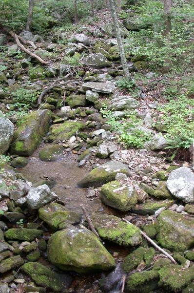
Take the Apple Orchard trail, continuing to rise, over beautiful, sometimes gnarly
blue limestone singletrack. The creek contributes to a lovely atmosphere in concert
with the Hemlocks and Rhododendron. Just about a country mile up this slow
grinder, a bridge leftwards across the stream appears, leading up a short trail to a
dirt road dead end with a kiosk. This is the bottom of Parker's Gap, and yes, you'll
be going to the top of that particular gap.
The Parkers Gap segment rises just over 1000' feet in 2.2 miles. A little ornery at
spots, this one terminates in another gravel forest road, FR 812. Take a right on FR
812, traveling 3.3 miles to Thunder Ridge itself, the Blue Ridge Parkway at the
Sunset Fields overlook, a cool 3130' higher than the North Creek Campground.
The Over segment: Across the parkway from Sunset Fields overlook is a gated
fireroad. Take that until it opens up into the Sunset Field itself. You'll note structure
remnants of the Air Force base that once was a fixture on Apple Orchard Mountain.
Your exit is at the far right corner of the sometimes thickly grown field, which is
due south. It's a wide trail, steep at the outset, but ride-able. As it crests, please
note a hard right, even though the trail you're on continues. Take the right, or
you'll find yourself in a fizzled field with nowhere obvious to go. You'll know you
turned correctly as the trail shows definite use, and becomes a fun and fairly gnarly
800' drop down to Overstreet Falls.
Now, back up to the ridge. The trail dumps you out at the falls on a dirt road. Go
right, upwards, for a 1.2 mile grade that spends a bit of time in the double digit
percentages. It's over, thankfully, with a downhill drift to the parkway, then right
back to the Sunset Fields overlook.
The Back Down segment: From Sunset Fields overlook, take the falls trail, being
courteous of day hikers along the way. This one is classic Blue Ridge singletrack of
the finest kind: rocks, switchbacks, drops. Not real long, but sweet. It opens up to
an open woods road. Take a left on the road, which becomes grassy and fun,
rolling about a mile to the Cornelius Creek upper trailhead. You'll know your almost
there because you'll be grunting up a nasty little steep granny pitch, uncommon to
that section previously, which had been mostly downhill or slightly upward rolling.
At the top, you'll note perhaps left and right options. You'll take the right trail, which
is open and grassy until the first switchback left shortly thereafter reveals Cornelius
Creek's true nature: rocks, loose rocks, and rocks. Steep and nifty at first, you'll
heat the brakes until reaching a bottom of sorts. Follow the main trail down the
ancient canyon alongside the creek, eventually crossing it several times. The whole
run is a bit over 2 miles, but what a 2 miles it is!
Upon surviving all that, you're reward is a gravel road downward drift for 2 miles
back to the start. Up-N-Over well done. 21 miles, over 4500' of climbing, hazards
galore, and both sides of Thunder Ridge slain!


I rode on this trail at team camp and it is technical with some steep sections. Overall, it is a good national forest trail.
| ThankThis trail was entered by me, n-man-726. It is awesome.
The "rough asphalt" listed near the beginning is now "smooth, fresh asphalt." TARP funds.* Review edited 10/18/2010
| Thank