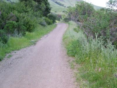
A reasonably nice city park, good viewspot at the top ("Eagle Rock"). Mostly dirt road, with some short sections of technical downhill singletrack. Can get a little crowded due to proximity to the city There's a big "Alum Rock County Park" sign up on the cliff; enter the park to the right of the sign, and go up the trail next to some rough wooden steps.
Follow the trail on up until it goes onto the main (paved) road into the park. Go up on the road for about a hundred yards, then a sharp left onto dirt ramp; at the top, turn sharply right onto a dirt road above the paved road. Eventually, it crosses a bridge over the paved road. Continue up to the "Youth Science Institute" (there are restrooms and a drinking fountain here). [Optionally, go on up the canyon to get the full sulphur effect of the "Mineral Springs" that made this park a famous resort many decades ago. Return via the same route, to the "YSI" building. Across the paved road from the YSI, the "North Rim Trail" starts up the side of the canyon. (It's paved here.) Climb up it, continuing along the north rim of the canyon. Shortly, the pavement disappears and there is a gate to go around; the trail snakes up and down (but mostly up) towards Eagle Rock (you can recognize it by all the antennae on it). One turnoff to the right is labeled "Loop Trail" -- worth avoiding unless you're into steep climbs. A couple of spots along the main trail get pretty steep -- you can avoid the second one by staying left as the road forks just at the bottom of that steep part, then taking the switchback right turn that goes up to the top of that part. Once you get up to Eagle Rock (elev. 790'), take a break. Take some pictures. To get down, take mostly right turns. At one spot, you're headed West (out towards San Jose) and the trail has a steep branch down to the left, but also continues a lot less steeply, sorta straight. You can see where the steep left branch goes down to another trail. At that point, take that steep left branch -- the other just goes out to a small place where a couple of goats live, and peters out. That steep descent is the trickiest technical challenge on this route. At the bottom of that steep left branch, turn rightish onto the trail that stays just above the paved road. There's one nasty down-and-up right turn that's easy to miss (but if you do, it just puts you out onto the paved road). Once the trail really puts you back onto the road, go right, down the road about 50 or 100 yards, then turn sharply left onto a small trail that takes you back to the main entrance trail, just above those "rough wooden steps" that were right by the start of the ride.


Trail was decent, keep an eye out for hikers can get crowded at times.
| ThankGood ride for non bikers or an ok
| Thank9 year old mt biker
The trails are mixed fire roads and switch backs. There are a few steep sections so be prepared to climb. Spring time is the best to ride because the weather is cooler and the ground has low dust. In the summer it's best to go early morning to avoid the heat and sun or else you'll drink lots of water. There's a hidden valley with some steep trails which not many are familiar with. One could spend most of the day covering the trails given enough water that food. On some mornings the cloud/fog covering is a site to see. It's definitely not a highly tree cover ride so sunscreen is advisable in the summer.
| ThankI'm a beginner so I thought this trail was perfect for me. Lot's of people for a Tuesday afternoon. Wonder how crowded it gets during the peaks hours.
| ThankIt was a pretty fun ride, mostly dirt roads. I'm new to mountain biking but I didn't have to walk it at any point. Note that they now close every monday for park maintenance.
| ThankIt's mosly for leisurely riding. Lots & lots of hikers with little awareness of their surroundings. You can make some of your own fun by hitting Todds Quick trail, as long as you can handle the climb. Some OK D/H coming down from Eagle Rock, but the rangers tend to want you to go slow even there.
| ThankLeast Favorite trail i have ever ridden
| ThankGreat trail for beginners, gets crowded with hikers on weekends so you have to be really early to avoid the crowd.
| Thanknothing too hard, alot of people and way to many rangers so you cant get too loose. Really nice area with creek crossing and an short single track that feels challenging but completly the opposite.
| ThankSo many flies, they were all over me. The fire road was kind of boring. The single track had been cleaned up if not it would have been terrible. Highlight of the trip was seein a California Mountain King Snake.
| ThankIf you want a workout then I highly recommend the Bacardo Trail. The downhill isn't very technical but you can get some good speed. You should make it to the top if you have a very low gear and are in decent shape else be prepared to push your bike up a few steep sections. If you are going to attempt it after it has rained, be prepared for some mud.
| Thank