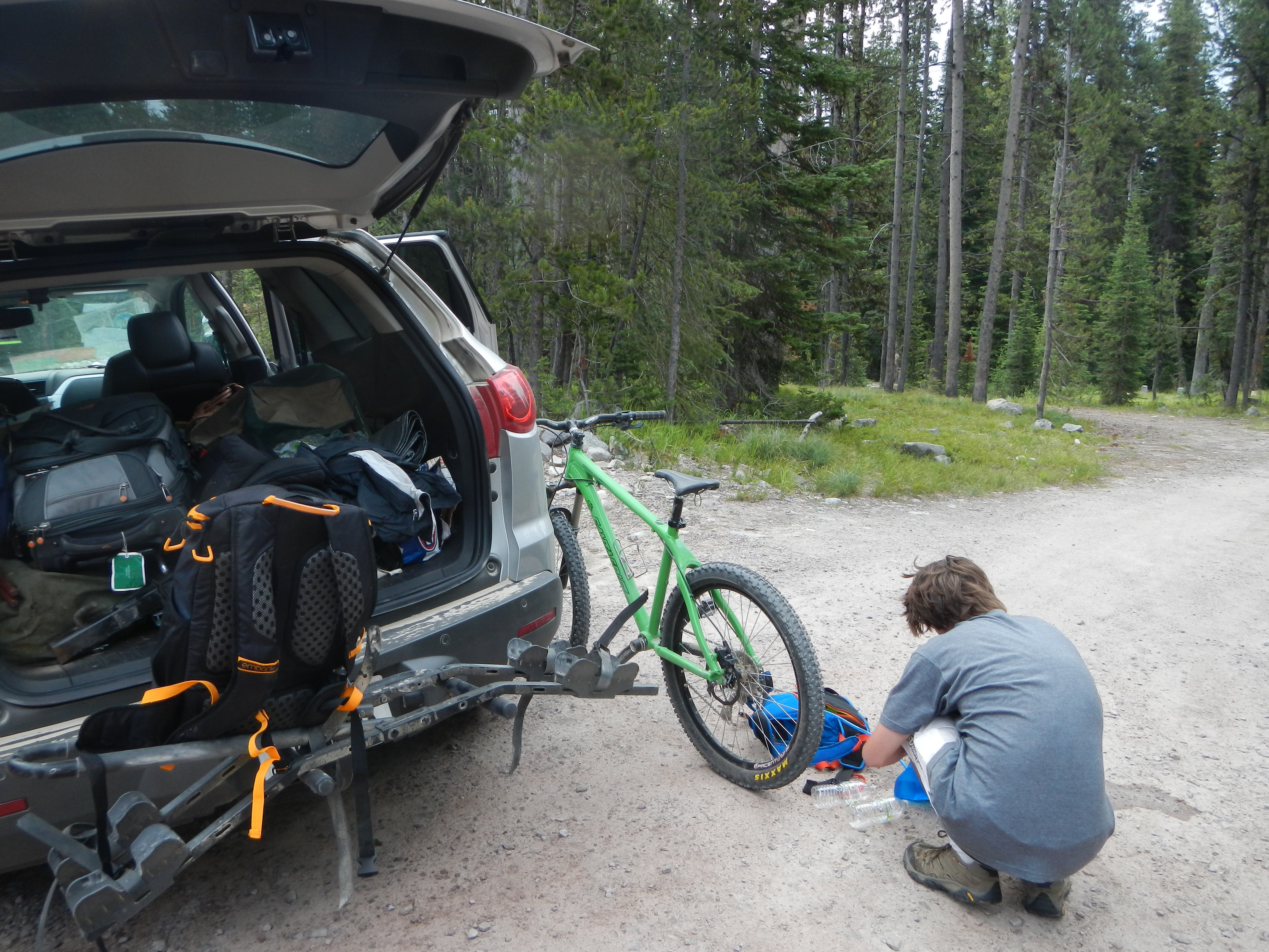
We pulled off to the side of the dirt highway we had been bouncing along in great anticipation. The bikes came off their rack, their chains were lubed, and the last checks were made to make sure they were in working order. After saying our goodbyes to our shuttle driver, who had many hours of driving ahead of her, we watched the silver Chevrolet cross over and with it, the last active sign of civilization. After the buzzing of the motor had faded away, the sound of mountains seemed to overwhelm us with its majesty and harmony. After exchanging a smile or two with my father, we tacitly agreed there was only one thing left to do. I started pedaling, and behind me, my father followed.
We were embarking on what we thought would be the best ride of our lives, only to be confronted with the stark reality of our worst. The Sapphire Crest Trail, near Hamilton, Montana resides in the Sapphire Mountains. The Sapphires, although sometimes overshadowed by their neighbors, the Bitterroots, are a rugged and majestic range in themselves. The Sapphire Crest runs along, you guessed it, the crest of the range. After 15 miles or so of the ridge, it dives down to the Bitterroot River, which makes for a very good swimming opportunity. Some websites had described it as “the trail that reminds you of why you started mountain biking,” and we were excited to experience it.
First, we had to gain the ridge. In planning this ride, my dad had recommended that we take a trail that went straight up the slope. After some discussion, however, I had persuaded my dad that the Crystal Creek Trail, which meandered up a small nearby valley until it hit the ridge, was the best choice. As we climbed the Crystal Creek trail, we were energetic and playful as we slowly ascended the technical, but sloping, singletrack. The creek’s crystal-clear water reflected the bright greens and browns of the surrounding environment back at us.
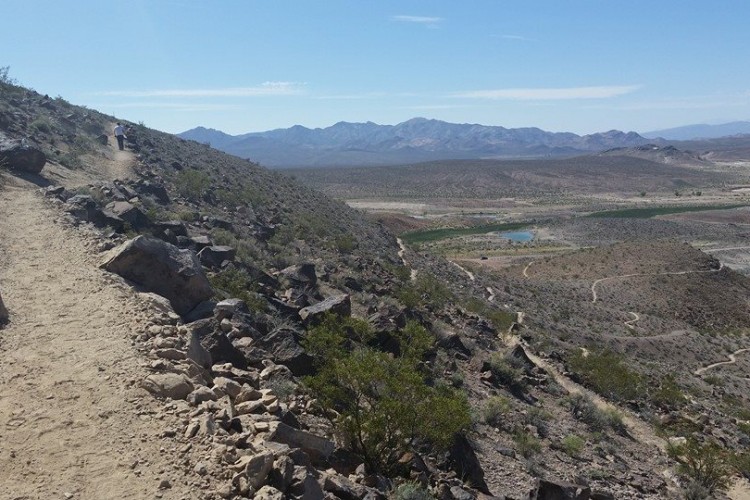
After an hour of serene mountain paradise, we finally hit the ridge. After checking the map, we decided on which way to turn, and progressed along the ridge. The eerie feel of the completely burned forest around us shocked us as we emerged on the edge of the barren landscape. The tree’s bottoms were charcoal black as if they had been touched by the fingers of Death. Besides the tall testaments to the thriving forest that once occupied this area, nothing else was present.
Soon, we gained the edge of the ridge and started the climb up Domed-Shaped Mountain. Although the climb was long, rocky, and grueling, one could not resist the temptation of looking east, where the ridge dropped away and the whole of Southwestern Montana unfolded. The climb could be best described as simply one, long hike-a-bike. Every once and awhile, we treated ourselves to the snow banks that still clung to the sides of this 9,000-foot ridge, even in July.

Finally, after many hours of hike-a-bike, the mountainous grade seemed to flatten out. We had made it! We were at the top of the main climb, and we were to be treated with eight miles of descent! Once my father had caught up, we rejoiced, ate some granola bars, dropped our seats, and got ready to rip.
The first two miles of the descent were amazing. The trees were scarce along the wind-swept ridge, so a quick look up from the high-speed action would be rewarded with an amazing 360-degree view, accompanied by that awesome top-of-the-world feel. But as we were just getting a feel for the trail, we hit our first problem. There was a tree across the trail, which had been burned in the 2015 mega-forest fire that had ravaged the Sapphires, which were then flattened by a storm. A quick step over, and we were back on track. After 30 feet, we came upon a much bigger obstacle. This time, 10 trees were stacked on each other and blocking our path. Naturally, we had decided to walk around it. But soon, fooled by that fact that we thought this was just another small patch of burned forest, we became trapped.
Eventually, we were forced to either climb our way over the massive piles of trees, which was not an easy task, let alone doing it with our bikes, or try to find a way around. Hours passed by as we slowly made our way down the northern ridge of Dome-Shaped Mountain. As we heaved, it soon became very clear that we needed to find water, and fast. My reservoir had been empty for hours, and I was starting to show the early symptoms of dehydration. Suddenly, after making my way over yet another pile, I heard a sound I will never forget. “Squish!” At first, I didn’t notice, and kept walking. But then I realized, I had stepped into a bog.

My father arrived with the filter, and we slowly purified the water through his tiny device, drinking to our hearts’ delight. A sound became loud and audible, and my dad and I turned our attention towards it. An elk of good size and stature was leaping over some of the smallest piles, looking like an angel sent from heaven. In higher spirits, we continued, only to be beaten down by the sight of more piles ahead of us.
After two hours of climb-a-biking, we finally had made it to the end of the eight-mile descent we had started six hours ago. As we sat on some rock outcroppings that had been bleached a stark white by the fire, we rested and collected ourselves. We knew we had to make a decision about the bikes. We had just climb-a-biked six miles in about five and a half hours, and we knew just how much faster we would be just climbing. After looking at the map and using our compass to regain the trail we had lost under the black charcoal-like ground, the decision was final. We laid down our bikes, which were naturally hidden by the piles, and continued on with 15 miles of hiking ahead of us. It was 5:30 pm.
After another hour or so, we finally made it out of the piles. The smile grew on my face as we encountered the same moist dirt and tall, luscious trees that we hadn’t seen since Crystal Creek. Next, we encountered a trail junction, which allowed us to completely lock our position. The map only showed a mile to the next junction.
That mile was terribly long. The ascent was more or less straight up the side of a mountain, which diminished our progress to a near-halt. After a very long time, we finally hit the next junction. We rejoiced, as we knew there was only a half a mile until we descended towards the river. As we walked along the trail, it seemed like it was taking forever to go a half-mile. But my beautiful surroundings and the quiet sound of the mountains helped suspend my disbelief of the length of a half a mile.
After an hour, we hit a junction. I quickly realized in weary astonishment that this junction was running off of the wrong side of the ridge. My father emerged from the forest, and we retrieved the map from his pack. We were three miles from the last junction, 2.5 miles overdue for our turn. My dad and I forced ourselves to remember whether we’d seen a trail junction before and missed it, but we soon came to the grim conclusion that the trail hadn’t existed in the first place. Beaverhead National Forest, who controlled one side of the ridge, had obviously spent time to maintain their trails and trail junctions. Bitterroot National Forest, however, had not maintained their trails at all, made apparent by the lack of a trail junction. Luckily, there was another trail that dropped into the same area another three miles ahead. Instead of going back for a trail we knew didn’t exist, we forged on to the trail that we hoped would be there.
This time, we knew exactly where the trail would be. Our topo map showed its junction with the trail we were walking at the base of a short, steep descent. After walking for awhile and soaking in the views of the ridge, we came to that massive descent. The steep, sharp downhill caused our thighs and calves to burn like the forest had before.
Once at the base, we walked around the site of the trail junction. To our dismay, it didn’t exist. We looked, but the trail could not be found under the cover of the charcoal black fragments of the trees that had once stood in the area. I told my dad we had several choices. First, we could hike five more miles to the nearest forest service road, stay the night, and hope a random car would happen upon us in the morning. Second, we could hike back six miles for the trail we knew wasn’t there. Third, we could bushwhack our way down the nearby Grizzly Gulch in the darkness that had almost completely consumed the mountainside. Finally, we could keep looking for the trail. At first, my father rooted around for the trail, but it quickly became obvious it wasn’t present. We started down Grizzly Gulch, and left the burn zone for the lushness of the real forest. Immediately, I found an old game trail, and we followed it, picking our way down the rocks and through the bushes.
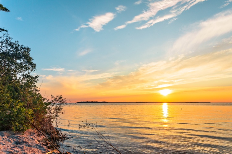
As we gained a crest, I noticed something about a broken branch. It wasn’t broken, it was cut. We were on the trail! This realization released us, and at that moment we knew we would get home alright. The sunset glimmered over the nearby Bitterroots, and the lights in the valley below us shimmered. Our spirits were at an all time high, and for good reason. But that beautiful sunset was not without consequences. Now it was completely dark, and my father was forced to use his iPhone to guide us down the increasingly-steep, threatening slope.
As many know, when a flashlight is used, it tends to make everything around the beam seem pitch black. This effectively meant that while my father could easily see the trail, I could see nothing of what was in front of me. I established a rhythm in which I looked through my father’s legs at the features of the trail, estimated how many steps they were away from me, and stepped over them accordingly. This worked 50% of the time. Every other time I tripped, almost sending my father and I tumbling down the mountain. The steepness of the trail, which was to the degree that we were sliding more than walking, didn’t bother us, as the more we walked the louder the sound of the Bitterroot River became. I stumbled down the trail until we broke out of the trees and onto a dirt road, whose bed was a pale white in the moonlight.
Now we were one mile away from our campground, where our shuttle driver would pick us up the following morning. My feet soared with pain, and I had thoughts of setting up camp right there on the road. I kept fighting until the glow of a campfire was in sight. We finally made it to our camper at 12:30am, where we immediately took off all our shoes and socks and crawled into our beds. I quickly ate an entire family-sized bag of Lay’s potato chips, sucked down five A&W root beers to balance the severe dehydration I had experienced towards the end of our journey, and went to bed. I knew that getting the bikes in the morning would be a whole new experience in itself, so I tried to get as much sleep possible.