×

|
Rate it:
Tags:
Level:
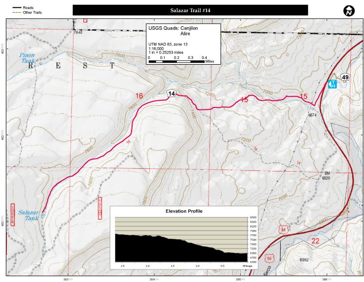
Length: 3 mi (4.8 km)
Surface: Singletrack
Configuration: Out & Back
Elevation: -
Total: 0 riders
Mountain Biking Salazar Trail #14
#267 of 283 mountain bike trails in New Mexico
Trail starts out level and begins a gradual ascent to the top of the mesa at about ¼ mile into the trail. Vegetation on the trail begins with sagebrush, and pinon-pine. At the higher elevations it contains Ponderosa Pine and mixed conifer. Watch out for low-lying cactus. Salazar Trail was once an access road used for uranium exploration by mining companies in the late 1960's and early 1970's. source: fs.usda.gov
First added by Jeff Barber on Dec 10, 2014. Last updated Apr 27, 2020. → add an update
Before you go
- Drinking water: unknown
- Lift service: unknown
- Night riding: unknown
- Pump track: unknown
- Restrooms: unknown
- Fat bike grooming: unknown
- E-bikes allowed: unknown
- Fee required: unknown
This trail information is user-generated. Help improve this information by suggesting a correction.
North on Highway 84 from Espanola, 45 miles. South on Highway 84 from Taos, 86.5 miles. South from Chama 39.5 miles Trail is on the west side of the road. The trail head is at the north end of the guard rail.

Loading reviews...View more