Dutchman Creek / #490 trail photo
See all photos (3)
×
User
Today
 
  |   Rate it:

Tags:
Level:
Length: 30 mi (48.3 km)
Surface: Singletrack
Configuration: Loop
Elevation: -
Total: 1 riders
 

Mountain Biking Dutchman Creek / #490

  Add a review
#1,024 of 1,368 mountain bike trails in Colorado
#16,261 in the world

This is an advanced epic ride located in the Cochetopa Hills. The Continental Divide is only about 11,000 ft. and below timberline. This was another hard ride. It's 11 mils up to the CDT/Colorado Trail from Needle Creek Reservoir then a couple more miles climbing to the Dutchman Creek Trail. Somehow I missed the turn and was 4 miles past Dutchman Creek Trail before I figured it out! Lots of softball to basketball sized rocks made the riding even harder! Dutchman Creek Trail wasn't much better. The first mile of Dutchman Creek was a nightmare. There were never any waterbars cut into the trail. The water from all the rain has carved a perfect channel right down the trail even around the switchbacks. The lower section has some redeeming qualities though. Smooth, fast and fun. Then you have to find your way out and climb back up to Needle Creek Reservoir. I thought the guide book was kind of confusing it mentioned roads that were barely visible. It's still the best insurance that you will make it back before dark!
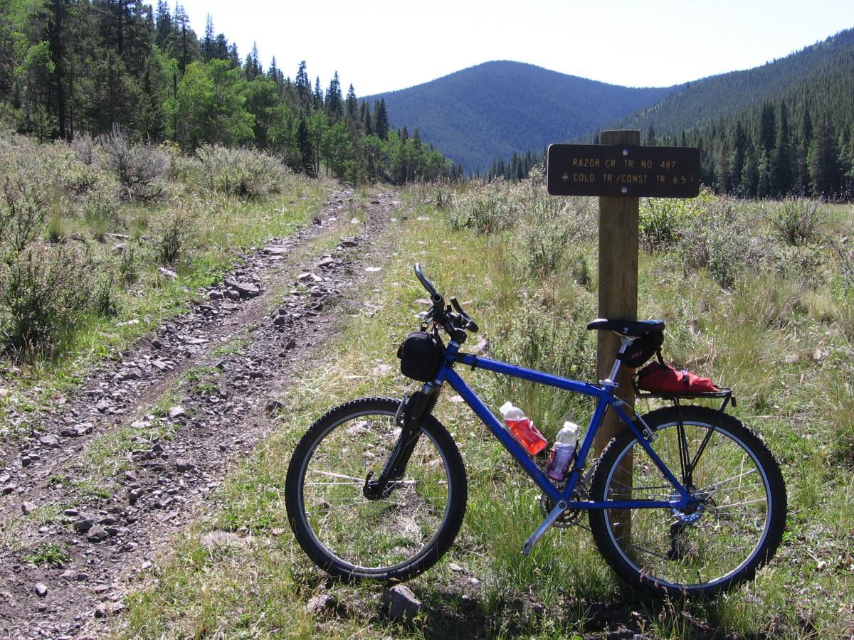
The route is pretty simple. From Needle Creek Reservoir ride up the main road (FR 781) to Razor Creek Trail continue up the valley to the CDT/Colorado Trail left to Dutchman Creek Trail. From the bottom of Dutchman Creek route finding back to Needle Creek Reservoir is difficult due to all the ATV trails and old roads. Map: Trails Illustrated 139 La Garita/Cochetopa Hills. This might help find your way.

First added by lostcause on Apr 22, 2009. Last updated Apr 28, 2020. → add an update
Before you go
  • Drinking water: unknown
  • Lift service: unknown
  • Night riding: unknown
  • Pump track: unknown
  • Restrooms: unknown
  • Fat bike grooming: unknown
  • E-bikes allowed: unknown
  • Fee required: unknown
This trail information is user-generated. Help improve this information by suggesting a correction.
Getting there
From Gunnison drive18 miles east on HWY 50 to Doyleville follow CR 45 south about 1 mile to CR 46 turn left. Continue 1.5 miles to CR 47 turn right. From here its probably easiest to follow the signs to Needle Creek Reservoir. Park at or just before the reservoir.


Dutchman Creek / #490 Trail map

Add to or improve this map // Share this map on your website

Local Info

Club Sponsor

-

Local Bike Shop

Trail checkins

Upcoming Events

None.
Add one

Trail conditions

(on Apr 23, 2024)
login to update

Camping & Lodging

Coming soon!

Dutchman Creek / #490 videos

Add a video
We don't have any videos of this trail yet. Add one here.

Mountain Bike Trails Near Doyleville, Colorado

| 4 mi
| 4 mi
| 2 mi
| 5 mi

Add a review

Rating
 
Difficulty
 
Review

Reviews

    Loading reviews...

Rider questions